Chair Peak Circumnavigation
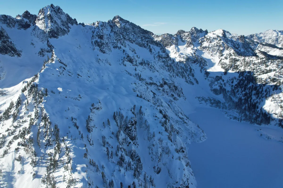
A classic Snoqualmie Pass ski tour, the Chair Peak Circumnavigation links several basins into a full-value loop from Alpental. Expect roughly 8 to 11 miles and 4,000 to 4,500 feet of climbing for the standard tour, with more if you add side laps. The terrain is never extreme for long, but it is committing enough to demand efficient travel, good judgment, and stable avalanche conditions.
The usual start is the upper Alpental lot. From there, skin to Source Lake and continue either counterclockwise over Snow Lake Divide toward Snow Lake, Chair Peak Lake, and Melakwa Pass, or clockwise via Great Scott Basin and Bryant Col. Both directions work, but clockwise is often cleaner on sunny spring days because it gets the south-facing terrain done earlier. Counterclockwise gives a more natural scenic progression and is a common first choice when timing and snow support it.
The crux is less about routefinding than snow management. This loop crosses multiple aspects and elevations, so conditions can change dramatically over the course of a day. Bryant Couloir is the technical and psychological high point for many parties: in good snow it is a broad, friendly couloir by Cascade standards; in poor snow it can be firm, scraped, thin, or filled with old debris. The Melakwa side usually skis best when timed for soft corn, while the north-facing Chair terrain can stay firm longer than expected. Snow Lake is generally straightforward but can feel slow and exposed if visibility drops or surfaces crust over.
A strong day here looks like stable avalanche conditions, an early start, and a willingness to adapt. If Bryant Couloir is not in shape, a lower-angle exit through Great Scott Basin is the usual alternative. If the upper north-facing terrain is firm or visibility is poor, skipping steeper add-ons is the better call. This is a route for efficient backcountry skiers who are comfortable with repeated transitions, short bootpacks, and making terrain choices based on aspect, warming, and coverage rather than sticking rigidly to one line.
Sources
Chair Peak Circumnavigation
A classic Snoqualmie Pass ski tour, the Chair Peak Circumnavigation links several basins into a full-value loop from Alpental. Expect roughly 8 to 11 miles and 4,000 to 4,500 feet of climbing for the standard tour, with more if you add side laps. The terrain is never extreme for long, but it is committing enough to demand efficient travel, good judgment, and stable avalanche conditions.
The usual start is the upper Alpental lot. From there, skin to Source Lake and continue either counterclockwise over Snow Lake Divide toward Snow Lake, Chair Peak Lake, and Melakwa Pass, or clockwise via Great Scott Basin and Bryant Col. Both directions work, but clockwise is often cleaner on sunny spring days because it gets the south-facing terrain done earlier. Counterclockwise gives a more natural scenic progression and is a common first choice when timing and snow support it.
The crux is less about routefinding than snow management. This loop crosses multiple aspects and elevations, so conditions can change dramatically over the course of a day. Bryant Couloir is the technical and psychological high point for many parties: in good snow it is a broad, friendly couloir by Cascade standards; in poor snow it can be firm, scraped, thin, or filled with old debris. The Melakwa side usually skis best when timed for soft corn, while the north-facing Chair terrain can stay firm longer than expected. Snow Lake is generally straightforward but can feel slow and exposed if visibility drops or surfaces crust over.
A strong day here looks like stable avalanche conditions, an early start, and a willingness to adapt. If Bryant Couloir is not in shape, a lower-angle exit through Great Scott Basin is the usual alternative. If the upper north-facing terrain is firm or visibility is poor, skipping steeper add-ons is the better call. This is a route for efficient backcountry skiers who are comfortable with repeated transitions, short bootpacks, and making terrain choices based on aspect, warming, and coverage rather than sticking rigidly to one line.
Sources

Interactive map preview
Open the full map for layers, filters, and route planning tools.
Open full mapYour next adventure starts here
Create your own maps with custom routes, waypoints, and layers. Then share with your friends to kick off your adventure planning.
