Discover Ski Tour Worldwide

Artur Barkan
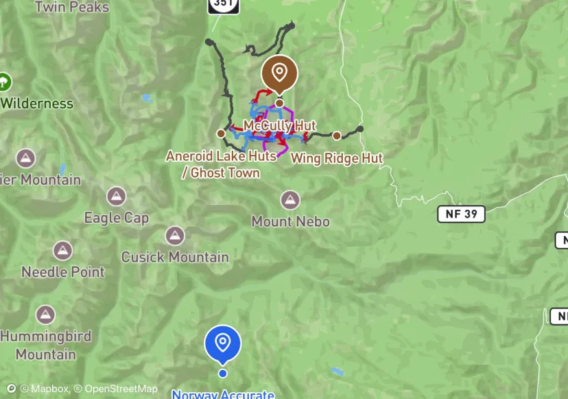
Wallowa Mountains
Map by Artur Barkan

Mason Wolters
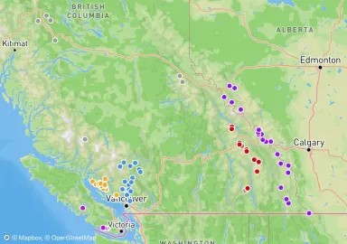
BC Backcountry Huts
Map by Mason Wolters
Backtrack
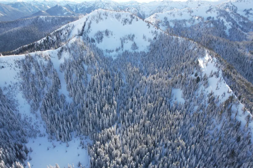
Crystal Mountain
Crystal Mountain is just a two-hour drive from Seattle and provides countless opportunities for backcountry adventures, whether you’re using the lifts or earning your turns. When the snow at Snoqualmie gets heavy and damp, the higher elevation and colder temperatures at Crystal can make the extra drive worth considering. On clear days, the breathtaking views of Mount Rainier are hard to beat.
Backtrack
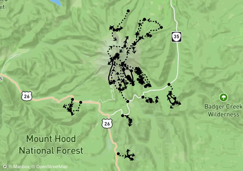
Mount Hood
Map by Backtrack
Backtrack

Mount Adams
Map by Backtrack
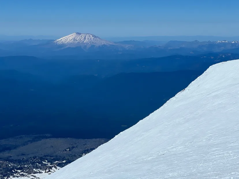
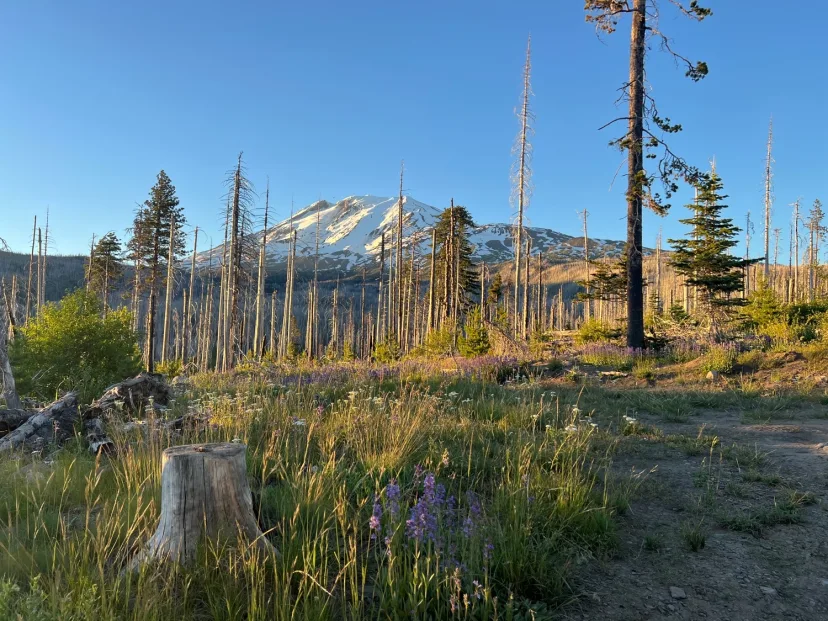
Backtrack
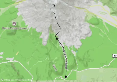
Mount Saint Helens
Map by Backtrack
Backtrack
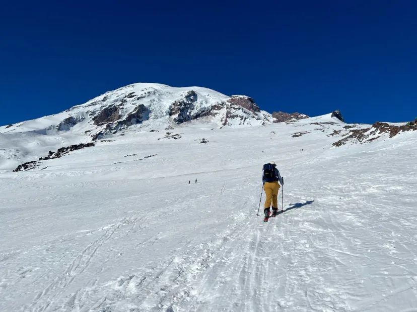
Mount Rainier
Map by Backtrack
Backtrack
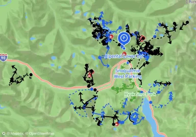
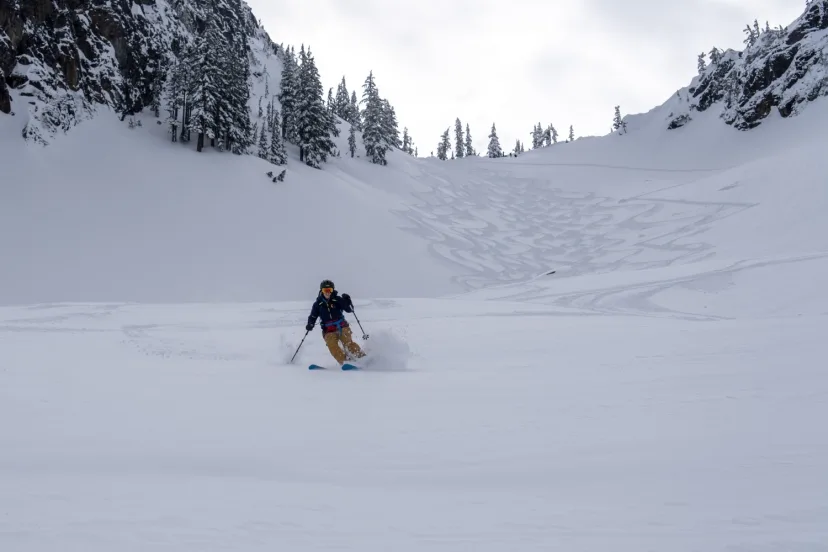
Snoqualmie Pass
Just an hour east of Seattle, Snoqualmie Pass is a backcountry skier’s paradise, offering a mix of rugged terrain and more accessible slopes. The proximity to the city and breathtaking views make it a popular destination, so it’s not uncommon to encounter crowds, especially on weekends. However, if you’re willing to venture off the main routes, you’ll find plenty of opportunities for solitude and untracked lines. For a classic experience, skin up to Snow Lake on a clear, low-avalanche-risk day. But be prepared — this spot draws plenty of fellow skiers, so arrive early if you want a parking spot and first tracks.
Backtrack
Stevens Pass
Steven’s Pass opens the door to a vast expanse of remote mountain terrain, offering thrilling backcountry skiing alongside mellow runs that are perfect for beginners. For an introduction to this area, check out Yodelin or Skyline Ridge. If you're looking for something more advanced, look at Jim Hill or Lichtenberg Mountain.
Backtrack
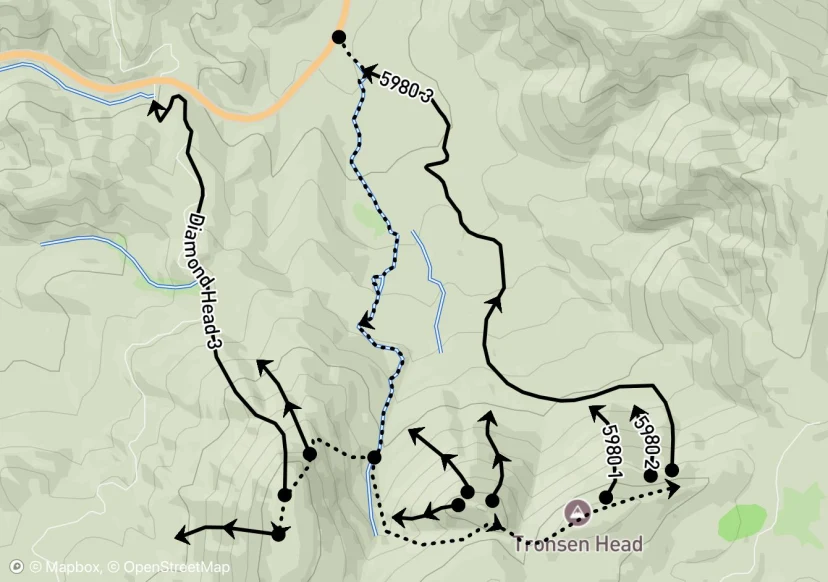
Blewett Pass
Map by Backtrack
Backtrack
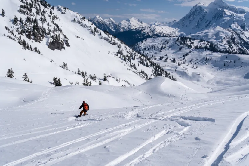
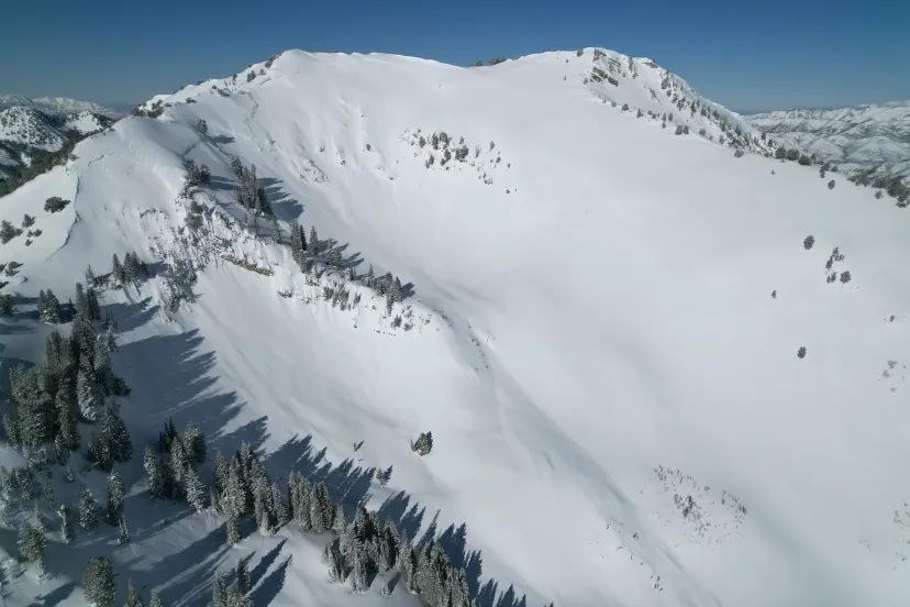
Mount Baker
Mt. Baker provides an expansive playground with terrain that spans a wide range of elevations and aspects. Beyond its stunning beauty, it boasts record-breaking snowfall and a wealth of terrain suited for intermediate to advanced skiers. While it’s a bit of a drive from Seattle, the reward is quick access to the heart of the mountains, where endless possibilities await. For those with a lift pass, there’s also plenty of sidecountry to explore.
Backtrack
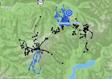
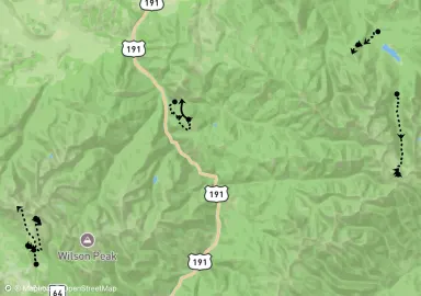
Wasatch
Map by Backtrack
Backtrack
Silverton
Map by Backtrack
Backtrack
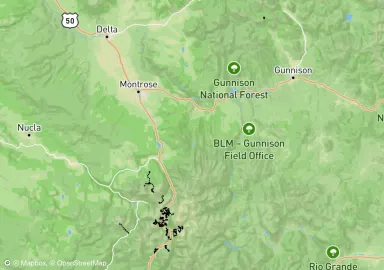
Crested Butte
Map by Backtrack
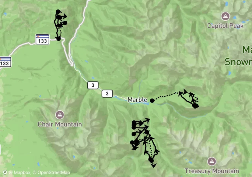
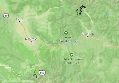
Backtrack
Marble
Map by Backtrack

Backtrack
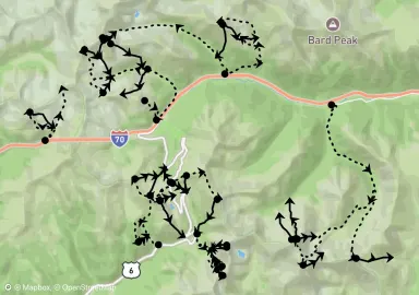
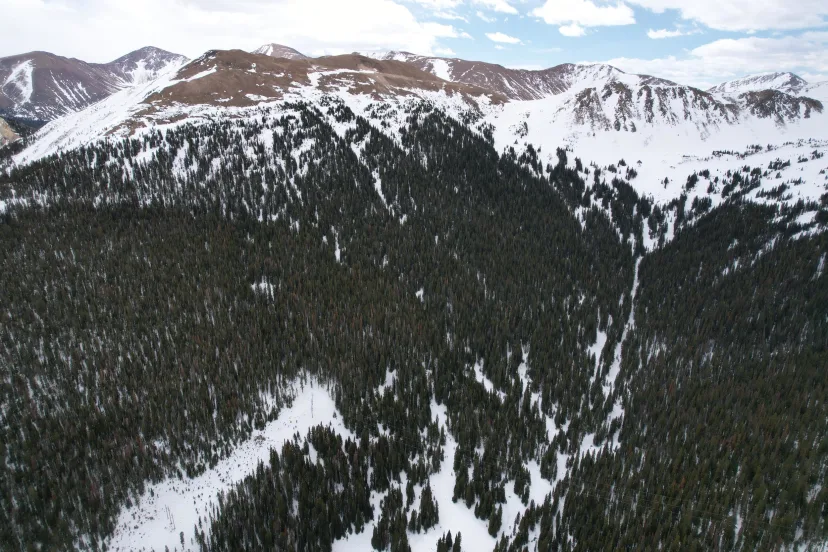
Loveland Pass
Map by Backtrack
Backtrack
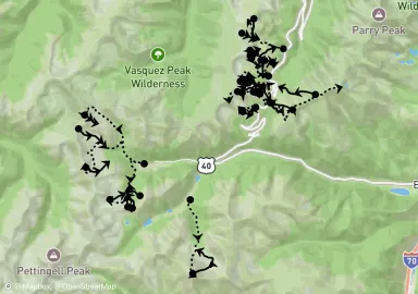
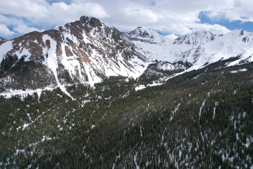
Berthoud Pass
Map by Backtrack
Backtrack
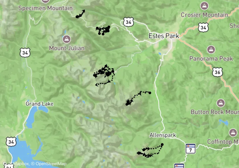
Cameron Pass
Map by Backtrack
Backtrack
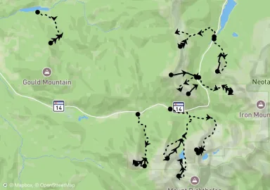
Rocky Mountain National Park
Map by Backtrack
Backtrack
Bozeman
Map by Backtrack
Backtrack
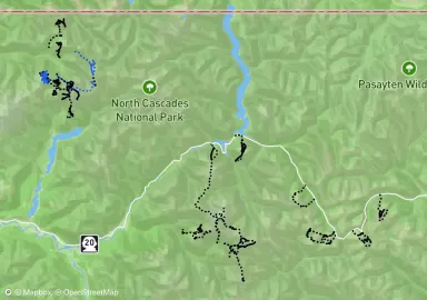
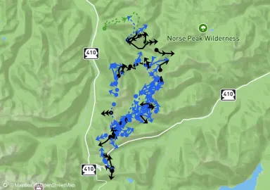
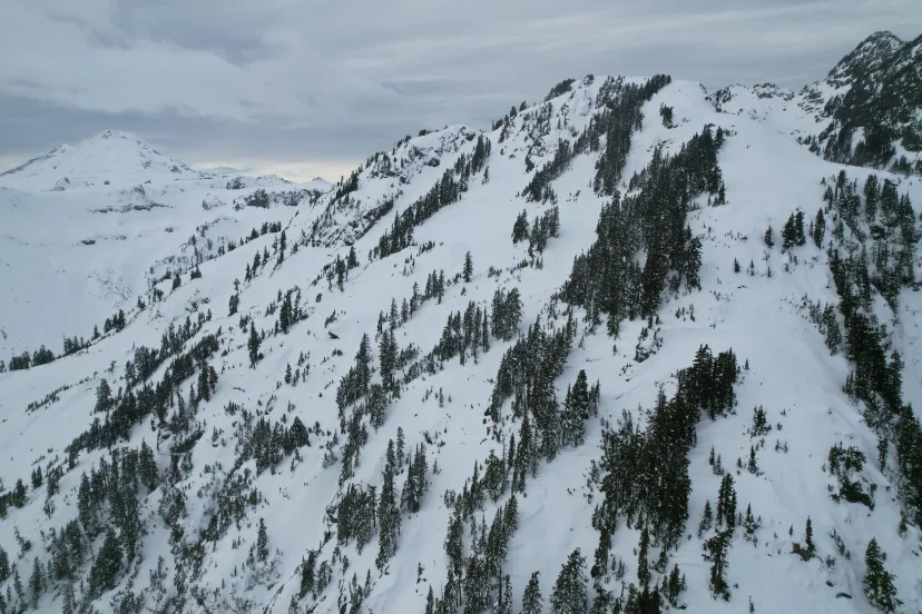
North Cascades
Map by Backtrack
Ryan DeLena
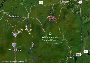
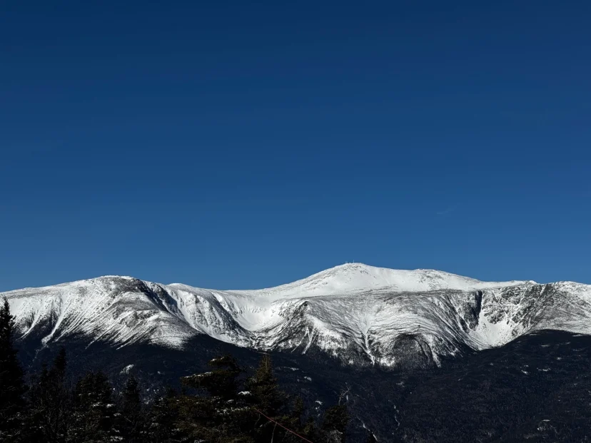
White Mountains
Map by Ryan DeLena
Ryan DeLena
Mount Mansfield
Map by Ryan DeLena
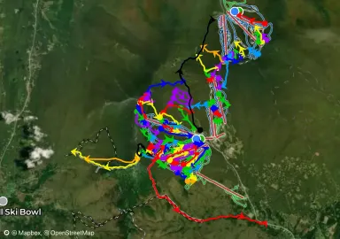
Scottsen21
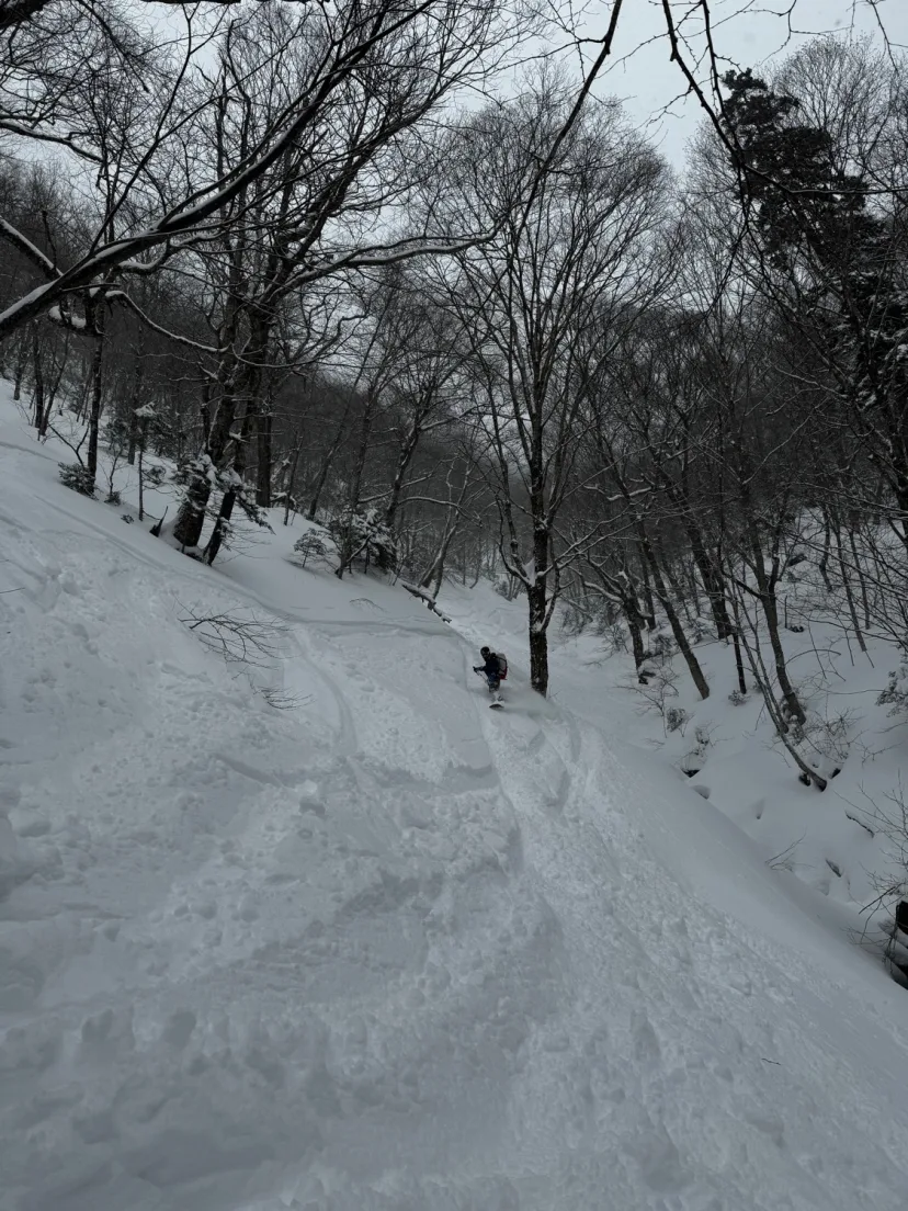
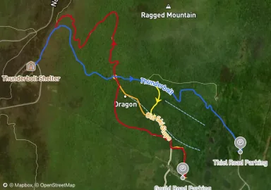
Mount Cardigan
Sources: https://www.outdoors.org/resources/amc-outdoors/outdoor-resources/best-backcountry-skiing-at-mount-cardigan/ http://www.jccrosscountry.com/2021/01/mount-cardigan-ski-tour-alexandria.html

Scottsen21
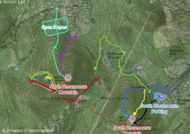
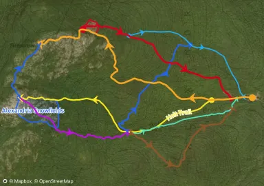
Uncanoonuc Mountains
Once a thriving location for skiing in the early 1900's the Uncanoonuc mountains are now home to many hiking trails. When conditions permit, backcountry skiing is also possible here. This map contains many historical trails that were part of the 100 year old ski trail system, some of which are still skiable today. Sources: https://www.nelsap.org/nh/uncantrailguide.jpg https://www.nelsap.org/nh/uncanoonuc.html
Jonathan Sawn
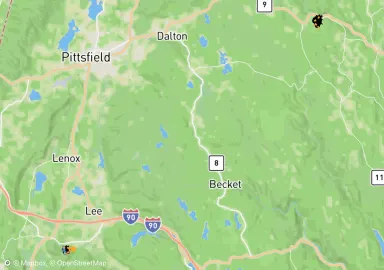
Western MA Backcountry Alliance
BC skiing zones maintained by the Western MA Backcountry Alliance, a chapter of the Catamount Trail Association. Learn more and support the organization by visiting: https://www.wmassbcalliance.org/
Scottsen21
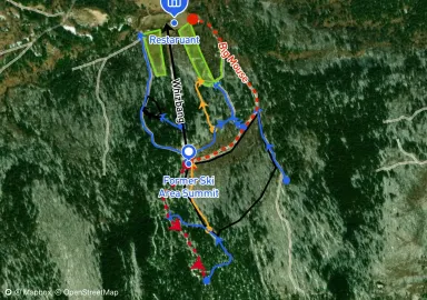
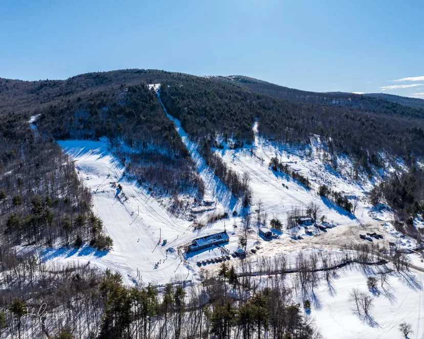
Moose Mountain Recreation Area
Formerly a ski area operating from the 1960s to the late 1980s. It is now open as a recreation area with backcountry skiing, snowmobiling and tubing. Most of the best skiing can be had on the former trails, which are still cleared and mowed. There are also trails leading to the geographic summit of the mountain above the ski area. There are a few good trails up there as well. The owner asks that you contribute someway if you are visiting through donation or buying lunch at the restaurant. They put in lots of effort to keep the area open.
Jonathan Sawn
Mount Watatic
This former ski area is now under the control of the Mount Watatic Reservation and is a good option for mild BC skiing down the former ski runs.
Scottsen21
Burnt Mountain
This is the official side country of Sugarloaf. Note that you will need a valid ticket to be here and also that there is a cat skiing operation when conditions permit. Sugarloaf Uphill Policy: https://www.sugarloaf.com/know-before-you-go/uphill-policy#question_4fd5dcd8-5284-43e8-97da-eae7024071a6
Finn Peartree
Mount Greylock
Map by Finn Peartree
