Uncanoonuc Mountains

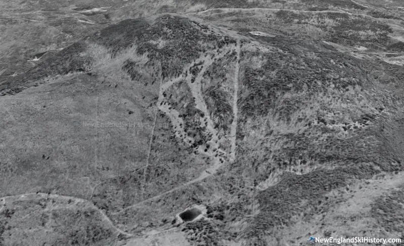
Once a thriving location for skiing in the early 1900's the Uncanoonuc mountains are now home to many hiking trails. When conditions permit, backcountry skiing is also possible here. This map contains many historical trails that were part of the 100 year old ski trail system, some of which are still skiable today.
Sources:
Uncanoonuc Mountains
Once a thriving location for skiing in the early 1900's the Uncanoonuc mountains are now home to many hiking trails. When conditions permit, backcountry skiing is also possible here. This map contains many historical trails that were part of the 100 year old ski trail system, some of which are still skiable today.
Sources:
North Uncanoonuc Mountain
This is where the majority of the still skiable terrain is.
South Uncanoonuc Mountain
South Uncanoonuc is the more accessible of the 2 mountains. There is some still skiable terrain but nothing maintained specifically for skiing.

Proposed Ski Area
North Uncanoonuc was slated for a regionally-large ski area development in 1962. With trails cut, chairlift and snowmaking equipment delivered, the plan was canceled in 1963 due to environmental concerns. These trails likely don't exist anymore and if they do probably aren't good skiing
Cross Trail
Connects North and South Uncanoonuc. Not flat, lots of elevation change.
Carriage Road
Not Sure if this is the original trail but its the best I could gather.
Interactive map preview
Open the full map for layers, filters, and route planning tools.
Open full mapYour next adventure starts here
Create your own maps with custom routes, waypoints, and layers. Then share with your friends to kick off your adventure planning.
