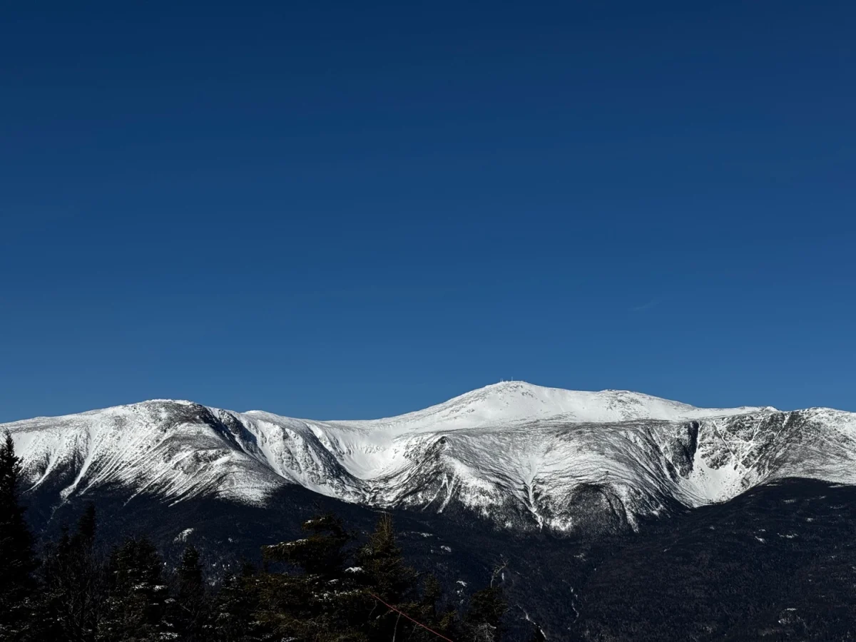


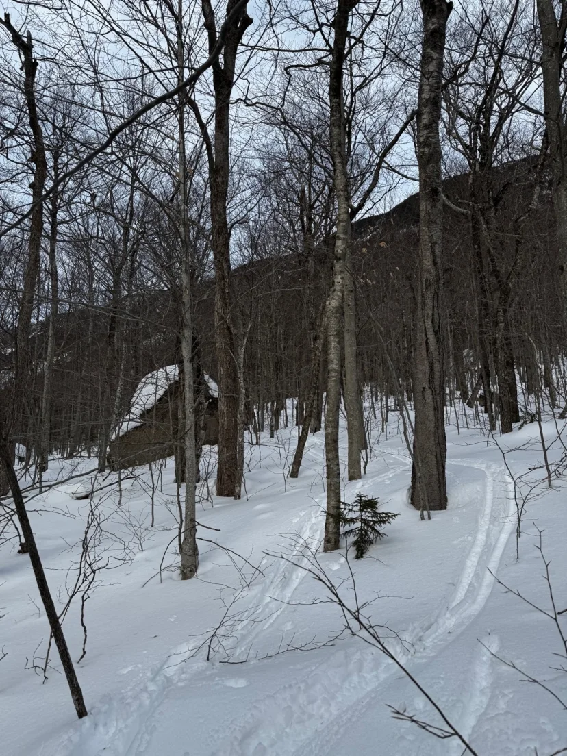
19 Mile Brook Trail
This Trail serves as an approach or exit from Carter Notch Couloir, Little Wildcat, Carter Dome Slide and many others. It’s a mellow skin and a surprisingly fun ski. Assuming you’re skiing it starting from Carter Notch Couloir, start by skinning the Wildcat River Trail back to the pond. Enjoy beautiful views of the ramparts and dramatic landscape of Carter Notch, then descend north off the height of land. Some survival skiing is necessary in the beginning, but the angle quickly mellows out to a long, pleasant glide back to Pinkham Notch. Watch out for the occasional foot bridge and be mindful of and kind to hikers. Chances are they aren’t anticipating you skiing this trail.
Attitash Cascades
Lincoln’s Beard Center
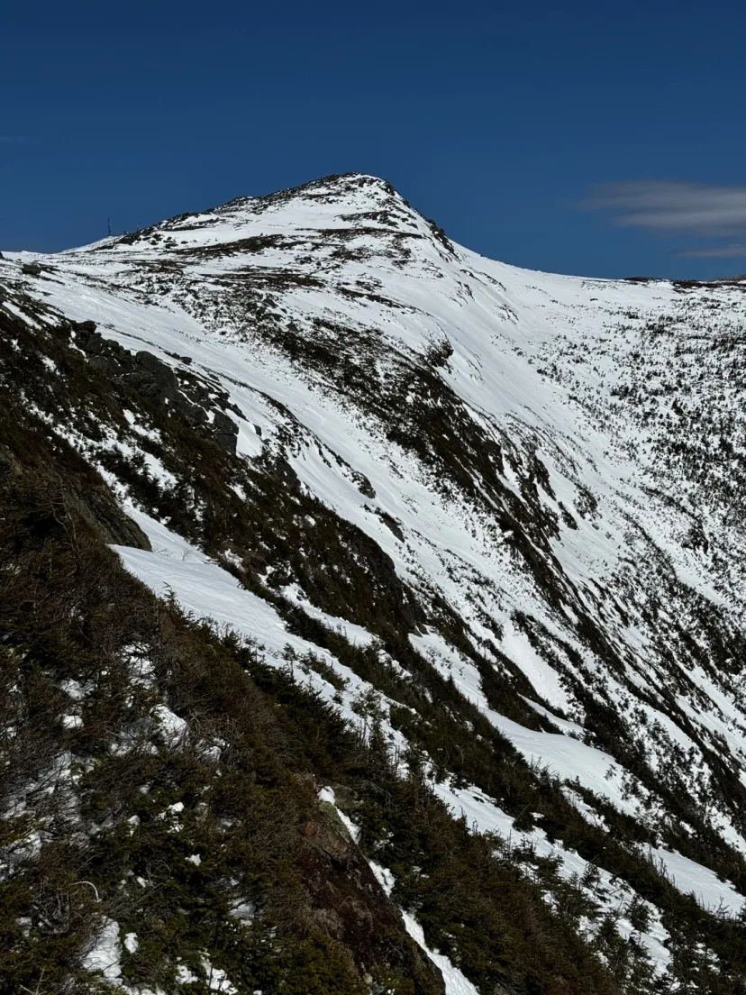
An excellent ski line on the backside of Franconia Ridge, and a great intro to Pemi skiing. This line is less of a slide, and more of a zone, with multiple ski options. It’s almost like a lower angle version of Gulf of Slides or Oakes Gulf. The best approach is to skin Falling Waters Trail to the summit of Mount Lincoln. From here you can ski in directly off the summit or continue along the ridge to your desired gully. The skiers right side off Mount Lincoln is avalanche terrain, but the skiers left side off Mount Lafayette is not avalanche terrain. This makes it a great low angle option. The easiest exit is to skin out the skiers left line back to the right near Lafayette. From there you can descend any of the Franconia Ridge lines back to Falling Waters Trailhead, which will likely be the crux of the day.
Lincoln’s Beard Right
An excellent ski line on the backside of Franconia Ridge, and a great intro to Pemi skiing. This line is less of a slide, and more of a zone, with multiple ski options. It’s almost like a lower angle version of Gulf of Slides or Oakes Gulf. The best approach is to skin Falling Waters Trail to the summit of Mount Lincoln. From here you can ski in directly off the summit or continue along the ridge to your desired gully. The skiers right side off Mount Lincoln is avalanche terrain, but the skiers left side off Mount Lafayette is not avalanche terrain. This makes it a great low angle option. The easiest exit is to skin out the skiers left line back to the right near Lafayette. From there you can descend any of the Franconia Ridge lines back to Falling Waters Trailhead, which will likely be the crux of the day.
Lincoln’s Throat
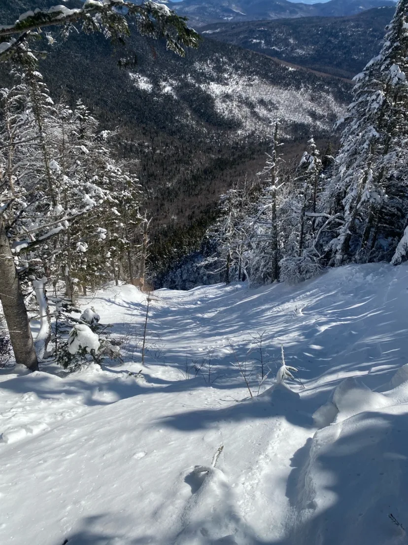
One of the most classic gully lines outside the Presidential Range. Start from the Falling Waters Trailhead. Skin along the Old Bridle Path until it starts to head steeply uphill to hikers left. Descend a short pitch of downhill skinning to Walker Brook. If this is open water, it’s possible to stay to hiker’s right of the Brook in some low angle woods that appear to have been thinned out. A long low angle skin eventually forces you into a high walled gully. Kick turn until it stops being efficient and boot pack from there. Hike to the base of the ice bulge and dig out a spot to transition. Excellent steep gully turns lead down to the brook, with great views of Franconia Notch. Be aware that this line is a huge terrain trap.
Red Rock South Twin Approach
Red Rock Brook Approach
This is the lower approach and or ski out of Red Rock Ravine. While it requires a lot of off travel travel, it’s not as heinous as it might look, and there is some merit to approaching/exiting this way. Skin the flats of Lincoln Woods to Franconia Brook Trail, from here it’s still mostly flat, but likely a lot of trail breaking. Cross Hellgate and Red Rock Brook, then hang a right shortly after. Moderate bushwacking leads to an old logging road. This is mostly grown in. But the flat contour makes for easy skiing. Stay hiker’s left of the brook until the water holes are filled in enough to skin up the brook. Eventually you’ll reach a junction. Break left for Bear Pond Slide. If you’re heading to Redrock, stay right. More low angle creek bed skinning leads to a spot where you will want to break left and bushwhack out of the gully towards the base of the leftmost slide. Hang a right in an open patch to access the right line.
Redrock Ravine Slide
One of the most beautiful lines in the White Mountains, this slides descends steeply into the magnificent cirque of Redrock Ravine. It’s also one of the most remote lines, requiring 20 miles of skinning no matter which approach you choose. As you near Mount Guyot, keep an eye on the map for where the slide nears the trail. For how much approaching it took to get here, there is almost no bushwacking involved to get from Twinway to the top of the slide. The entrance is steep and may require some spicy side stepping. The upper part of the slide is characterized by beautiful bands of Red Rock and remarkable views. Pick your route through the rock bands to the lower gully, where you’ll be rewarded with excellent open turns. From here, you can either boot back out the slide to Twinway, or in high snow years, ski out Red Rock Brook.
Bear Pond Slide
One of the most remote slides in the White Mountains by mileage alone, but also one of the hardest to approach. With thick vegetation above, it’s likely best approached by skinning up from below, or by skiing into Redrock and cutting over. Either way. Follow the drainage through moderate bushwacking to the the base of Bear Pond. A short but very thick bushwack gains the base of the slide. From here you can skin most of the way but you will likely want crampons for the top half of the line. The upper section is usually scoured down to rocks, but a few sheltered spots allow for passage. Weave your way through rock ledges and a few small ice bulges to a much more open lower gully. Enjoy excellent turns and even better views in one of the most remote areas in the Whites. Shwack back to your skin track and ski back the way you approached.

North Twin Slide Left
Approach as for North Twin Slide, but take the left fork. This is both steeper and narrower, but fans out into a really cool open area with ice bulges up high. In good conditions, it’s quite “freerideable”. It makes a great addition to a North Twin Slide Tour. As with all slides, this is both avalanche terrain and a terrain trap. Make conservative decisions.
The Steaming Gift
One of the most obvious and aesthetic ski lines on Osceola. Anyone who’s driven the hairpin turn has likely given it a glance. Start on the East Pond Trail. After crossing the Brook, skin another 15 min and look for an open patch of woods to the left. This is the easiest place to start the bushwhack. Once you reach the creek, follow the right side until it’s possible to skin in the creek bed itself, and follow this to the base of the slide. The Steaming Gift has 4 possible ski lines. All offer excellent open turns, each with their own character. As well as great views of the Pemi. Be aware that this is avalanche terrain and in a very remote setting. Additionally, the prevailing NW winds, paired with its northerly aspect make it likely you will find wind slab here. Or at the very least, punchy snow thats hard to ski well. Plan accordingly.
Clearbrook Ravine Southeast
Clearbrook Ravine West Slide
Follow the Old Osseo Trail, marked with orange flagging tape until it leaves the drainage. Continue following the creek, which is in a steep walled, awkward gully to skim through. Eventually you’ll reach a split, continuing to follow the brook leads to the South Slides. Taking the right fork leads to the West Slide. The West Slide is the most reliable option in low snow due to smaller rocks. Comically hard bushwacking up the faint drainage leads to an obvious opening, from here the slide fans out into a huge arrow shaped slide with amazing views. Moderately pitched skiing, with Loon Mountain South Peak looking back at you in the foreground, leads back down to the shwack. Be aware that this line is avalanche terrain. It is also incredibly remote, parties need to be self reliant and plan for a potential overnight stay if things don’t go as planned.

Northwest Snowfields
Not really a route so much as an alternative to skiing directly alongside the tracks. The NW snowfields are generally stripped down to talus by the wind, but when there is a heavy layer of Rime Ice or snow that hasn’t been transported by the wind, these snowfields can be a very fun, surprisingly shark free, low angle descent. Simply traverse left from the Cog, a short downhill through a rocky slope gives way to wide open, low angle turns. Traverse right before you get lulled into the North Branch of Ammo. In good conditions you can ski the ridge left of Jacob’s Ladder to a flat bench, where you can pass under the tracks to regain the cog. Be aware of annoying spruce traps as you re-enter treeline. These can be a pain and really hang you up in lean conditions with unconsolidated snow.
Crossbow
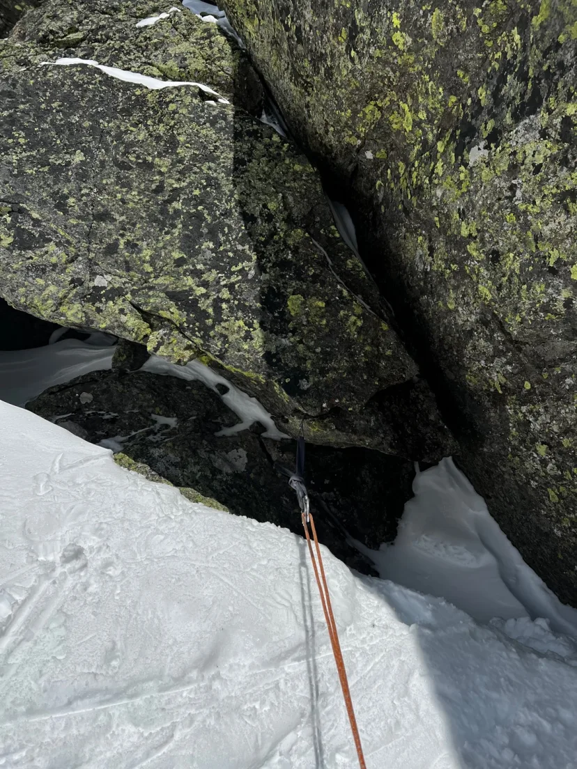
On the lookers right side of King Ravine, just right of West Gully, is a gully that trends diagonally right, then straight down, with a prominent ice bulge in between. This was reportedly skied in 1996 with no rappel, but a rope is almost always required. This could easily be done as a top down objective, but thinly covered ice above the crux bulge makes it a good idea to climb the route from below to get a sense of where to start the rappels. Bushwack climbers right from the bottom of Great Gully to the base of a narrow runout, climb through a small WI2 bulge in a rock lined constriction, following a wider snow gully to the base of the main ice. Climb this at WI3 into the upper gully. Easy bootpacking up to the snow gully above brings you to a left trending ramp, which finishes at the top of West Gully. Drop in and ski gentle double fall line skiing down and to skiers left to the mouth of the gully, moderately steep turns lead down to a constriction above the crux. Some trees to skiers left provide an easy anchor for a short rappel or ski belay down to the edge of the ice. In the conditions I skied it in, I side slipped on rappel for 20m to an exposed stance above the bulge. Build a V-thread and rappel 25m over the ice bulge into the lower gully. Steep turns into a narrowing constriction lead to a steep commitment turn over a small, non vertical ice bulge. This could potentially be bushwhacked around to skiers right. Ski the increasingly bushy exit until it terminates in thick vegetation. A short bushwhack brings you back to the base of Great Gully.
North Tripyramid Slide
North Tripyramid Slide is known by many as a notorious scramble hike to attain the Tripyramid Peaks, but the North Slide makes an excellent ski. While the skiing is steep and sustained, this is a good “intro slide” since it has a trail directly to the base, rather than a creek or bushwhack. Start on a groomed XC Trail and skin to the Tripyramid Loop. After leaving the roads, you’ll begin following a narrow but still easily skinned trail, which brings you to the narrow entrance to the slide. Kick turning is remarkably inefficient in the narrow lower section, so it’s good to A-frame the skis here. Climb the narrow runout to where the Slide fans out, the upper section gets more wind scoured and has big rocks, so it takes a good snow year to fill it in. When it’s in, this offers wide open skiing with remarkable views of the Sandwich Range and Pemigewasset Wilderness to the north. Drop in and ski through the wide upper section. Move into the long, but still steep and sustained lower slide. This often holds better powder as it’s more sheltered, but slough management is important here. The exit is mostly mellow gliding, but the groomed XC Trails will require a long and arduous skate back to the car. Be prepared for old men to heckle you while they glide past you at 7mph, while you waddle your way over the last few miles to the car. A small price to pay for such a fun adventure. Be aware that this slide, like most in the White Mountains, is a textbook terrain trap with is funnel shape and terminus in the trees.
Greeley Pond Slide
An excellent ski objective off the Kanc, and a good intro to the Osceola Terrain. Greeley Pond Slide descents precipitously from just shy of the East Osceola summit, down to Greeley Pond, dropping a series of ice bulges along the way.
Cedar Brook Slide
A lot of walking for not a lot of skiing. Nevertheless, it’s a good adventure, and the people who like this kind of thing will likely enjoy it. This slide is mostly low angle, with only a small section at the very top being steeper than 30 degrees, making it an excellent option if you’re looking for a slide tour that’s feasible on a day with elevated avalanche danger. Skin the Hancock Notch Trail to the Cedar Brook Trail and continue along as it kicks up in angle. Reach the height of land, rip skins, and ski down the Cedar Brook Trail, which is for the most part easy to follow in winter. The drainage of Cedar Brook Slide is not obvious, so checking the map frequently will be helpful. Break right from the trail a skin through moderate bushwhacking terrain. It doesn’t make great skiing on the way out, but it’s not a thrash. After a few hundred feet you’ll find a logical place to re-enter the drainage and reach the toe of the slide. Most or all of the slide can be ascended on skins. The slide has some interesting halfpipe like feathers and boulders you’ll need to get around. Despite looking gravely on maps, this slide needs a good amount of snow cover to ski well. While avalanche terrain is less of a concern here, be aware that this slide is very remote, and a small injury could leaf to a nightmare rescue scenario. From the tote of the slide, reverse your approach back to the Kanc for the exit.
Arrow Slide
An excellent White Mountain slide. Arrow Slide is stunning, with excellent views, surprisingly freeridable skiing, and a straightforward approach. Due to its southerly aspect and sheltered location, this line is often one of the first in the range to corn. In turn, this is a poor objective for the first warm up in a while. Park at the Hairpin Turn and cross the Kanc, following the Hancock Notch Trail to the Cedar Brook Trail. Where the Cedar Brook Trail forks left, break right to the Hancock loop trail. Skin easily to the junction and take the left fork of the loop down to where it crosses the Brook. From here, break left from the trail and follow the Brook to the base of the slide. Virtually no bushwhacking necessary, it’s remarkably close to the trail. Climb the slide, skinning until bootpacking becomes more efficient, to where it ends in the trees. Drop in and enjoy excellent turns down to the bottom. The majority of the approach glides well, with minimal pole planting until you reach the Hancock Notch Trail. Be aware that this line is a textbook terrain trap.
North Twin Slide
A classic White Mountains slide. This beautiful line is visible from town in Twin Mountain. It captures the skiers mind from afar, beckoning you to go ski it. The approach is long, but goes faster than you’d expect, and is fairly straight so long as you don’t get lost. Park at Seven Dwarfs Inn and be sure to follow parking payments instructions. Do not park illegally on Little River Road. This has been the subject of access issues in the past. Walk to the end of the road and pick up a herb path, this is not well marked but is often tracked out of snowshoers accessing the 4000 footers in winter. After about a mile you meat Haystack Road, take a right then turn left onto an unmarked forest road. Follow this gently uphill until you reach the drainage for North Twin Slide. Don’t skin the creek, make your way into the bushes to skiers left and skin easily through conifer woods trending roughly alongside the creek. Eventually the terrain will funnel you towards the base of the slide, skin the low angle drainage and pass a spot where moose antlers are secured to a tree, indicating you’ve found the slide. Easy skinning leads to a fork. The left option is steeper and more narrow, fanning out to some ice bulges at the top. The right option is lower angle and wider. Offering excellent pow turn. Either way. Skin as far as you feel comfortable and switch to bootpacking when necessary. The sheltered location of this line and cold, north facing aspect, make this a good spot to find powder when that would be unreasonable anywhere else. However,, both slides are considered avalanche terrain and present significant terrain traps. Keep your head on a swivel and be aware that you are a long way from help in the event of an accident.
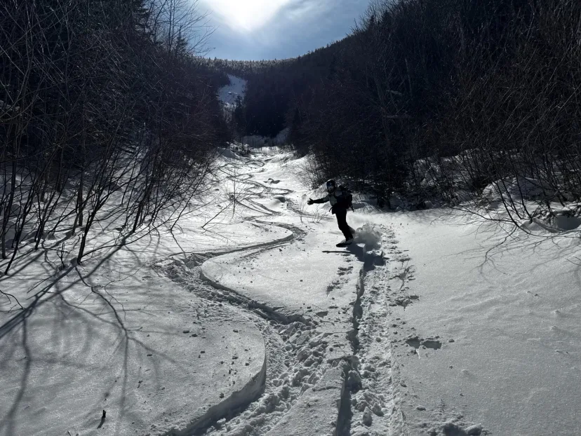
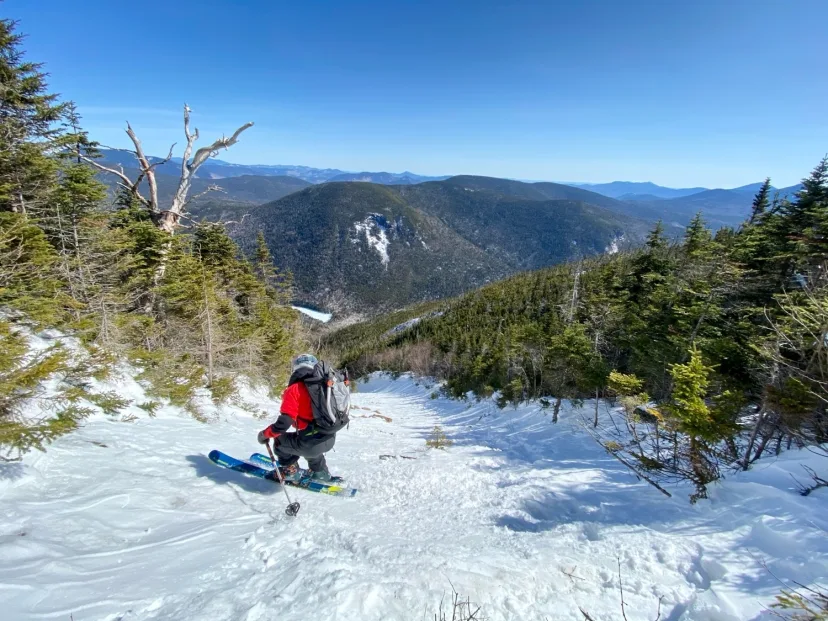
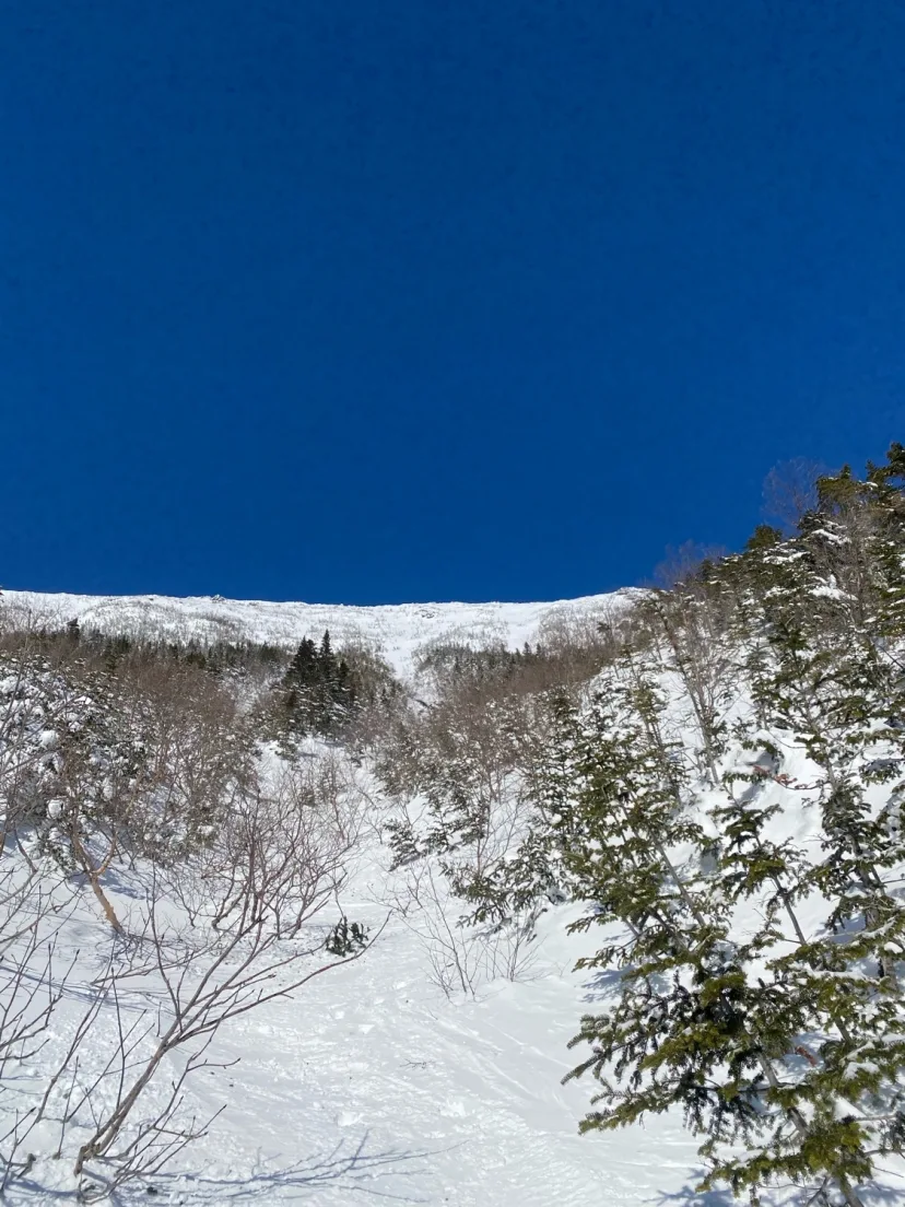
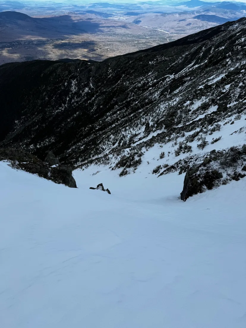
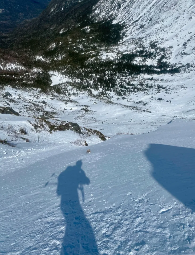
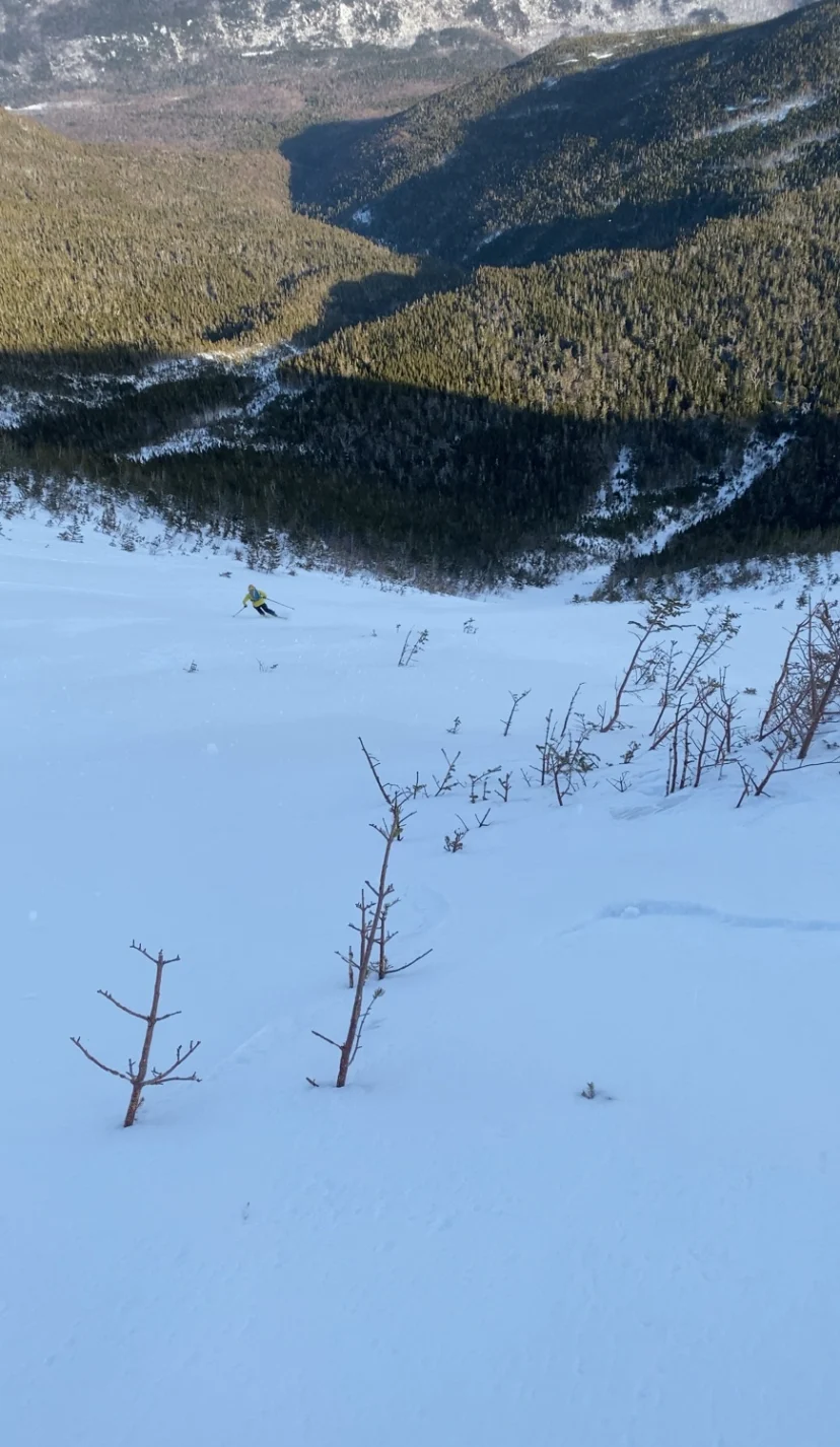
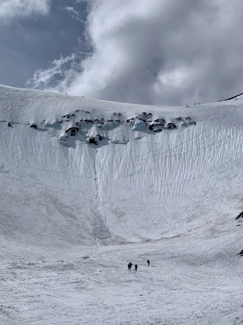
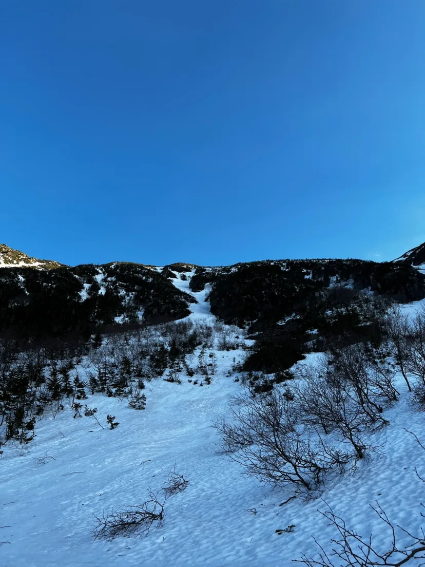
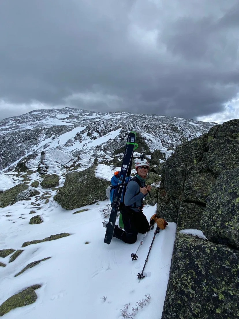
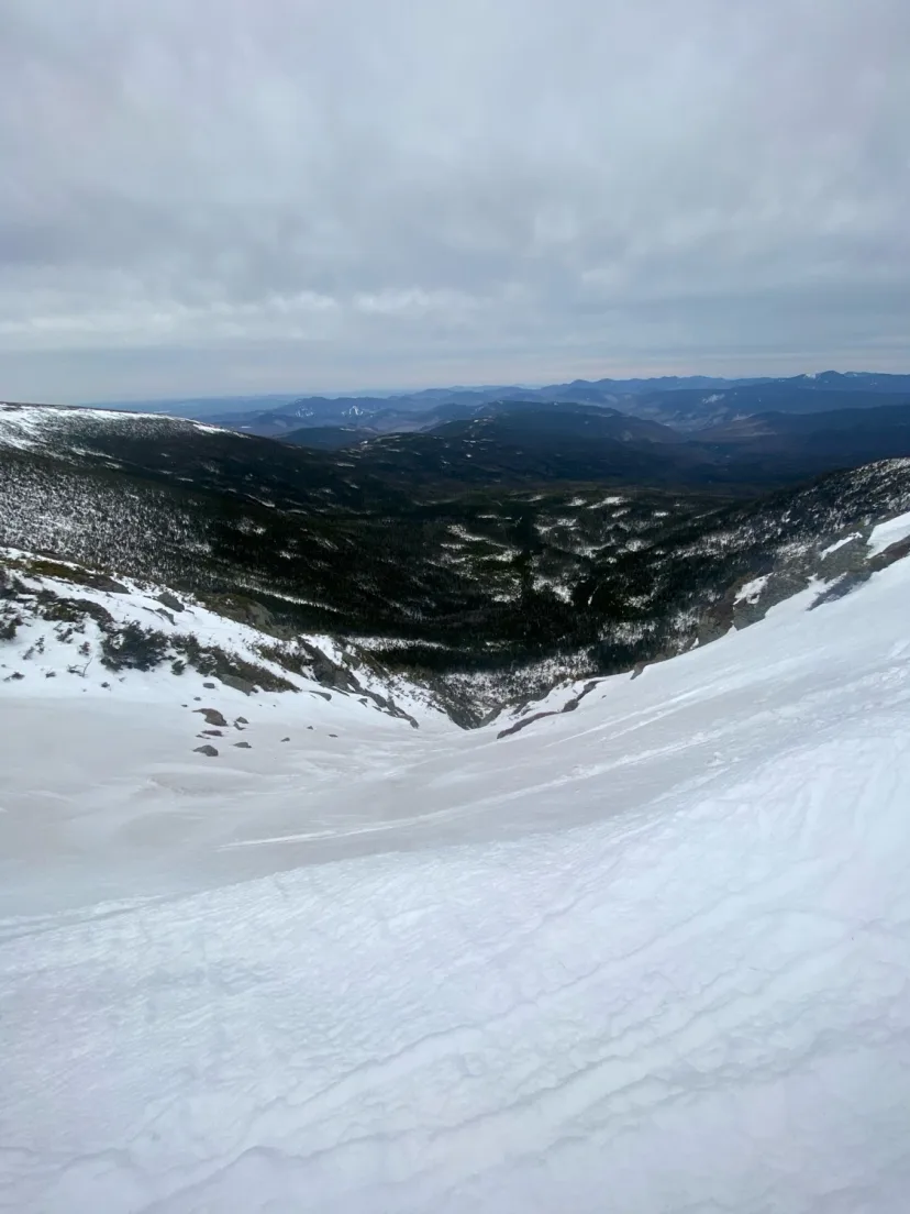
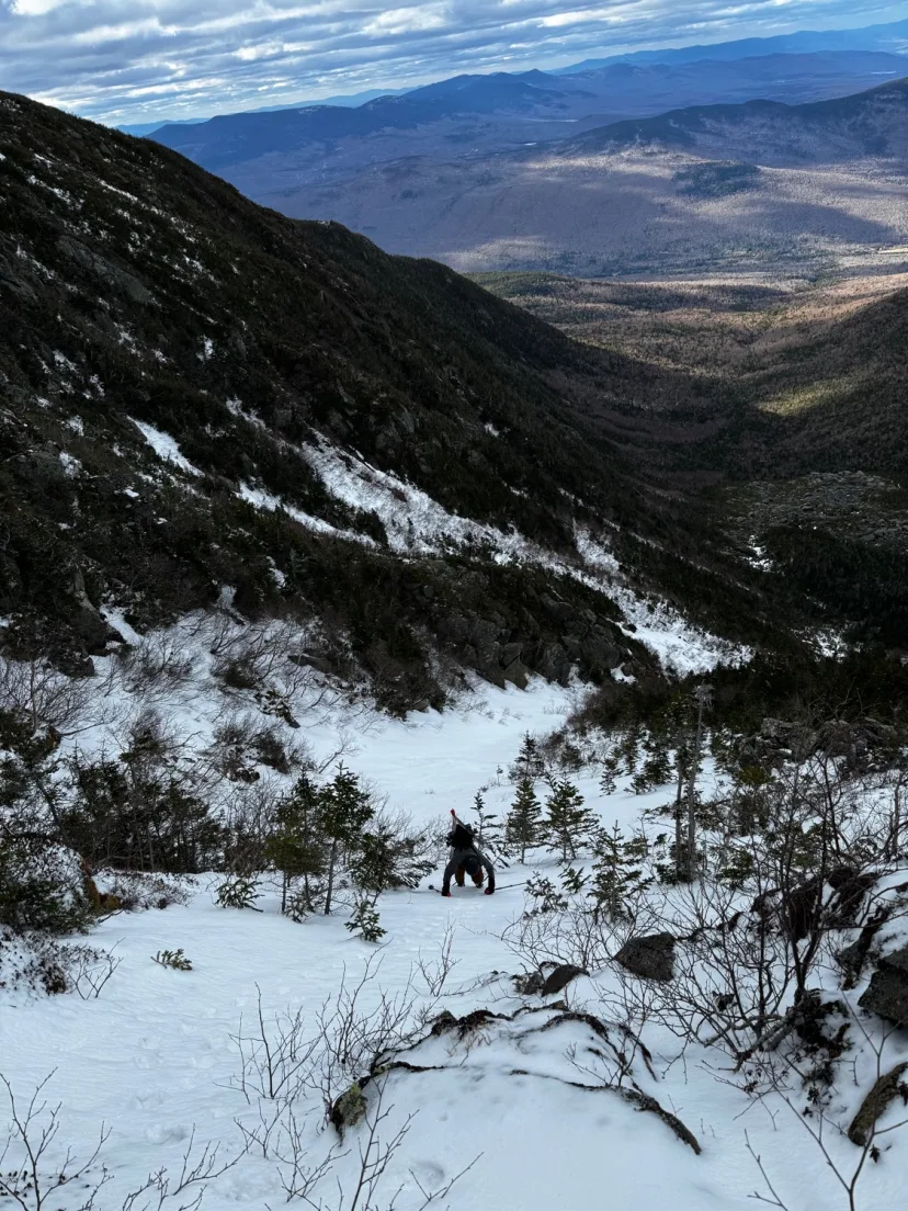
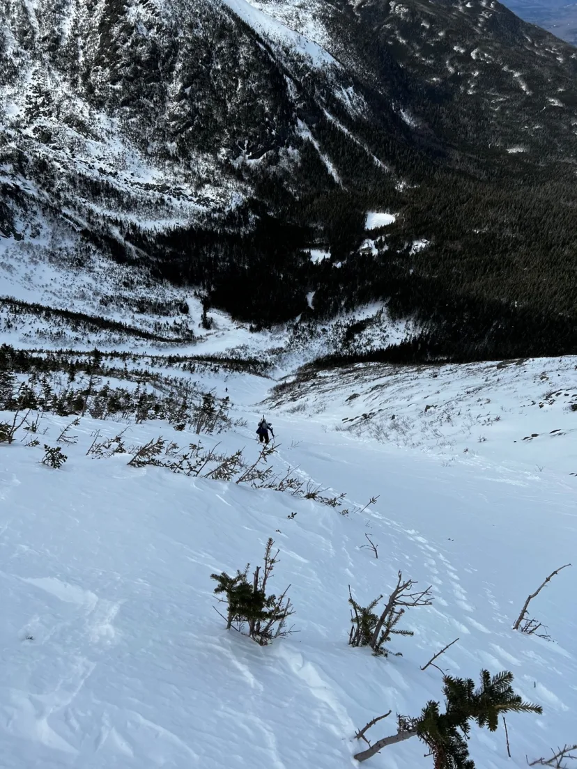
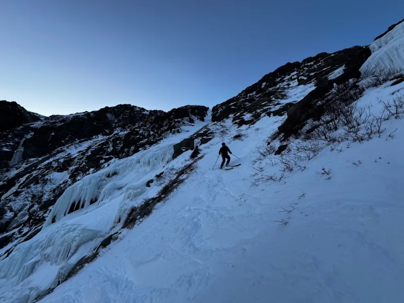
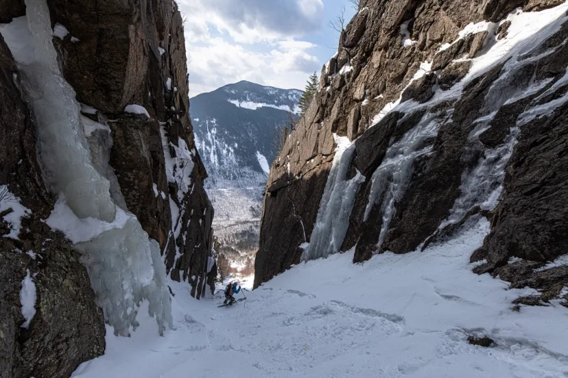
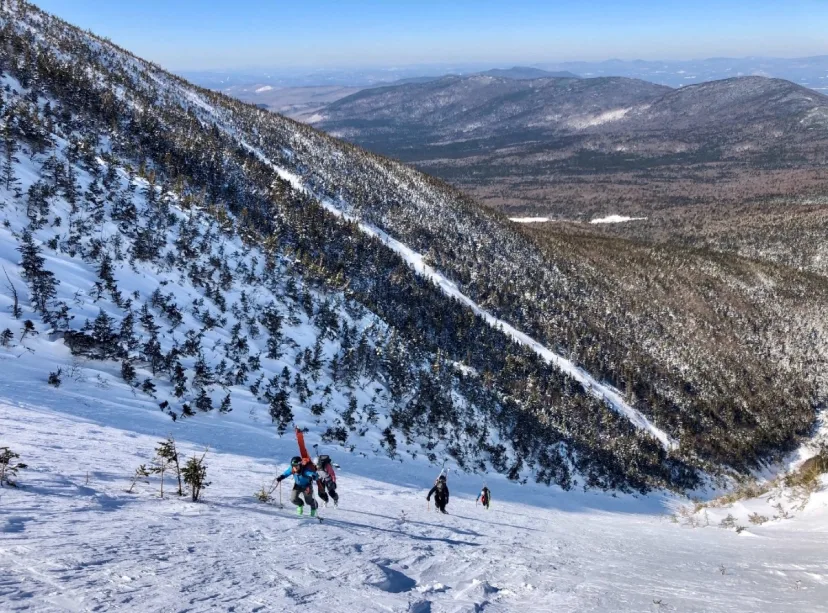
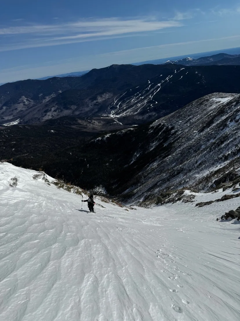
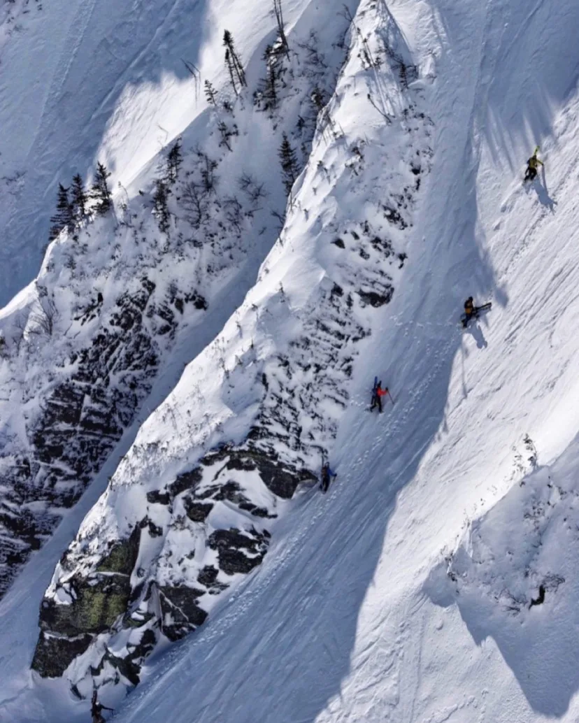
Carter Notch Couloir
A very steep couloir off the east face of Wildcat B. There’s a couple approaches, depending on your style. One approach is skin 19 Mile Brook Trail to Wildcat River Trail and climb the route from below. Another is to reach the summit of Wildcat B either by hiking the trail from Carter Notch Hut, or by riding the lift at Wildcat and skinning along the Wildcat Ridge Trail. Either way your journey begins at Wildcat B. Drop into some glades that are inobvious from above, then follow these to the top of the slide. A short open section with an excellent view leads to a large ice bulge that can be skirted to skiers right. This is also a textbook avalanche trigger point, so be extremely cautious if you’re going top down. Enter this tight, steep, high walled chute and ski exciting turns down to the runout. Exit out to Wildcat River Trail and skin back to Carter Notch Hut. From here you can easily coast down 19 Mile Brook Trail back to Route 16.
New Route
PF Flyer
Normally climbed as a WI3 ice route, PF Flyer sees almost no ski traffic. In fact, our descent in 2025 is the only recorded descent as far as I’ve been able to find. However, despite its obscurity, this line makes a worthwhile ski objective for the intrepid Presidential Range adventurer. In most years, the bottom is sealed off by a large ice bulge. This burns out quickly in the spring, and can be an open waterfall, even when Pinnacle Gully is still fat and plastic. While we managed a ropless descent under rare circumstances, aspiring parties should plan for a significant rappel here. Skin the King Ravine trail to where it wraps around a large boulder to the left side, revealing an incredible view of the line. From here, remove skis and bushwhack to the boulder field. Take the path of least resistance through the large stones, this is challenging but not as bad as it looks on paper. Bushwhack through shrubbery to the base of the line. From here begin boot packing up. At the bottom you’ll encounter a choke point, for us this was a mere commitment turn, but in most years it’s a pitch of WI3. Negotiate this to reach the inside of a deep couloir. About half way up it splits into two, the left is sealed off by a large ice slab, the right is clean and features a narrow dog leg. Ascend to skiers right, passing another ice bulge that squeezes the line to a choke point. Top out the line and put skis on in a comfortable spot. The initial gully begins low angle, before quickly steepening to around 40 degrees, with a wicked double fall line in a narrow chute. Ski carefully above the ice section, being mindful that ice could be shallowly buried under the snow. Make a hair raising commitment turn, (in lean years this could also require a downclimb or small rappel). From here, the chute dog legs to the right. More tight turns bring you back into the large couloir. Here it becomes more challenging to find safe zones. Ski the excellent ballroom to the exit crux. For us this was another short straight line, but in years when this requires a rappel, there are trees that could be reached on either side of the line. Most are small and I didn’t personally inspect them, but I’m sure you could find one that’s adequate, or equalize multiple. Exit the line into a wide fan, and ski out to the bushes, reversing your approach to the King Ravine Trail. While this line is a lot of fun, be aware that it is quite serious. Both as a challenging ski, and as a massive terrain trap. Even a small avalanche could have serious consequences. Treat this complex and temperamental line with the respect it demands, as it would not spit you out kindly.
Seven Direct
When the lower portion of Great Gully is closed off by blue ice bulges or running water in late spring, it’s common to traverse into a lookers right (skiers left) variation to skirt around it. However, this variation can also be skied top to bottom, which makes a great objective within itself. I haven’t found a name for this so I’ve simply given it one. Either climb it from the bottom of traverse over to skiers left from the top of Great Gully. Steep turns in a funnel shaped chute bring you to the top of a 20 foot cliff, this can be avoided to skiers left or right through the bushes. Rejoin the gully and follow more mellow turns down the open finish. Due to the cliff in the middle, this line is a no fall zone and should be approached with a high degree of caution. A fall or avalanche will have serious consequences.
Horseshoe Gully
An excellent ski mountaineering line on Webster, Horseshoe is like an easier version of Shoestring. Start from Webster Cliff Trail and skin past the base of Shoestring Gully. Follow blazes for a few more minutes to the inobvious base of the drainage. From here, skin up through dense woods to gain the runout of the gully. A boulder field that is thankfully shorter than Shoestring and Landslide leads to the base of the first ice bulge. This can be skirted to climbers left, climb a long section of snow to another ice bulge, before reaching the base of a narrow rock slot. This is the only mandatory ice bulge, and presents the crux at WI2. Climb a few funky bulges into the steep upper gully, which ends at a prominent rock buttress, the drainage above is choked out with bushes. Drop in and enjoy steep turns to above 20 feet above the ice choke, traverse skiers right to a good spruce tree. As of 2025 there is a blue dyneema sling with a locking carabiner on it for a rap anchor. A 20m rappel gets you over the rock band, you may need to downclimb some low angle ice to reach the snow again. From here, enjoy excellent chute skiing in a beautiful setting, skirting the next few ice bulges easily to skiers right. Exit the boulder filled runout and skin back to the car.
The Fingers
Also called Gully #4, this is where the Gulf of Slides terrain transitions from big defined gullies, to many parallel isles of snow. For what the fingers lack in spaciousness, they make up for in vertical. Skin up the Gulf of Slides Trail to where you reach the big downhill skin into the gully, at the center, break right into the deep, tree filled gully. Some gentle bushwhacking and awkward skinning eventually gets you to a split, break left at the split to access The Fingers. These chutes are long and steep, the central line is likely the cleanest. As the line peters out into steep talus, locate a spot to put your skies on. Enjoy great skiing down these thin, technical gullies to the run out, where you will likely deal with some side slipping around trees and other obstacles. This runout also creates a massive terrain trap should any of the gullies that join it happen to slide. This zone is a fun way to mix up the usual routine in Gulf of Slides, just make sure you pick a good stability day.
Carousel Gully
A short, low angle, double fall line gully that mostly serves as another entrance to Mother in Law. From the cog, break left to follow the gulf side path. Pass the large funnel shaped gully (Stinkbug) and look for the steep entrance to Junebug. To skiers right, locate a line that almost looks more like a traverse. This is Carousel. Drop in and ski across to join Mother in Law.
Turkey Feather
The most technical line in the Great Gulf. Turkey Feather is a variation of Turkey Chute that is closed off by ice bulges at the bottom. A downclimb or rappel is usually necessary, but fat conditions sometimes offer a way to sneak through. From the top of Turkey Chute, traverse hard right to the shoulder. Drop into the gully, ever steepening turns in a tight chute bring you to the top of the ice. A little down climbing may be necessary to reach V-threadable Ice. One rappel with a 60m rope gets you over the first ice bulge, the second ice bulge can usually be skirted to skiers right. This deposits you in a snowfield above the boulders, where you can traverse skiers left to the bottom of Turkey Chute/Airplane Gully. Shake off the rope work with some nice turns to the bottom. Be aware that this is a complex line in a remote wilderness area, with no realistic exit out the bottom. This should only be attempted in the best conditions, by skiers who are experienced ski mountaineering terrain.
East Gully
A long run on the East side of King Ravine. This skis better than it looks from far away. Iced Out and Great Gully are still the best options, but East Gully is definitely worthwhile. Drop in to a halfpipe shaped gully. Open turns up high lead to a constriction, negotiate this, then ski a tree lined gully to the runout. As the drainage starts to close out. Traverse through the trees to the bottom of Great Gully.
Drainpipe
This was originally called Rog’s Run but was renamed to Drainpipe. This line is quite exciting and deserves more traffic. Start skiers left of Airplane, just beneath the false summit of Clay that Pipeline begins on. Ski a low angle snowfield towards the intimidating blind roll. Sniff out the entrance to the chute, a very skinny slot that gets wider as you make your way down. As soon as you clear the choke, you’ll find yourself above a small cliff. Skirt it to either side and follow the steep, meandering gully to the bottom. Traverse right to Airplane Gully and bootpack up it for the exit.
Left Buttress
The steepest option in Oakes. Locate the top of Halfpipe Gully and pick through the bushes to skiers left. A tight entrance leads to a V shaped chute. Steep turns bring you through the choke and out to the shared runout with Halfpipe Gully and Right Buttress.
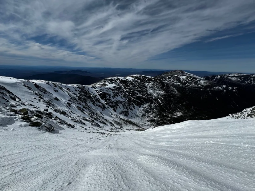
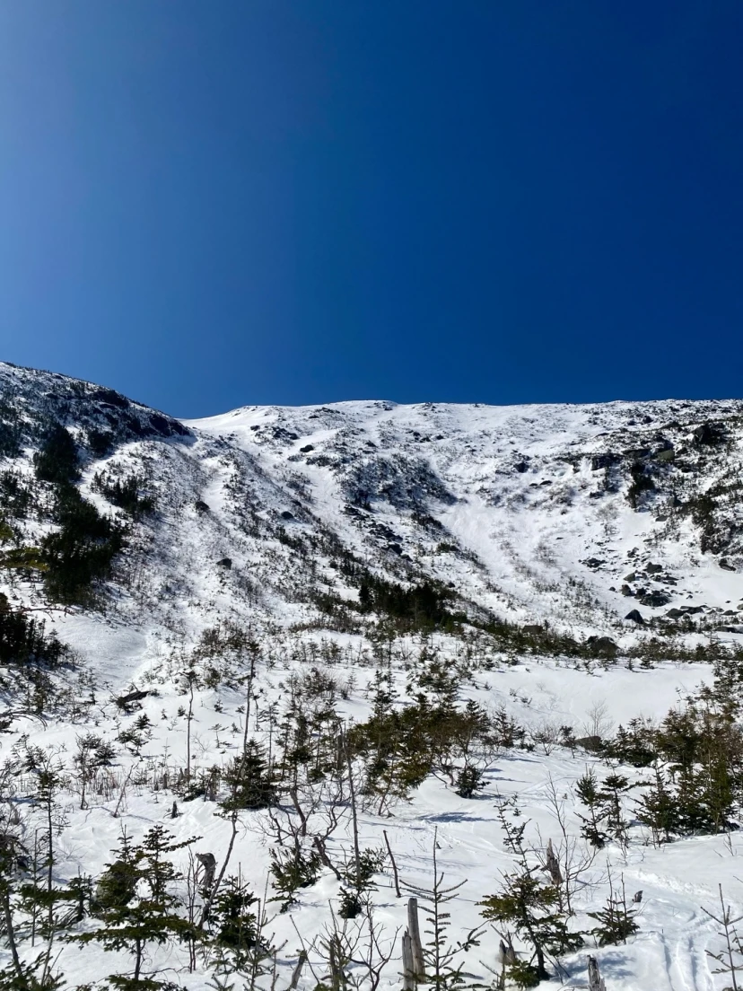
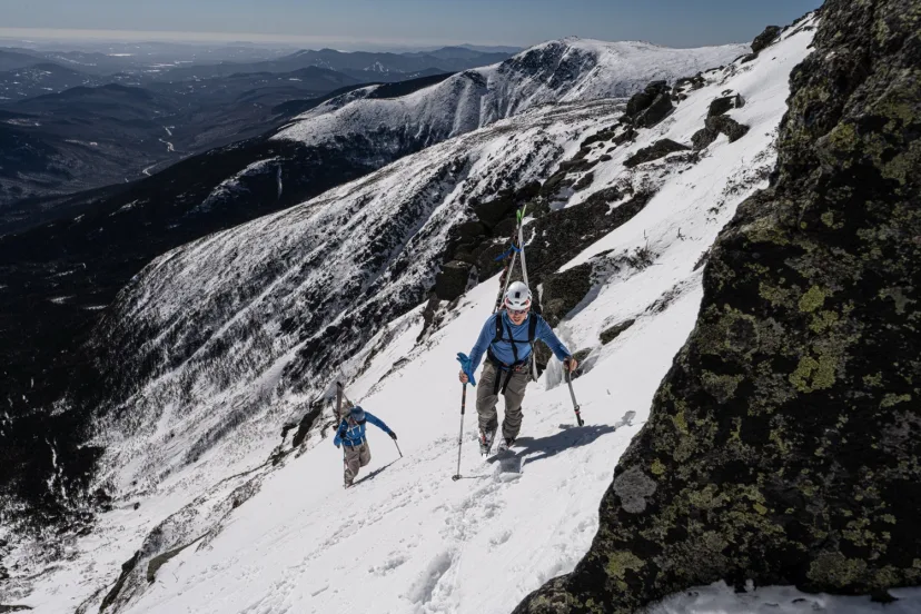
Tuckerman Ravine Trail
Perhaps the most significant trail in White Mountain ski culture. Almost every route outside of Gulf of Slides on the east side of the range is approached via this route. The trail is pretty self explanatory, but there’s a few things to know. It’s common to skip the initial flat part and the switchbacks by skinning the bottom of the Sherb, then crossing over. It’s debatable weather or not this is actually faster, but it’s common. As you skin up you’ll pass the split for the Huntington Ravine Trail and pass over two bridges. Here you get a nice view of Raymond Cataract and the upper mountain that’s bound to put you in a good mood on a sunny. Arrive at a junction with the Huntington Ravine Fire Road and hang a left. After a more switchbacks, you’ll pass the Lions Head Summer Route and the Lean Tos at Hermit Lake. Arrive at the Hermit Lake Shelter, where you get your first view of The Bowl and Boott Spur. If heading to the Sherburne Ski Trail, rip your skins here. If you’re continuing to The Bowl, continue to the narrow trail past a water pump (great place to fill up). The next stretch of trail is notoriously annoying. Very steep skinning in mid winter, or rock stairs you need to A-frame your skis for in spring. Another 20 minutes of hiking gains you the bottom of The Bowl.
Gully #2
A great way to beat the crowds in Main Gully. Gully #2 doesn’t quite touch the GOS trail, generally keeping things quieter. Unlike Main Gully which fans out into a few smaller fingers up top, Gully 2 stays pretty much the same width throughout. If there aren’t tracks coming out, where you break right from GOS trail isn’t super obvious, low angle bushy skinning leads into a more defined gully. Begin boot packing where it makes sense and top out to the lower angle talus slope above. Enjoy the long, meandering gully back down to where you started. Like all the GOS gullies, this is a textbook terrain trap.
South Gully
A step up from Escape Hatch, and a step down from Central and Diagonal. This is a great intro to the bigger lines in Huntington Ravine. South Gully is the comma shaped gully on the left side of the ravine. In thin conditions some light bushwhacking can be necessary to reach the runout. Enter the walls of the gully and bootpack up steep snow to the top. South Gully begins with steep turns in a deep gully, about half way down, it’s necessary to traverse skiers left into a side gully to navigate around an ice bulge. Join the bottom of the gully and ski out to the runout.
Mother In Law
The longest continuous gully in the Presidential Range. Mother In Law is an unfortunately ephemeral line. Usually scoured down to rock, when it’s in, this line is a real treat. From the Wilderness Boundary sign, drop in and ski consistent turns with a really cool perspective of the other Great Gulf lines. Pick your way around some talus to gain the next good section as ski this all the way to the bottom of the Great Gulf. One final steep section at the bottom can sometimes present a water hole in late spring. Either hike out the way you skied in, or ascend Airplane Gully to exit. As with all Great Gulf lines, there is no realistic exit out the bottom in winter. In the event of an emergency, your only exit is likely in a helicopter.
Southern Snowfields
A very fun and unique line that can be a great run on its own. It’s also a great way to access to bottom of Franklin Cirque, allowing you to ski in, rather than hike over on the ridge. This allows you to assess conditions on Bifocal and others from bottom up, rather than dropping in blind. Hike up to Lake of The Clouds and traverse beneath the summit of Mount Monroe, come around the corner and drop into the Southern Snowfields. Open turns up high blend into a series of tree covered benches. Weaving around these benches is a lot of fun, and has a mellow vibe compared to the steep gully skiing in most of the range. Ski down, generally trending to the right, to the floor of the cirque. You’ll finish roughly beneath Franklin Headwall and Bifocal Gully.
The Icefall
This is the series of ice cliffs located in the center of The Bowl of Tuckerman Ravine. There are a number of lines possible here with airs ranging in various sizes. In high snow years. It’s possible to ski through one chute in the center of the icefall cleanly. Otherwise, it’s air time. A huck of the icefall is likely to get a cheer from the entire Ravine, and in the spring it’s common to see spectacular sends and wipe outs. Beware that in late spring, melt holes open up that you can fall into and become trapped under the snowpack, which has resulted in numerous accidents and some hair raising near misses.
Franklin Headwall
Another underrated line in the Southern Presi. This line has great variety and is fairly “freerideable”. The best approach is to traverse South beneath the summit cone of Monroe and gain the ridge. Locate the top of the line, this may take some prior scouting to know where you’re going. Drop in and ski an open snowfield that slowly gets steeper, hang a turn to skiers right to enter a tight chute. Negotiate a small choke point, and enter a wider chute to finish. Bootpack out the way you came or climb Bifocal Gully to exit.
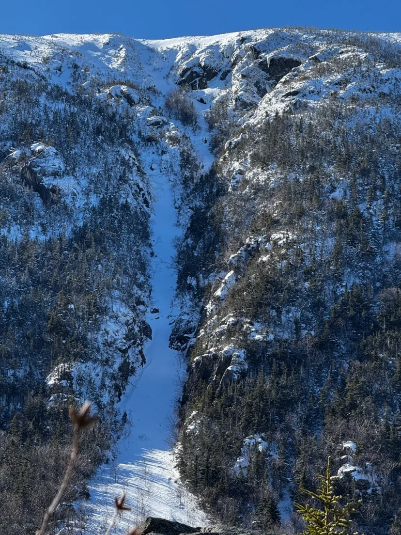
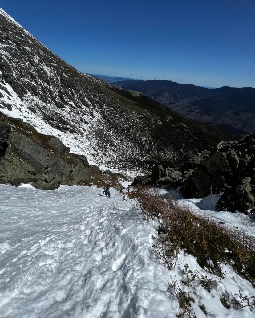
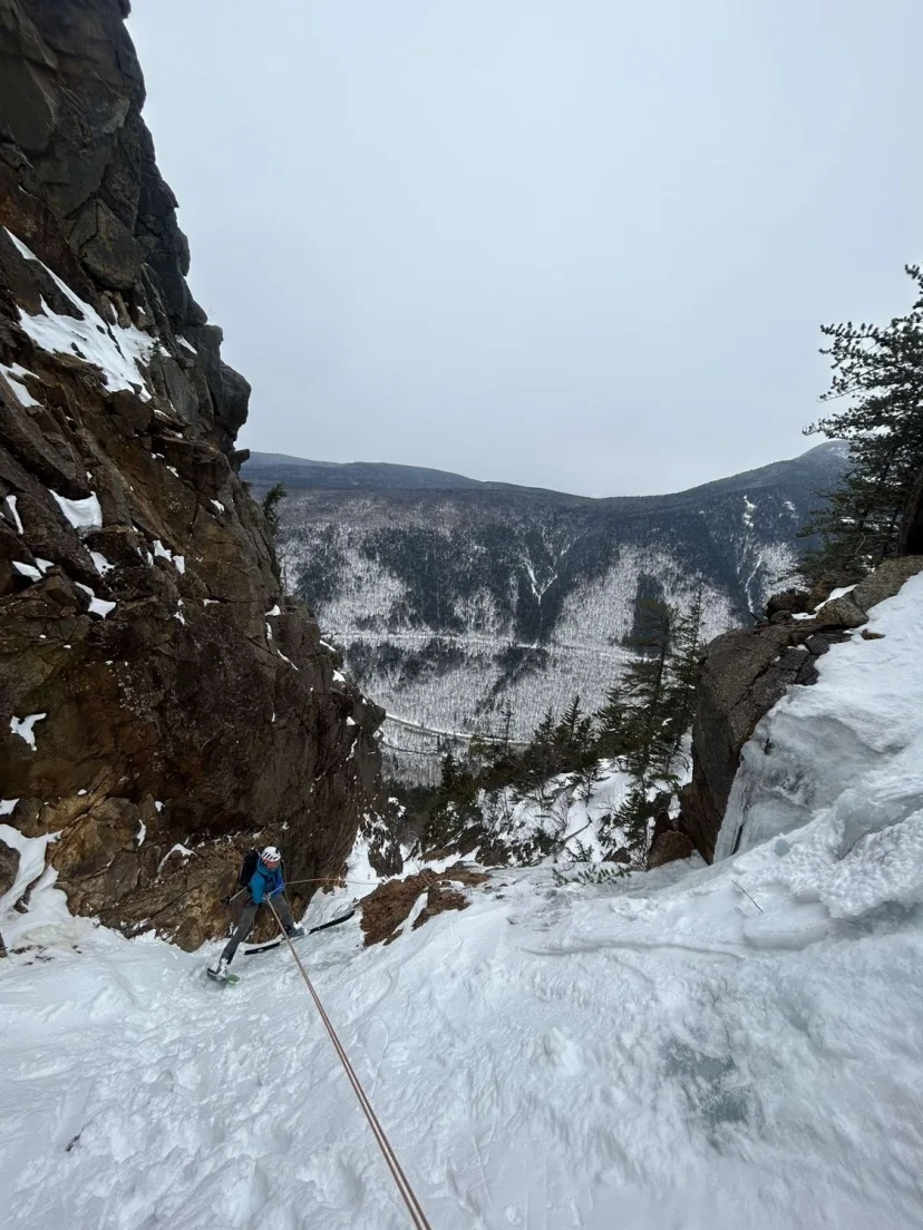
Damnation Gully
The crown jewel of ski mountaineering in the White Mountains. Usually climbed as a WI3 ice route, under the right conditions, this can be an amazing ski. The amount of rappels necessary can vary from season to season, but there is always one mandatory rappel in middle of the route. The best approach is to climb the route from the bottom to assess where the ice is. Depending on your risk tolerance, you may want to bring enough screws to lead the crux pitch if you’re not comfortable soloing. The top of the route is often capped with a cornice. This can be avoided to skiers right via a softer entry. The line begins with 50 degree turns in a majestic upper couloir. Weave around blue ice and rocks as the line meanders and fuels you towards the crux, a small ice bulge presents a dicey move above big exposure. In lean years this could be another rappel. Look for a small alcove to skiers left where you can set a rappel anchor high and back from the edge. As of 2023 there was a fixed anchor with three medium to large nuts in place, but bring your own rock gear and tat. Rappel over the WI3 ice bulge and gain access to the lower gully. These turns feel victorious after all the exposure and ropework you just endured. Ski out to the fan and enjoy open turn to the bottom of the ravine. You’ve just skied one of the most coveted technical routes in the range!
Stealth Gully
Named because you can’t see it from above, Stealth Gully is the best line in Jefferson Ravine. Warm up the legs by skiing The Beach. A few hundred feet or so above where it starts to terminate, at the low angle section of ridge near treeline, look for an entrance to skiers left. A big open pocket at the top sometimes sports a wind lip, drop in and ski to a convex roll, where the line narrows to a poorly defined gully. There’s one central thread, but many variations are possible. Ski out to a large area of downed trees at the floor of the ravine. Enjoy the peace and quiet, this is the only ravine with no trail to the bottom, and chances are you’ll be the only ski party there.
Iced Out Gully
An epic, high walled gully, with beautiful blue ice in top. Despite the name, this line is not obstructed by ice bulges, and it’s usually possible to ski around them. The best approach is to climb from the bottom. Ski a narrow entrance and stick to skiers right to ski around a prominent ice bulge, join a larger, deeper gully and ski this excellent chute to the runout.
Jefferson Headwall
This is like a mini version of the Tuckerman Ravine Headwall. Short and steep, this is a great area for hot laps. The best approach is to ski Stealth Gully first, then climb from the bottom. Alternatively, you can hike over from Adams and ski directly in. Either way you get to the top, the line begins with low angle turns to gain a right trending ribbon of snow, ski across this and drop into any of the various chutes. Steep turns in the 45 degrees range lead through the chutes to merge in a big open patch. Ski the bushy runout to the the ravine floor.
Robinson’s Neighborhood
A short run that roughly follows the Dry River Trail. This area has a max pitch of 25 degrees, making it a great option for high danger days, just be aware of your exposure to steeper terrain nearby such as Main Gully and Monroe Snowfields. Ski in from Lake of The Clouds and enjoy very wide gladed terrain down to a flat spot, just above where the drainage begins to steepen. You can skin multiple laps here quite easily, or progress into steeper terrain, that’s still on fairly small features if you feel more confident in the snowpack.
Chute Variation South
Perhaps the most complex line in the bowl. Ski the ever steepening Headwall until you are confronted by a cliff band, a very skinny entrance allows you to slip around it into a reverse comma shaped chute. The dog leg in the line presents a series hazard in the event of a fall. Make some incredibly steep turns and hang a left at the dog leg, exiting into the bowl. A lot of snow is needed to make this line necessary.
Ammo North Branch
The North Branch of Ammo is a unique line that unfortunately doesn’t always form. NW winds frequently scour this area, preventing a snowpack from developing. The North Branch offers mellow, yet adventurous skiing. Start by skiing up the Cog Railway. Above Jacob’s Ladder, traverse right following the cairned West Side Trail into the heart of the gully. Surprisingly low angle skiing in the upper gully, slowly steepens and funnels into a series of cascades. The lower half consists of tree lined gully skiing with a series of convex rolls. These rolls often present ice bulges that can be traversed around in the trees to either side. Negotiate these little rolls and cruxes until you reach the creek bed below. Ski out to where it joins the South Branch, and follow this back to Ammonoosuc Ravine Trail.
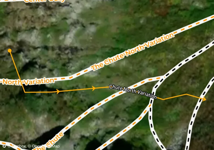
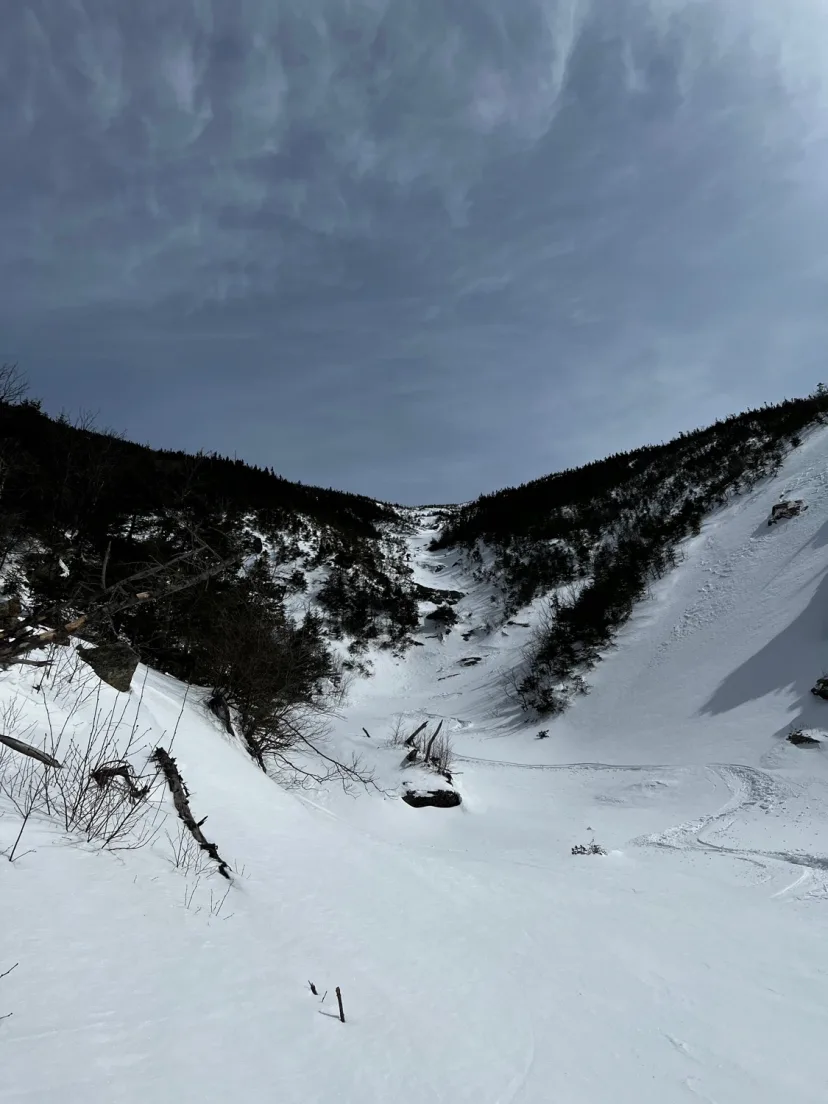
Chute North Variation
A short chute that can be accessed from either half way down The Chute or Center Headwall. An ice bulge at the top that can be skirted to either side gives way to a short, well defined Chute.
Central Gully
The eye catcher. Central is a striking couloir formed by the largest rock formation in the ravine. Start by climbing to the top of the fan, then climb the crux. The bottom of Central is choked out by a rock slab. This can manifest as a committing straight line in most conditions. In thin years, this can be a WI2- ice bulge that requires a rappel. In fat years, it can be all turns. Whatever you get, climb this section into the beautiful upper gully, which pinches out to rocks about 20 feet beneath the alpine garden. The beginning of the line is a bit of an optical illusion from below, because it’s actually lower angle to the top. Ski ever steepening snow until you hit the crux, however it presents, negotiate this to gain access to the fan. Enjoy open turns down and left of the boulder field all the way to the floor of Huntington Ravine.
Dodge’s Drop
Perhaps the most striking chute in the Presidential Range. Dodges is the first thing you see when you hike the final stretch of the Tuckerman Ravine Trail to Hermit Lake. It incites awe, inspiration and fear upon first glance. While the Headwall of Tuckerman Ravine is technically steeper, Dodge’s is a much more serious undertaking, with high consequences should you fall. In the spring, the best approach is to climb Hillman’s Highway and hike over to the top, to avoid standing in the line of slough. In mid winter you may want to consider climbing the line in order to evaluate conditions. There are two entrances, the skiers right being narrower but more direct, the left being wider but above exposure. Drop in steeply either way and join where they merge. Exciting turns lead to an exit crux, a constriction sometimes sporting an ice bulge or small air in thin conditions. Ski out the meandering bush gully to join Hillman’s. You’ve now skied one of the most coveted ski lines in the White Mountains.
King to Jefferson/Castle
This is another option for accessing the Mount Jefferson Ravines. Climb Airline Trail or Great Gully and hike up and over a col. Roughly follow Gulfside Path, there’s often sheltered pockets of snow that can be traversed on skins or skis to speed things up. The first line you come to is Abbey’s Way. This would be a really efficient way to get into Jefferson Ravine if it wasn’t a heinous bushwhack. If approaching from Adams, you’re better off descending to Edmands Col and skiing in Jefferson Headwall. Castle Ravine is also accessible from here.
Turkey Chute
One of the more reliable options in the Great Gulf. Turkey Chute’s northerly aspect usually allows it to last late into the season. Walk uphill to the top of Airplane Gully to the top of a high walled, funnel shaped chute, split by large rocks into the top. Pick your desired entrance and drop in. Steep turns merge the various entrances into the center of a high walled chute. Ski through the gut and out to a snowfield above a boulder field. Due to the rocks beneath this line, a fall in Turkey Chute could be very consequential. Traverse to skiers left and join the runout of Airplane Gully. Ski this to the bottom of Great Gulf and hike out. Usually Airplane has a bootpack in place for an easy exit.
Stinkbug
Very enticing from above, this line has a technical, downright dicey crux. From the cog, connect to Gulfside Path and walk uphill until you reach the top of a large, funnel shaped gully. Drop in and enjoy wide turns in this fantastic upper section. The line closes off about half way down, with a large cliff in the middle. A small ribbon of snow offers a way through. Side slip hair-raisingly close to the edge of the cliff, and tip toe left across a skinny traverse above the cliff. Continue to side step down until you can gain access to the lower gully. In lean conditions a downclimb or rappel may be necessary to negotiate this section. Ski the lower gully to join Mother and Law and ski out to the bottom. It’s worthwhile to scope this one from below before committing to it. As with all Great Gulf lines, there is no realistic exit out the bottom in winter. In the event of an emergency, you will likely need a helicopter.
King Ravine via Short Line Trail
The best option to access King Ravine is the Short Line Trail. Skin up Airline to a Junction with Short Line Trail. This avoids the water crossings of lower King Ravine Trail, at the final push to boulder field. Skinning up to this point is quite easy. From here, you ascend what basically serves as King Ravine’s version of the Little Headwall. In firm conditions you may want to bootpack this section. Arrive at a boulder field and stick to the left side to pick the trail back up another short section in the woods brings you to to a junction. Take the Great Gully Trail to the base of the ski terrain. For the ski out, you will likely have to walk to the boulder field, once you regain the King Ravine Trail, it’s possible to side slip the steep and narrow section back to Short Line, but in late season this can be torn up with post holes. Once on the Short Line, the trail is low angle and smooth enough that you can coast all the way to the bottom. The woods are wide enough that you can weave around dirt patches and rocks easily off to the sides. The lower mountain offers natural glade skiing in well spaced northern hardwoods to either side of Airline. Be aware that there could be uphill and downhill traffic at the same time on this route. Please respect other parties.
Halfpipe Gully
One of the best offerings in Oakes. As the name implies, this is a deep, well defined gully that splits the Buttress feature in Oakes. The start is equidistant from Tuckerman Ravine and Lake of the Clouds. Both approaches have have their merits. The line is difficult to spot from above, and there is usually a small cornice at the top, so approach the edge cautiously. Drop in and enjoy steep turns in a wide chute. The line empties out into a large slide path with sparse bushes that gets more dense the farther down you go. Stop and boot out when you’ve had enough, or for the full run, ski it all the way to the flats in Dry River Wilderness. From here you can skin climbers left to a steep drainage near the bottom of double barrel. Steep kick turns lead to the bottom of Robinson’s Neighborhood where more mellow skinning gets you back to Lake of the Clouds.
West Gully
A narrow gully to the lookers right side of King Ravine. This line is rarely skied and is not in very often. Ski the top of the gully to a constriction of rocks and bushes. Skirt around this and ski out the narrow runout to exit.
Yale Gully
When it’s in, this route is one of the longest and most sustained ski lines in the White Mountains. From below, the amount of blue ice makes this line seem incredibly unlikely from below. However, it’s possible to weave around almost all of these, except for the final bulge at the very top which is rock lined on either side and requires a perfect storm with minimal scouring to set it up. As a result, this would be classic can go entire seasons without being skied. The best approach is to climb the line to assess where the ice is. The bottom bulges can be avoided by taking the rightmost line of snow, and the middle bulge can be avoided with an elbow gully to climbers right. Top out the gully and enjoy the unique perspective of Huntington from this angle. The line begins with open turns that quickly pinch out to a steep, rock lined gully. Ski through a choke, then hang a hard skiers left traverse around the obvious ice bulge, the gully dog legs back right and opens up into a huge hanging snowfield above the majority of the ice bulges. Don’t ski this too low or you won’t be able to get into the exit gully. Traverse hard left again and get a skinny chute that avoids the majority of the ice. Ski out to the fan and enjoy victory turns to the bottom. This line is incredible, but is also one huge no fall zone, be prepared.
Right Buttress
The easiest of the buttress lines. Drop in to a shallow chute above a tree bench, hang a left to an open bowl which connects you to the bottom of Halfpipe Gully. Hike out from here or pick your way to the bottom of Oakes via well spaced shrubs and drainages.
The Muffin
A deep and aesthetic gully between Great Gully and Iced Out. This line is short due to the fact that a cliff band closes it off at the top, making it a good bonus lap after skiing another gully. Climb up to the base of Great Gully and hang left. Dig out below the steep rock band and drop in. Steep turns open up into a short ballroom, which narrows again before exiting to the runout to Great Gully.
Boott Spur Gully
An eye catcher from Hermit Lake, Boott Spur Gully evokes a “what’s that” look. Despite the popularity of the Boott Spur terrain, it’s pretty rare for this line to see tracks. Boott Spur Gully sports two distinct ice bulges. These can be covered in fat years, but often require a traverse around through the bushes when it’s thin. Start by bushwhacking for a short distance from the base of Hillman’s. Climb the gully and top out at a cool shoulder on Boott Spur. The perspective of the East side of Mount Washington is incredible here. Ski a low angle start to a rock band at the convexity, which can be avoided to skiers left. Excellent skiing down a wide panel leads to the first ice bulge. Negotiate this, then ski the second panel. A final ice bulge guards the lower third of the gully. Ski out to where you started.
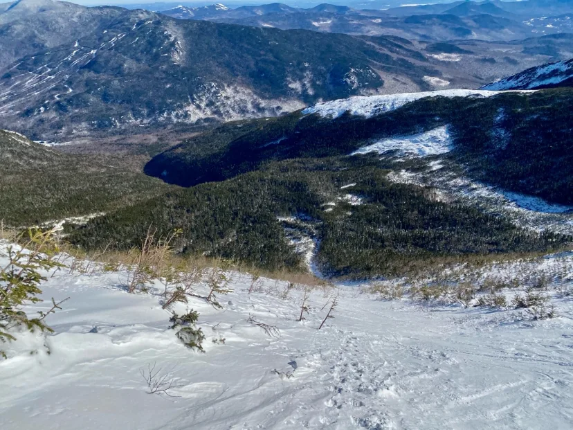
Activator Gully
A long and slightly complex line, very unique for the area. Activator Gully faces east, making it a good early morning run in the spring. This also means it can be baked out very quickly on a hot day. The exit to this run burns out in late spring, so March / early-mid April are the best time to attempt this line. Reach the summit of Mount Clay and drop in to the Great Gulf, a short hanging snowfield leads to a left trending ramp. Make turns down this exposed ramp, which empties out into a wide, low angle chute. Ski this all the way to the bottom, until the line is closed off by a small cliff. Bushwack to skiers right and exit the gully, trending towards Spaulding Lake. Skin back towards Spaulding Lake and reconnect with the bottom of Airplane Gully for the exit.
Burt Ravine South
Not always in, but when it is, this is a great tour on its own. Additionally. Its westerly aspect means it corns later in the day during the spring. Making it a great finish run after a day of skiing in the Great Gulf. There are a number of entrances to Burt South. You can enter from The Cog, or ski directly in from the ridge. Ski any of the long gullies into the bottom of the drainage, and follow it until you reach a landslide to skiers left. This makes a fun bonus lap, but also serves as the standard exit. Put your skins on and ascend the slide to the top, then contour back to the Cog Railway. Alternatively, you can continue to follow the brook out to the Jewell Trail. Only do this in deep conditions and expect bushwhacking and other adventure shenanigans.
Diagonal
This is essentially an alternate entrance into Activator Gully, avoiding the entrance ramp. From the col where Hallway begins, hang a high left traverse, gaining a left trending ramp. Follow this to join Activator Gully beneath the initial Headwall.
Diagonal Gully
This is one of the best ski lines in the White Mountains, and possibly the most aesthetic. From the parking lot in Pinkham Notch. This skinny couloir evokes inspiration and fear. Upon first look, you either instantly want to ski it, or are certain you don’t. This would be the most popular line in the range if not for that pesky Harvard Bulge. A 60 foot vertical ice bulge that seals off the bottom of the line, a fall or avalanche in Diagonal Gully could result in one being swept over the edge, with serious consequences. As a result, Diagonal is respected and feared. For the purposes of climbing and skiing the line, it is possible to climb the entry to Yale Gully, and climb a thin snow chimney to climbers right of the Harvard Bulge, so you can leave those ropes and ice screws at home. Top out the gully at a small snow patch just below the junction of the Huntington Ravine Trail and Alpine Garden Trail. Put skis on here and drop in. A steep convexity presents the first crux, as you drop into the high walled couloir. Consistently steep and memorable turns take you down Diagonal, with the constant awareness of the big exposure as a reminder to keep your slough beneath you. A number of safe zones are available to pull into, so you can ski the route in sections. As the walls open up, side slip to skiers left, getting uncomfortably close to the Harvard Bulge, until you can get into the skinny ribbon of snow. Side step down into the exit of Yale Gully and ski out to the fan.
Airplane Bowl
Another excellent offering. Airplane Bowl is longest, cleanest line in Oakes Gulf. It’s the eastern most line in the gulf, making approaching from Tuckerman Ravine a logical option. However you approach, begin at the top of a funnel shaped snowfield to skiers left of The Buttress. Open turns quickly become a long, consistent hallway, similar to The Fingers in Gulf of Slides. Once at the bottom of the gully, either reascend the way you came, or skin to climbers left, crossing a drainage and skiing back up to Robinson’s Neighborhood.
Abbey’s Way
This would be the best way to get to Jefferson Ravine from Adams, if not for the thousands of trees obstructing the line. Abbey’s Way is named for a sub peak that was once considered to be named after Abigail Adams. The best approach is to ski up Airline Trail and hike over along the Gulfside Path. Descent towards Jefferson Ravine towards an entrance to skiers left. An enticing opening gully gives the illusion that this line is clean and continuous. A traverse to skiers right leads to a few more good turns, as the vegetation slowly closes in. By the time you realize you’re in it, both hiking out and finishing the line both seem equally difficult. Bushwhack the line of least resistance to a talus slope, then continue bushwhacking to the open patch at base of Jefferson Ravine. Pick the spruce needles out of your teeth and climb out via Jefferson Headwall. This route should only be skied in a deep snow year.
Odell’s Gully
Now we’re starting to get into gnar. Odell’s Gully is named for Noel Odell. This aesthetic line is broken up by a large blue ice bulge that makes it a popular ice climbing route. However, this route is mostly snow, and is worthwhile as a ski mountaineering objective. In rare conditions, this line can be skied ropeless. In most cases, a rappel is necessary. Climb steep snow in the lower gully to the base of the ice. The left side of the bulge can be climbed at WI2. Set your belay in good spot above the ice, because this will likely also serve as your rappel anchor. Climb the rest of the steep snow to the top. The upper turns in Odell’s are super memorable. Very steep and sustained, the gully widening from just a pinch to multiple ski lengths wide. Just above the ice, there’s a big rock that splits the line. Skirt this to either side. The crux of the line is by far finding a good rappel anchor. Chossy rock, dubious saplings and ice that’s hard to reach from above present an unfortunate ‘choose your own adventure’. Don’t be afraid to take a belay to down climb to the ice. Rappel 30m or so into the lower gully. Enjoy high walled, open gully skiing all the way down to the fan. Congrats, you just plucked one of the big plums in the range.
Cathedral Gully
A seldom skied line to the left of Dodge’s. Cathedral Gully is a high walled beauty that is unfortunately often wind scoured, or burnt out early in the spring. Cathedral starts with narrow turns through a rocky start, then dog legs straight down to empty out into the bushes, the high walled skiing is over quickly, and the line finishes with a long, discontinuous bush gully, similar to the finish of Dodge’s. This is one of the rare forming lines in the Ravine and there are certainly better ski options.
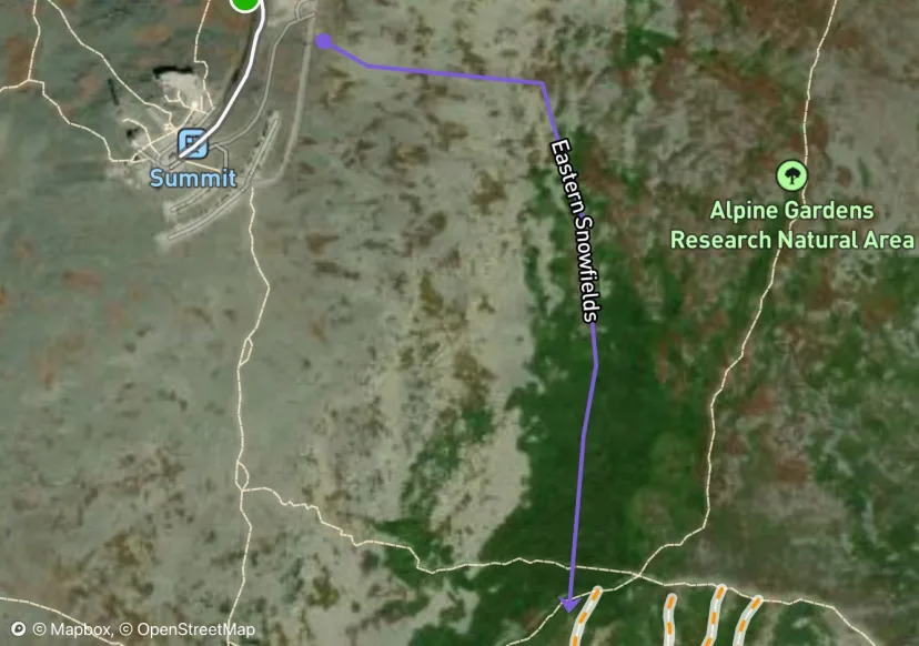
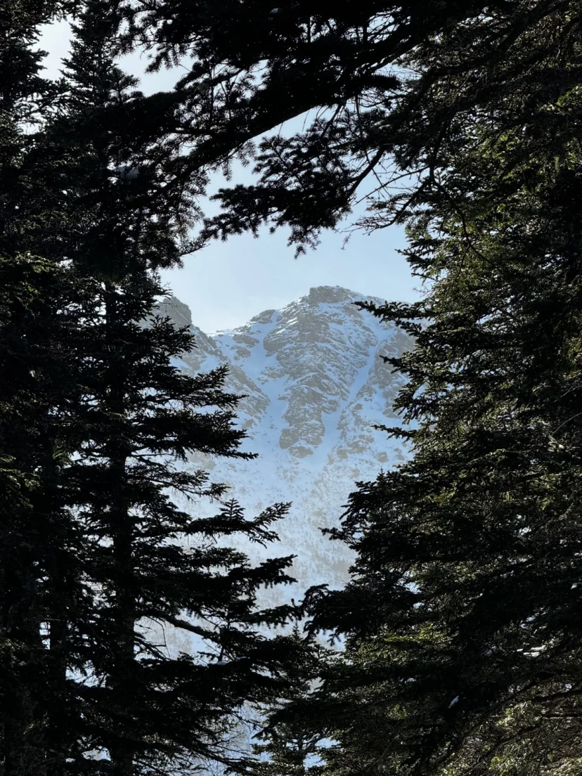
Eastern Snowfields
This is a great way to ski from Mount Washington into Tuckerman Ravine. The Eastern Snowfields start a few hundred feet shy of the summit of Mount Washington, right near the auto road. The easiest way to get there is to climb Right Gully and follow Lion’s Head Trail to the snowfields and trend right. From the summit. Ski down the initial hundred feet of the auto road and look for a pull off that gets near the edge. The Eastern Snowfields offer beautiful, wide open turns high above everything else in New England. Hang a hard skiers right traverse to gain access to the Tuckerman Ravine. It’s easy to ski right over to The Lip or any of the South Facing lines.
The Sluice
At the right corner of the bowl is a steep, curved Gully known as The Sluice. This is one of the steepest and most fun offerings in the bowl. Climb Sluice itself or climb Right Gully and traverse over. Steep turns funnel you into what’s affectionately called Chicken Rock Gully, where you can hang a right and ski into the lower bowl. Be aware that The Sluice sits above a boulder field known as The Lunch Rocks. This is not only a bad place to eat lunch due to overhead hazard, it also presents a hazard should you take a long sliding fall in The Sluice. While the Headwall is known to spit skiers out with only a bruised ego, falling down The Sluice could have much worse consequences.
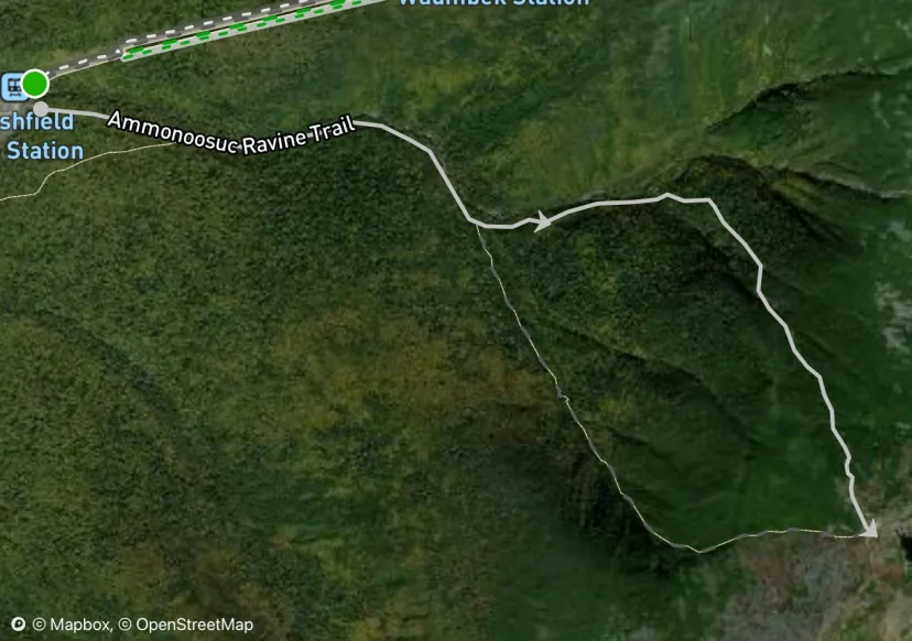
Ammonoosuc Ravine Trail
This is the standard approach route to Monroe Brook, Ammonoosuc Ravine and Oakes Gulf. This can be picked up from the Ammonoosuc Ravine Trailhead or The Cog. It begins as a long and flat trail. The first major drainage you encounter is Monroe Brook, further up the trail, just before the trail turns hard right to the hill, you can break left to Ammonoosuc Ravine proper. If you continue to follow it up the hill, bootpacking becomes necessary as you ascend to Lake of The Clouds. From here it’s possible to access Oakes Gulf and Mount Franklin Cirque.
Green Chasm
A high walled, aesthetic gem of a line. This route is incredibly ephemeral, which is unfortunate because it’s such a cool ski! Follow the approach from Willey House to Central Couloir, and climb most of the way up, where Central breaks left into the deep couloir, break right into the obvious chasm. This is not particularly steep, and bushes and rocks often obstruct parts of the line, but the setting makes up for it. Bootpack to the base of the ice climbing, and dig out a spot for your skis here. Drop in and enjoy tight turns in this wild chasm. A small chockstone sometimes requires removing the skis for. Ski out of the rock walls and either traverse right to join Central, or milk the independent line further down into the trees to join Central lower. Ski out the bottom of Central and retrace your steps to Willey House.
GOS - Tucks connect.
It’s common to link both of these zones in a single tour. In my experience, the path of least resistance is to hike directly over Boott Spur’s summit from Hillman’s and ski down a low angle snowfield that naturally funnels you into the top of Main Gully. Conditions are different every year, but in my experience wind loading tends to form this path of least resistance commonly.
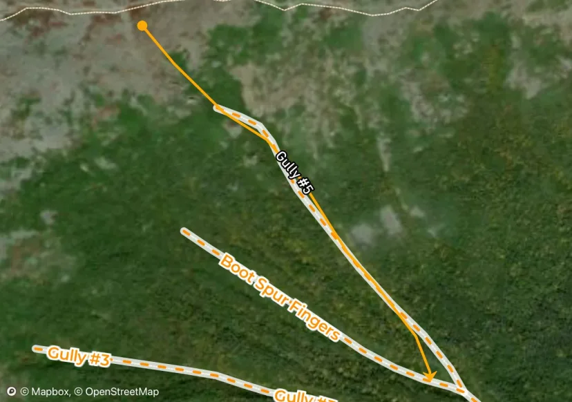
Gully #5
At the right end of The Fingers, is one wider, more prominent Gully. This is Gully #5, which deserves its own listing. Enter the big drainage after the downhill skin on GOS Trail, as you would for The Fingers. Break right at the fork and join this slender gully. Unlike the other GOS lines uphill of here, Gully 5 actually allows you to top out and ski from Boott Spur Ridge. The top can be bushy in lean conditions, ski through a short rock lined chute, which mellows into a long tree lined gully. Ski this back to the fork and navigate the bushy drainage back to GOS trail. This area is complex avalanche terrain and presents a big terrain trap, which all the fingers merging into one narrow drainage. Be aware and pick a good stability day to venture into this zone.
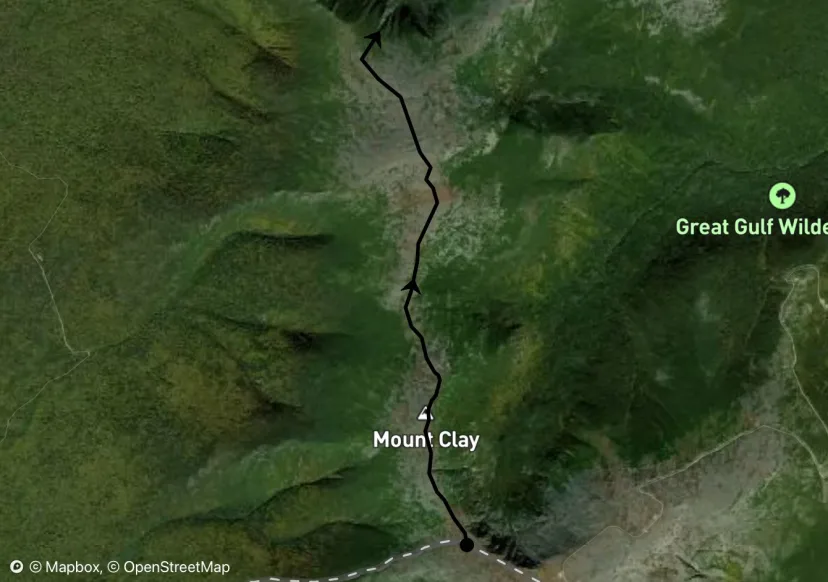
Sphinx Col Gully
A short little line that’s a great addition to any tour. Hike to the summit of Mount Clay and ski to the Col between Clay and Jefferson. Pass the Sphinx Trail and look for the top of an obvious gully. This line is short and steep, but certainly worthwhile. Bootpack back out for an easy exit.
The Hidden Hallway
This line threads a surprisingly gentle needle through otherwise improbable terrain. It’s also one of the longest runs in Great Gulf. Due to having a more easterly aspect, this line and others in the area can corn up earlier in the morning than the N/NE facing terrain further up the ridge. The bottom of this line burns out earlier in the spring than others in the Great Gulf. So plan on a March or early-mid April descent for this line. Hike past the top of Pipeline to the col between this, and the true summit of Mount Clay. Ski a blind, low angle snowfield, to the edge of a convex roll. Part of the reason this line gets the name Hidden Hallway is because you can’t see the line in its entirety from anywhere in the range, except inside it. As you near the edge, a long narrow gully should reveal itself. Ski this to a junction. From here. The line blends into a series of skiers left trending ramps. Ski the first ramp to a construction. In late season this can blow out into a water hole. In this case, you can skirt it to skiers right. Either line you take, follow the next ramp until it peters out into an ill defined gully. While it’s tempting to try and traverse right through the boulders, for the best exit, ski straight down this bushy drainage, which slowly transitions from skiing to bushwhacking. Ski out of the woods directly to Spaulding Lake, and skin easily back to the bottom of Airplane Gully. Those who have tried to cross the boulder field have reported regrets.
Monroe Brook
This is easily the best offering in Ammo, and possibly the best line on the West Side. This would make a great first tour in the Presidentials as well. This can be approached easily by following the the Ammonoosuc Ravine Trail to Lake of The Clouds and traversing South beneath the summit of Mount Monroe until you reach the gully. But it is smart to approach from below to assess conditions. To do this, skin along the Ammonoosuc Ravine trail and locate a faint drainage on the right. A gladed path provides a gentle skinning approach to the base of the gully. After navigating around some water holes, you gain the bottom of the line. Ascend the meandering gully and top out in the bushes below the summit cone of Mount Monroe. There are two entrances, the left is quite steep at the top, the right is lower angle. Both join a long gully that provides excellent skiing down to Ammonoosuc Ravine Trail. This route makes an awesome exit run after a day of skiing of in Oakes Gulf.
Escape Hatch
This route is the standard walk off for ice climbing routes in Huntington Ravine, during mid winter conditions. It also makes a great ski. Escape Hatch is the least exposed offering in Huntington, making a great option for those who want to explore this Ravine but don’t want to ski no fall zones. From the floor of Huntington Ravine, bushwhack up and left to the base of the gully. Boott pack up to where the gully tops out on the shoulder of the ravine. The top of the gully is marked by a famous shovel handle wedged in a cairn like the sword of Excalibur. The line begins with steep turns on a wide open panel, about half way down the line steeps and gets tighter. Exit the gully and pick your way skiers left back to the Huntington Ravine Fire Road.
Ammo South Gully
This is the most reliable option in Ammo Ravine. This line is quite fun and doesn’t get the attention it deserves. Follow the approach for Ammo Central but break right at the final split, a narrow, low angle aisle takes you around the corner, before opening up into a wide, steep gully, similar to that of Gulf of Slides Gully 3. The angle eases off and the gully fans out into a wide open snowfield. Put your skis on and enjoy excellent turns down this clean run. Be aware that this line is a massive terrain trap.
Main Gully
This short option offers great skiing with a short steep pitch. A good first tour in the range, and a good terrain progression if you’re looking to step out into steeper terrain. Main Gully is avalanche terrain, but it’s a much smaller feature than Airplane Bowl and the Buttress chutes. Ski a low angle halfpipe gully to a convex roll and enjoy steeper turns down to the bottom of Robinson’s Neighborhood.
Hillman’s Highway
Hillman’s is an undeniable East Coast classic. It’s long, wide and sustained skiing above treeline. To access the base, skin from Hermit Lake across the bridge at the beginning of the Sherburne Ski Trail, take a right and look for a small trail that splits up and left. Steep skinning brings you out of the bushes and into the bottom of the line. Boot pack up until a split is encountered at the “Christmas Tree”. The climbers right option is wider, and not quite as steep. The climbers left option is steeper and meanders more, meaning more consequential in case of a fall. Enjoy beautiful fall line skiing down this perfect run to the bottom. Be aware that Hillman’s Highway can, and has been the scene of large and powerful avalanches.
Burt Ravine North
Don’t do it. Okay maybe that’s harsh, just be aware of what you’re getting into. This line unfortunately doesn’t form except in very rare conditions, like the 2010 snow year. This line requires consistent heavy snowfall on east winds to fill in. Additionally, the many years without avalanches appear to have allowed trees to grow taller, and present a significant obstacle. If you still want to explore this branch of Burt, skin up the Jewel Trail until just below Mount Clay. Pick your way through a talus field to a promising upper gully. A few nice turns quickly blend into heinous bushwacking. Fight your way into the creek and follow it to where you’ll emerge into an open patch. Here. A landslide on the skiers left wall merges into the drainage and opens up a section of good skiing, until you reach a waterfall. Bushwhack to the left to avoid it, then follow heinous bushwhacking through a low angle creek. Terrain only gets worse until you can exit the creek to the right and ski along side it in the woods. Cross the Clay Brook the skiers left side and try to locate an exit path marked with flagging, until you can join the Jewell Trail again. This line is best avoided unless it’s really filled in.
The Beach
Perhaps the most reliable patch of snow in the range. It’s not uncommon to find snow here in June. Ski this low angle snowfield with incredible views of Great Gulf Wilderness, until it ends just above Stealth Gully. Continuing into the aforementioned line makes for one of the longest alpine runs in the east! However the beach is worthwhile on its own as an objective in late season.
Lower Oakes Exit
From the bottom of Oakes, skin left through the trees and cross a small creek to gain the bottom of a skinny drainage, make steep kick turns past the bottom of double barrel to gain the bottom of Robinson’s Neighborhood. Easy skinning gets you back to Lake of The Clouds.
Junebug
A sleeper classic. Junebug is one of the longest runs in the range if you take it all the way to the bottom, and offers steep and sustained skiing throughout. From the cog, break left to follow the gulf side path. Pass the large funnel shaped gully (Stinkbug) and look for the steep entrance to Junebug. It’s a little sneaky, but you should see a steep, fall line gully with a small cliff in the middle of the entrance. Drop in and circumnavigate the cliff to skiers left. More open turns join Mother In Law. Ski this to the bottom. Long, clean, epic! Mother in Law is usually thin at best, so for maximum skiing, it’s better to try this one a little earlier in the spring. However Junebug itself can last late into the season due to its northerly aspect.
Gully #3
The longest and cleanest run in Gulf of Slides. From the final stretch of GOS Trail, look for a faint drainage in the woods to the right. Follow this until you emerge from the trees into the lower gully. Bootpack up until the line ends in the lower angle talus slope above, and put skis on. Enjoy wide open, beautiful turns in a big gully. As it peters out, weave more technical turns through the runout back to GOS Trail. Like all the lines in GOS, this is a textbook terrain trap.
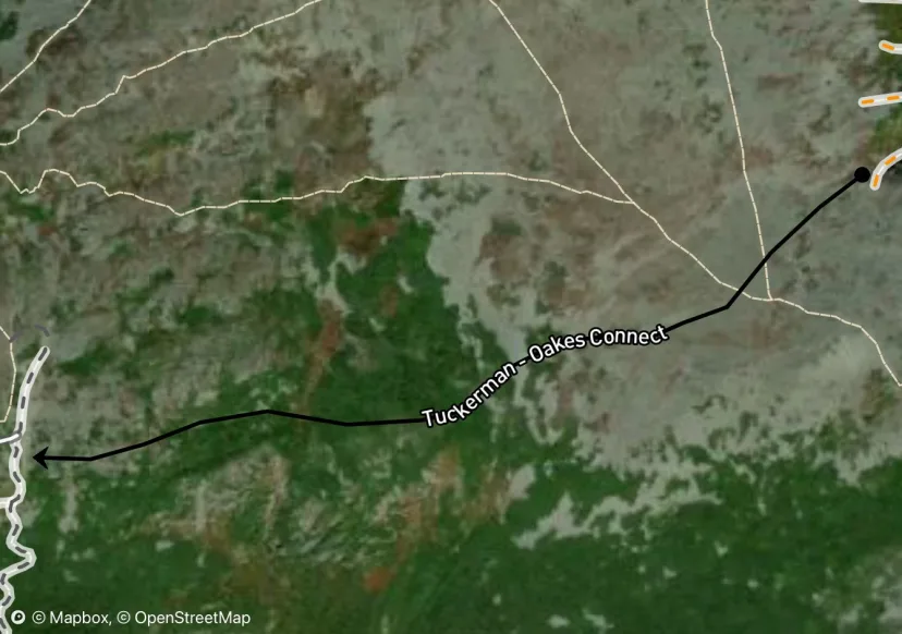
Tuckerman - Oakes Connect
While Oakes Gulf is most easily approached from Lake of The Clouds, there are a number of reasons why it might make sense to approach from Tuckerman Ravine. - The West Side terrain is not as reliable, frequently suffering from blown out creeks, thin conditions, and heavy wind scouring. This makes Tuckerman Ravine the more reliable ski exit. - Airplane Bowl and the buttress are a longer walk of Lake of The Clouds, in mid winter to early spring it’s possible to ski gentle downhill from the Bigelow Lawn to the top of Halfpipe Gully. - It’s more fun, plain and simple, it’s awesome to ski Oakes all day and finish with a lap down Tucks to The Sherb. Ultimately both approaches have their merits, but I wanted to offer this as an option, since many people I’ve talked to think it’s super complicated to ski Oakes from the east side. Climb to the top of left gully and walk up and over talus until you cross the cairned paths of Lawn Cut Off and Davis Path. This area gets scoured by the wind and conditions can always be different, but almost every time I’ve done this approach, there is usually an isle of snow/rime ice you can ski. The terrain trends slightly downhill and it’s most natural to ski to Airplane Bowl/The Buttress Line. To get to Main Gully / Robinson’s, keep trending down and right along a series of protected snow patches all the way there. Enjoy as many laps as you want, then skin back the way you came to return to Tucks.
Pipeline Gully
One of the most aesthetic lines in the range, Pipeline is on everyone’s hit list. It’s a high walled couloir that splits the false peak of Mount Clay. An ice bulge seals off the bottom most years. In the fattest conditions, this line is all skiing. In the lean years. A rappel may be necessary to exit the bottom. In most cases, there is a small ice bulge that can be negotiated with some air time. It’s good to scope this one from below to know what you’re dealing with. From the cog, bootpack up to the false summit of Mount Clay, the gully is obvious from above. As you drop in, the line gets continually steeper, bringing you to the exit crux. Negotiate this. And traverse right at the runout to meet the bottom of Airplane Gully. Be aware that the ice bulge in this line presents a high consequence situation in the event of an avalanche.
Main Gully
A Mountain Washington Valley Classic. Skin the Gulf of Slides Trail as far as it goes, and you will eventually be funneled directly to the base. From here, you can begin boot packing. This wide and beautiful gully, lined with short fir trees on either side, is broken only by a non vertical ice bulge in the middle. Steep turns in the upper half lead to the ice bulge, where you can easily skirt it to either side. Lower angle turns down the run out funnel into a low angle drainage with tight trees. Try not to tangle up as you make your way back to GOS trail. Like all the GOS gullies, this is a textbook terrain trap.
North Sister
The most aesthetic of the 3 Sisters. Also known as Twisted Sister. Drop into the rock lined funnel. Beautiful, steep turns in this high walled gully lead to a talus crux. Sidestep through and gain the lower runout. Unlike other ravines that are more U Shaped. Castle Ravine is rather V-Shaped. Meaning the skiing stays pretty engaging until you hit the creek. Hike out the way you came. As with all Jefferson lines. Be aware that this is remote, consequential terrain far from any help.
Jefferson / Castle Ravine Approach Beta
Jefferson is the pole of inaccessibility in winter. With the closure of Jefferson Notch Road, there are no easy ways up this mountain. Described below are a few options for approach and my personal recommendations. For Jefferson Ravine, the fastest way to access is most definitely to skin the Cog or Jewell Trail and tag Mount Clay. In general I’ve found it worthwhile to hike over the summit of Clay rather than bypassing it to the west side, the side hilling on talus is way more annoying than 100 extra feet of elevation gain. Usually a short snowfield can be skied from the summit of Clay down to Sphinx Col. From here, gentle ridge hiking following Gulfside Path leads to a shoulder where you can access The Beach. Skiing The Beach into Stealth Gully is an excellent run, and the fastest way into Jefferson Ravine. If your objective is Jefferson Headwall, it probably makes more sense from a “ski positive” perspective to ski Beach/Stealth, then climb Jefferson Headwall from below, than it does to hike up and over Jefferson. For Castle Ravine, the fastest way to get there is to summit Mount Jefferson, then hike down Castle Trail to the top of the gullies. It’s a chore to get in and out of Castle this way, making skinning in via Castle Ravine trail look more appealing on paper. I haven’t gone in this way, but everyone I’ve heard about doing it this way seems to have regretted it. Another “ski positive” alternative is to ski Beach/Stealth, climb Jefferson Headwall, and top out at Edmands Col, then cross directly into Castle. It’s a huge day, but makes the hike/ski ratio a little more justifiable. For the best exit to Castle, trust me, hike up and over Jefferson. Trying to circumnavigate Jefferson via Cornice Trail was not the move. Be aware that this is big, remote terrain, all without realistic exits out the bottom. You likely won’t see any other parties out here. Skiers must be self reliant in the event a situation arises.
Baby Sister
This line descends from near Edmands Col into Castle Ravine. It roughly follows the prominent left facing rock buttress. Unfortunately, it’s usually a mess of boulders and shrubbery. Pick your way down until you can join the runout of the sisters.
Kite String Couloir
This looks better from afar than it actually is. Still, it’s a worthwhile adventure in a remote setting. Tag the summit of Mount Franklin via your approach of choice. From the summit, you can faintly see the top of the line. Drop in and ski a few beautiful turns on a snowfield, which quickly blend into dense vegetation. Side slip and schwack down towards the mouth of the slide. It’s easiest to enter from the skiers left side. Shake off the fir needles and enjoy great turns down to the where the gully fans out. This area is a little sheltered from the wind and can be a great spot to score fresh tracks. Its southerly aspect and sheltered spot on the mountain makes it a nasty spot to be on a hot day, expect big roller balls during a warm up. Milk the tree skiing for as long as you want and put skins on. Rather than do the bushwacking portion of this line as an uphill battle, it’s much better to skin back towards Bifocal Gully. Some easy skinning with a little light bushwhacking leads to a clearing beneath Bifocal Gully.
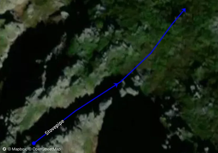
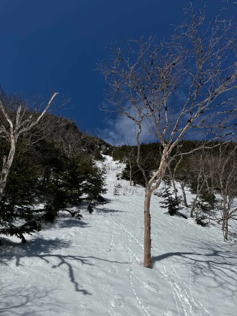
Stovepipe
Stovepipe is a striking couloir to lookers left of Dodge’s. Skinny and high walled, this line offers steep and committing turns. The best approach is to hike most of the way up Hillman’s and cut left, however some choose to approach via a downclimb from above, the line is pretty self explanatory. Turn, turn, down hit either wall. Over all too quickly, the line exists into a small talus field where one can traverse into the exit of Dodges, or pick down the narrow exit tail of Cathedral. Both join Hillman’s Highway.
The Lip
Another steep face to lookers right of The Icefall. This is a great intro to the Headwall Routes. The Lip is a crazy line in concept. In early season, it’s a multi pitch ice climbing route. As the season goes on, improbably large features get completely buried by the astronomical wind loading that occurs in Tuckerman Ravine. Come spring time, this incredibly steep line can see hundreds of skiers per day. Some shredding it in style, others sliding down it headfirst after tumbling on their first turn. When combined with the summit snowfields, this is one of the best runs anywhere. Either climb The Lip or climb Right Gully and traverse over. Hug the bushes to skiers left and cross the blind roll over. Once you get a view of the line, drop in and enjoy steep turns into the bowl below. In the spring, the water flowing underneath the lip that forms all the ice bulges in early season, undermines the snowpack and creates glide cracks. These huge cracks are like crevasses that you could fall into and end up trapped under the snowpack. As a result, this area has a seasonal closure once glide cracks start to open.
Shoestring Gully
Proof that anything is skiable with enough rope work, Shoestring Gully is known best for being a popular ice climbing objective. While it’s mostly snow, the line is broken up by about 4-5 WI2 ice steps. Despite the amount of shenanigans it will likely require, this is one of the most aesthetic ski lines in The White Mountains and, how can you pass up seeing the look all those ice climbers will give you when you drop in on skis! Park as for Webster Cliff Trail and skin across the bridge to a junction with Saco River Trail. Skin along until you find a faint drainage that climbs steeply up the mountain. Hopefully some ice climbers have packed it out for you, otherwise get ready to wallow. A long, Boulder filled runout makes for incredibly technical skinning. Start boot packing when it feels necessary. The bottom of the gully is sometimes guarded by a 10 foot ice bulge, however this can also be completely buried in snow during a deep year. The line becomes a little more alpine, with orangey-brown rock walls forming a couloir, and various ice steps requiring technical climbing. Once above the last ice bulge, stay left for the “snow finish” of Shoestring Gully. Top out in the trees and transition to skiing. Very steep and incredibly narrow turns in tips to tails terrain, take you down the snow finish of Shoestring into the meat of the line, the first ice bulge is hard to access from above. Taking the skis off here and down climbing can be necessary to access V-thread-able ice. Make a short rappel, make another couple turns above the next nice bulge, another V-Thread rappel takes you into a longer section of skiing. One more section of rock and ice may require a downclimb or could be side slippable in certain conditions. A few more turns take you to a constriction. This can sometimes require one more rappel or a small air, but can also form all snow. At long last, ski consistent turns down the long runout. Enjoy them while they last, because what the bottom lacks in rope work, it makes up for in rocks. Tree not to obliterate your bases in the boulder field, as you descend the final stretch into the trees. Take a breathe, count your core shots and skin back to your car. Now wasn’t that so much better than powder skiing in Jay Pass?
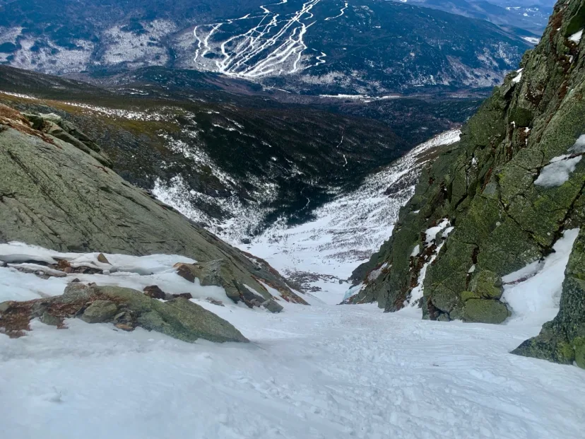
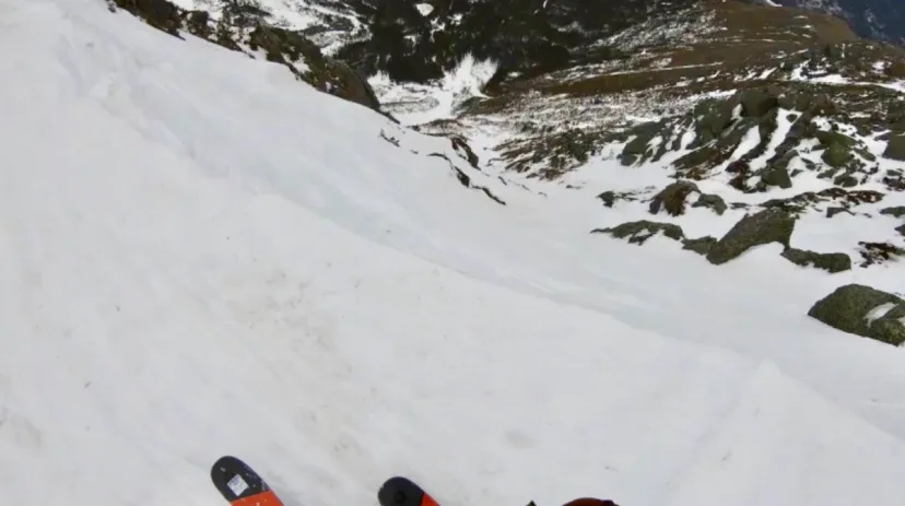
The Chute
One of the best lines in Tuckerman Ravine, and the scene of some terrifying falls. If The Chute spits you out, you aren’t stopping until you hit the bottom. However the steepness that makes it so consequential, also makes it a thrilling ski! The two common approaches are to climb Left Gully and cross over or climb the Chute itself. Climbing The Chute allows you to assess conditions, but it’s also a very steep climb so you’ll want to consider using an axe. It also exposes you to the hazard of other humans dropping slough on you, or dropping themselves on you. So when the crowds come in the spring and the snowpack is more uniform, consider the Left Gully approach. The line begins with a blind roll, approach cautiously until you can spy your line, there is usually a rock band guarding the top, that you can avoid to skiers left. Drop into the gut and enjoy steep turns down the fall line. A constriction at the bottom gives way to the lower bowl.

Lion’s Head Gully
A collector’s item of sorts. Lion’s Head Gully rarely forms deep enough to be worthwhile, and when it does, it means just about everything else is stacked. However if you’ve skied everything else and want a new adventure, Lions Head offers the treat of excellent skinny chute skiing in a new place. Drop in and ski the wider upper gully, around the half way mark the line pinches out and gets more technical. Exit the walls of the chute and pick through the bushes back to the floor of Tuckerman Ravine.
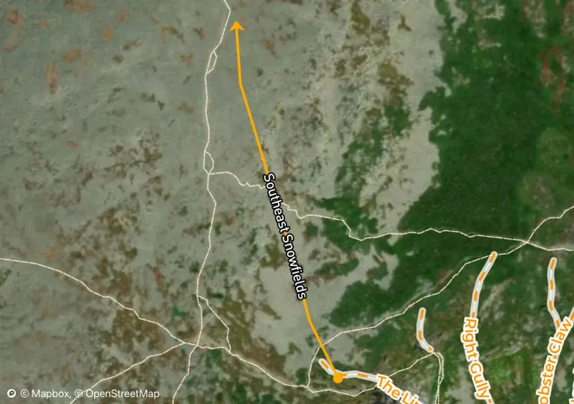
Southeast Snowfields
While not quite as wide as the Eastern Snowfields, this zone provides an opportunity to ski on the summit cone without so much traversing to get back to Tuckerman Ravine.
Cog Railway
The Cog is the Sherb of the West Side, except it has a train track splitting it in half. While there are mixed opinions on whether or not the Cog Railway should exist, the swath cut to either side of it does offer some nice skiing, as well as an approach to the Great Gulf. Start by skinning up along either side of the tracks, you will pass a fire pit with some seating after the initial hill, then a water tank higher up. After the water tank, you will need to cross to the left side of the tracks, as the hikers right side pinches off. This next section is known as Jacob’s Ladder, an elevated section of tracks. This section is often wind scoured and difficult to skin. Ski crampons are helpful here, and if you don’t have them, you may want to consider bootpacking. It’s common for skiers to turn around above Jacob’s Ladder and ski from there, but on days with good weather, it’s possible to ski all the way from the summit. The terrain above Jacob’s Ladder is low angle, and generally blown down to the most recent ice layer. But skiing over this rime and glare ice alongside the tracks is oddly fun. The most intense skiing comes alongside Jacob’s Ladder, where one has to content with a double fall line, rocks, and narrow space for turns. After getting back below treeline, the swatch widens a bit and the angle is a bit more gentle. This makes for a great turns, and can often be a powder stash during storm days. Ski across the bridge back to Cog Parking. Note: It costs $10 per car to park at the Cog and if you forget to pay, they leave a huge sticker on your car window, that leaves behind paper and glue all over your window when you rip it off. It takes forever to get the glue off and a car wash won’t do it, or so they tell me.
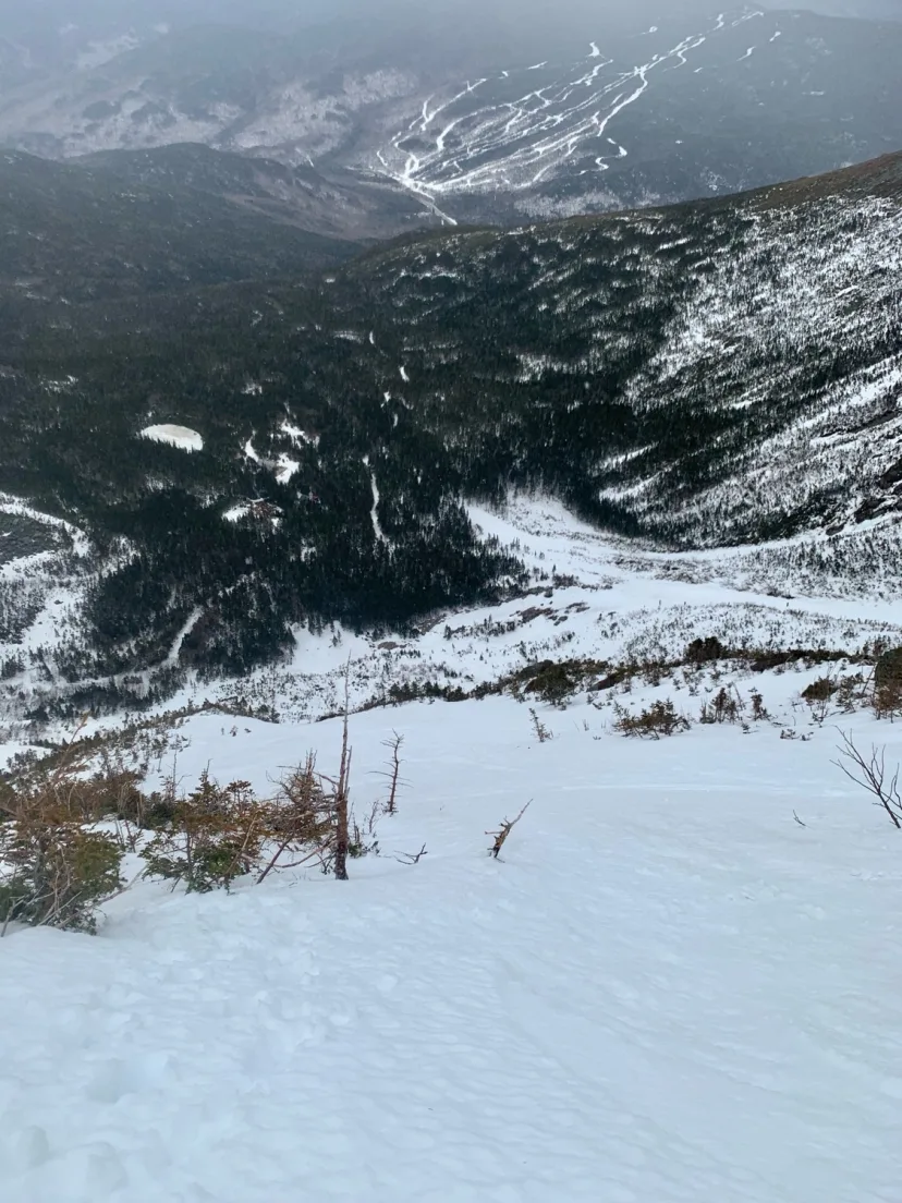
The Empress
For the skiers with good balance, excellent route finding and calm nerves. The Empress is quite possibly the most exposed line in the northeast. Start by locating the top of The Duchess. Walk down a steep talus slope, navigating aimlessly through loose boulders, to the top of a hanging snowfield. Click into the skis and take a few breaths, relatively mellow skiing for about 20 turns leads you seemingly to a dead end. Side slip to the right through a steep choke above a massive cliff. Hang a high left traverse, squeezing you ever so close to the edge of the cliff, until it’s possible to gain a skinny exit chute. Ski out with relief to the lower snowfields. Woooh, now wasn’t that something. In lean years, it’s possible to ski the top half of the hanging snowfield, then traverse right to finish on Duchess.
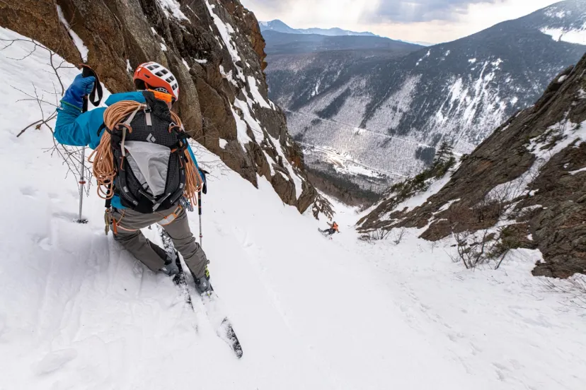
Central Couloir
One of the longest and most ephemeral chutes in the White Mountains. Central spends much of the year, sometimes multiple winters, being mostly a long stretch of rocks and ice bulges. However in rare conditions, this line fills in with snow and becomes an epic ski mountaineering objective. From Willey House, skin along the Saco River until you are below the drainage of Central. Skin up as far as you can, then switch to crampons and begin bootpacking. A tight constriction formed by the Lost In The Sun Slab to climbers left, gives way to a more open gully, broken up by large ice bulges. It’s usually possible to weave around all these ice bulges. A slabby, ice filled gully, soon gives way to a massive, high walled couloir that feels like it just might swallow you into the mountain. Each step gets steeper and narrower until you reach the last ice pitch of Central. Dig out a spot to put skis on a drop in. Exceptionally tight hop turns in a 50 degree couloir slowly bring you around the corner, until you arrive at the first big ice slab. Skirt this to skiers right and ski the long gully to the constriction formed by the Lost slab. Tight turns and sometimes a small commitment move here guard the lower runout. Ski back into the trees and retrace your steps back to Willey House.
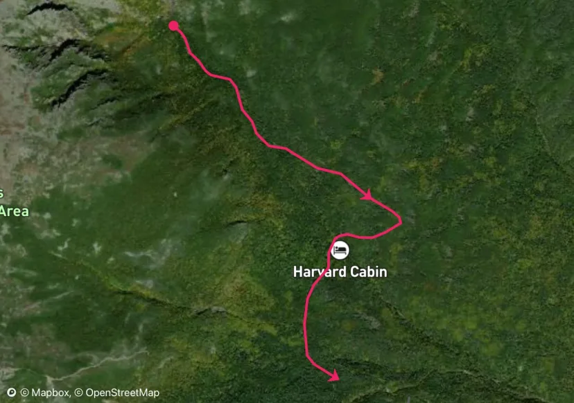
Huntington Ravine Fire Road
The best approach and descent for Huntington Ravine is the fire road. This wide path splits from the Tuckerman Ravine Trail after the bridge, follow signs for Harvard Cabin. Skin flat terrain past Harvard Cabin and begin switch backs up towards the Ravine. In early season there is often some shenanigans involved, with a few creeks to cross and dubious wooden bridges. As you enter the ravine, you may need to take skis off to walk through some sections of boulders. As this area fills in, these become buried making for a much cleaner entry. Be aware as you ski out, you will be encountering both uphill and downhill traffic. Don’t crash into anyone! You will also need to navigate a few hundred feet of the Tuckerman Ravine Trail before you can cross back to the Sherb. Be prepared for people to stop you and talk to you like you don’t know where you’re going if there’s crowds on the TRT
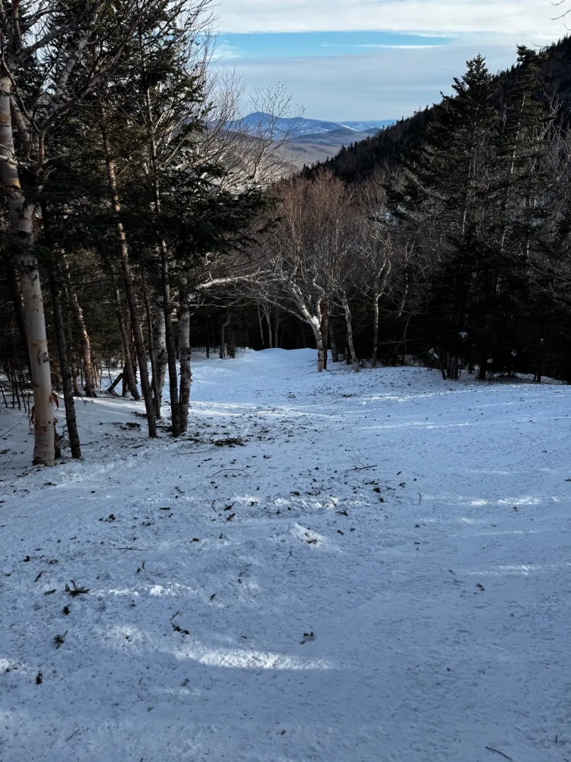
Gulf of Slides Trail
Longer, narrower and slightly more engaging than The Sherb, GOS Trail provides both the approach and exit for Gulf of Slides, as well as a great run in itself. Start skinning the initial part of The Sherb and look for signs of Gulf Of Slides after the bridge, skin left and start heading uphill. It’s common to skin through the woods to short cut the lower switchbacks of the trail, though this is not marked and hard to tell where to go unless someone else has done it. The skinning is relatively uneventful until a big downhill skin into the drainage that exits The Fingers. Continue uphill until the trail flattens out, if you’re approaching Gulf of Slides, all the gullies are accessed by breaking right into the woods following faint drainages, however, if you continue following GOS Trail around the corner, it will funnel you directly to the base of Main Gully. Climb your line or, rip skins and enjoy this classic New England trail. Be aware that unlike the sherb, uphill and downhill traffic both travel this trail. Be aware of other people recreating in either direction, and don’t crash into eachother.
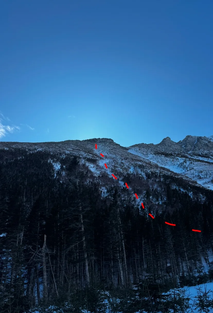
Boott Spur 2
Almost never skied, this route is the least popular option in Tuckerman Ravine. Similar to Boott Spur Gully, this line is essentially the same concept, but with no ice and more bushes. Usually scoured by the wind, this route is only worthwhile as an adventure alternative to the usual Tuckerman Ravine routes.
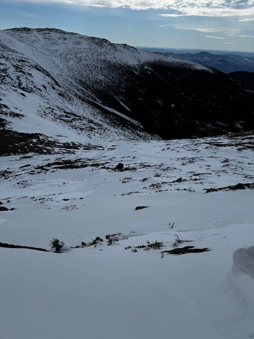
Monroe East Snowfield
A great way to extend a run in Robinson’s Neighborhood. A must do for those who enjoy skiing from summits. From Lake of the Clouds. Hike up Monroe Summit loop for another 10 min or so. The skiing starts just below the true summit. Usually pretty wind scoured, it’s not always the best snow, but it’s wide open and has a great alpine feel. Ski down and join Robinson’s Neighborhood for more low angle skiing into Oakes Gulf.
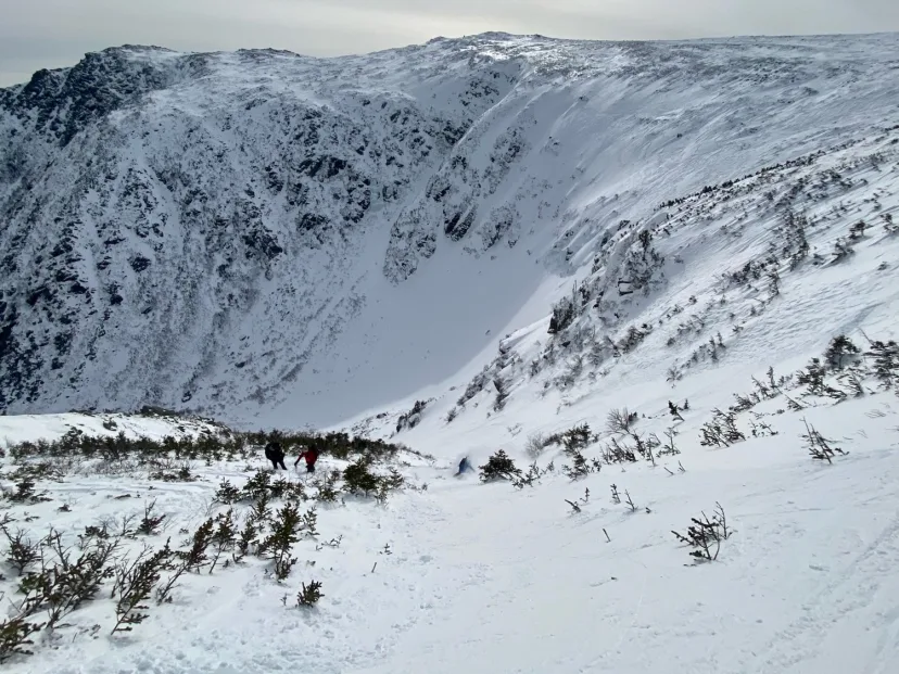
Right Gully
One of the easier options in Tuckerman Ravine, Right Gully is a mega classic. It’s not quite as steep as The Headwall, and not quite is narrow as Left Gully, but still gives you that high alpine feel. Being a southerly aspect, Right Gully gets a lot of sun, and can be one of the first lines to corn up as spring rolls around. This can also present a hazard, and you may want to avoid this line if warming snow is on your list of avalanche concerns. Climb out of the ravine through the bushes on a faint runout, and join the bottom of the gully, which is wide and half pipe shaped. The terrain is pretty consistently in the 30 degree range but steepens to around 40 at the top. Top out in the trees on the Lions Head Trail and put skis on. In thin conditions the drop in can involve negotiating some bushes. Join the wide gully and ski fall line to the ravine floor. A good first run in Tucks.
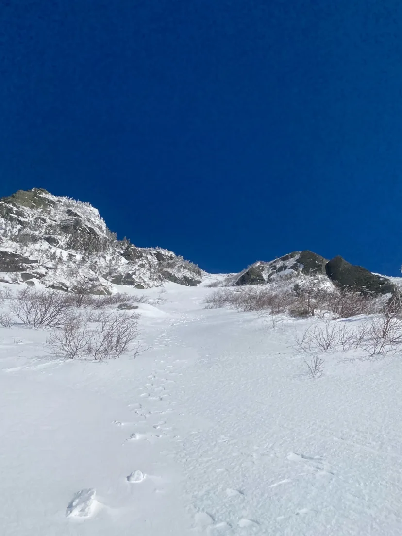
Lobster Claw
It wouldn’t be New England if we didn’t have a line named after Lobster. This is by far the easiest line in Tuckerman Ravine. It’s lined with bushes, rather than rocks, and is more comparable to the steepness an inbounds run out west. However it’s worth noting that this is still an alpine chute in backcountry and is subject to all the hazards associated with that. Don’t let your guard down, but recognize this is a good place to start. Lobster Claw has too possible variations. Lookers right which the standard descent, a clean gully between 15-20 feet wide. Or the lookers left option, a steeper, meandering line featuring a few constrictions. Lobster Claw, along with Right Gully are southerly aspects and therefore get a lot of sun. This means they are often the first to corn in the spring, and the last to refreeze as the sun goes down. This also means it can be a dicey place to be if warming snow is an avalanche concern for the day.
Lower Cutler
After the second bridge on the Tuckerman Ravine Trail, drop in and ski the wide riverbed with boulders and other fun features. MAKE SURE you don’t miss the Huntington Ravine Trail. It’s your last chance to exit the riverbed. Skiing too low will result in a great deal of bushwhacking and sorrow. Hopefully some snow shoers tracked it out so it’s easy to spy the crossing.
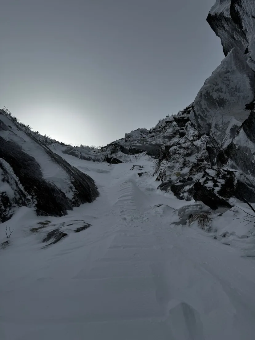
Middle Sister
The most condition dependent of the 3 Sisters, but one of the best when it’s in. The middle of this line is often squeezed off by a rock band/ice bulge. The top of the line begins with a narrow gully, this leads to the top of the rock band. Skirt this through a narrow choke to skiers left, then join a steep runout. Ski the shared exit the others sisters to the bottom and bootpack out.
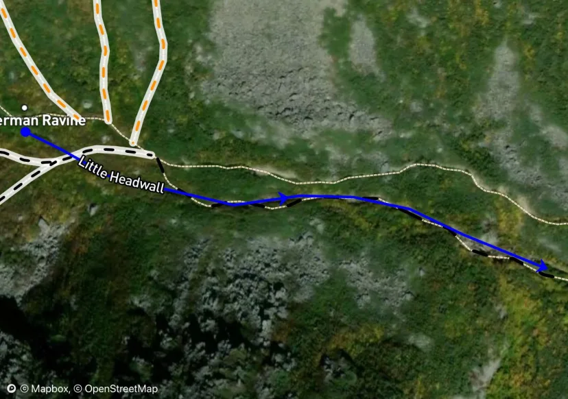
Little Headwall
This is the standard exit from Tuckerman Ravine when the snow is deep. However the massive amount of water that usually flows through here often keeps this area looking more like a rushing river than a ski line. When it’s in, follow the natural drainage out of the ravine flow. Meandering riverbed skiing leads to a convex roll, like a much smaller version of the Tuckerman Ravine Headwall. Ice bulges or open water often occur here. Ski the mini headwall and join the Sherb. Due to the flowing water, this area gets dangerously undermined in the spring, be cautious!
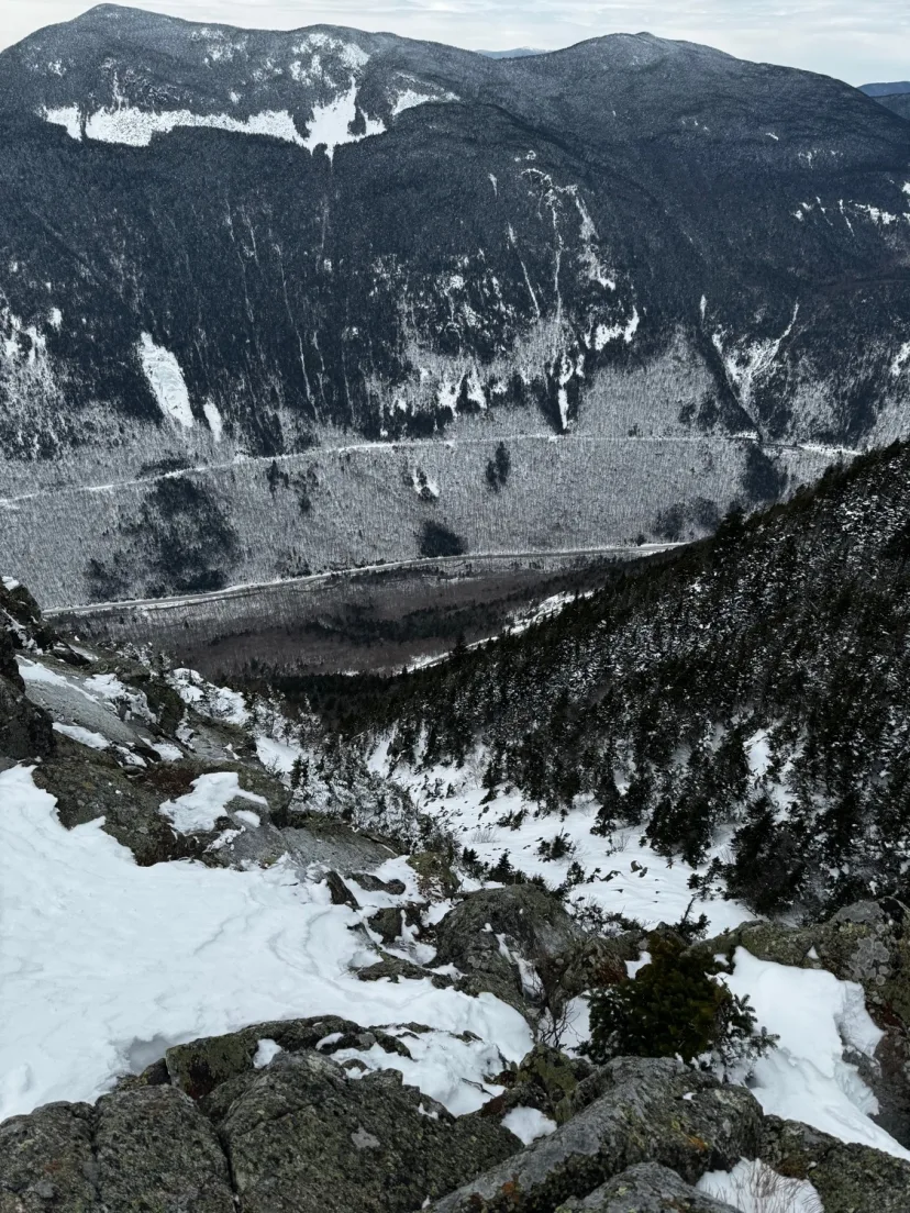
Mountaineers Route
Perhaps the rarest line in the White Mountains. What would be the longest run in the range unfortunately spends most seasons as an unskiable talus slope. Due to constant wind scouring and being lower elevation, any snow that falls on this line tends to get destroyed. Only when big storms fall on East wind (and don’t get scoured away the next day) does the Mountaineers Route form up. The best approach is to skin from the Highland Center up Webster-Jackson Trail to the summit of Mount Webster. Just below the summit to skiers right, bushwack down into the line. We’ve through a long talus slope, milking the best stretches of snow, until the talus slope closes out to a narrow gully. This is the top of The Bore-Tide Slab, a large section of low angle water ice. Bushwack to skiers left and gain a sneaky exit through the trees that takes you around the slab. You’ve cleared the meat of the line, but you still have a lot of work to do. Ski steep natural glades, likely traversing back and forth a bit to find the best path through the woods, until the angle mellows out. Locate the Saco River and follow it back to the wooden bridge at Willey House. Hopefully you stashed a car here. If not, cross the street and skin up to the railroad tracks on Mount Willey, and skin back to your car at the highland center.
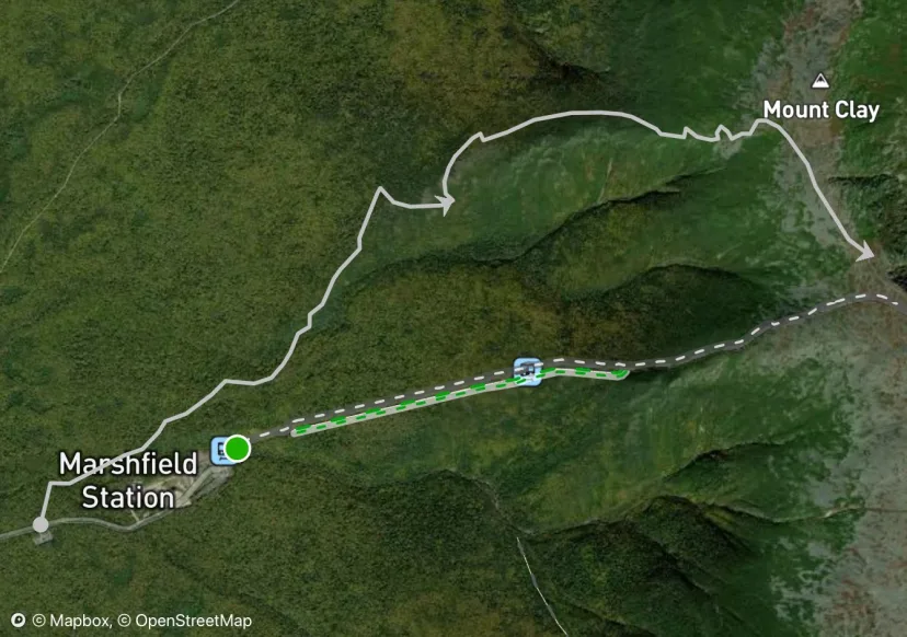
Jewell Trail
This offers an alternative way to access the Great Gulf lines and Northern Presidentials without paying for The Cog. The Jewel is a relatively straightforward skin, until you reach the talus at treeline. This is a poor option in late spring due to mud and rotten monorail making for poor travel. In this case, approach via the cog or Pinkham.
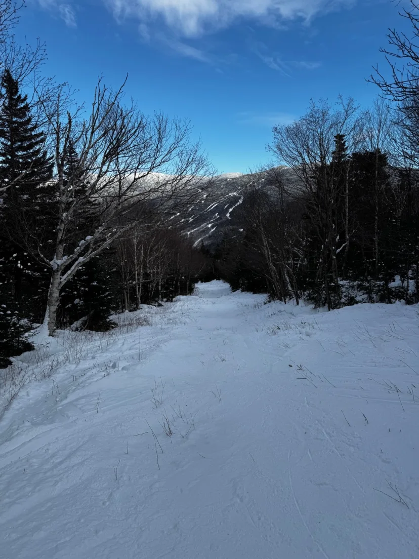
John Sherburne Ski Trail
Known by most as simply “The Sherb” this is the ski trail to exit Tuckerman Ravine. Whether you’re heading back to your car in Pinkham after a huge day in the Ravine, or this is your first tour. The Sherb is enjoyed by many. If starting from Hermit Lake ski the initial hill and cross the bridge. If coming from Little Headwall or Hillman’s, you will be naturally funneled into the Sherb. Low angle turns lead to a long meandering section with moguls, good views of Wildcat and some fun jumps, eventually lead to a series of switchbacks. There’s usually a dirt patch or two to contend with here, as well as some side glades to explore. Cross the final bridge back to the big open field at Pinkham Notch Visitor Center. This trail is intentionally closed, either partially or fully as it gets melted out in the spring. This is to prevent erosion from foot traffic. More erosion means bigger exposed rocks, meaning this trail will need significantly more snow to be skiable. Please preserve this trail by respecting the closures.
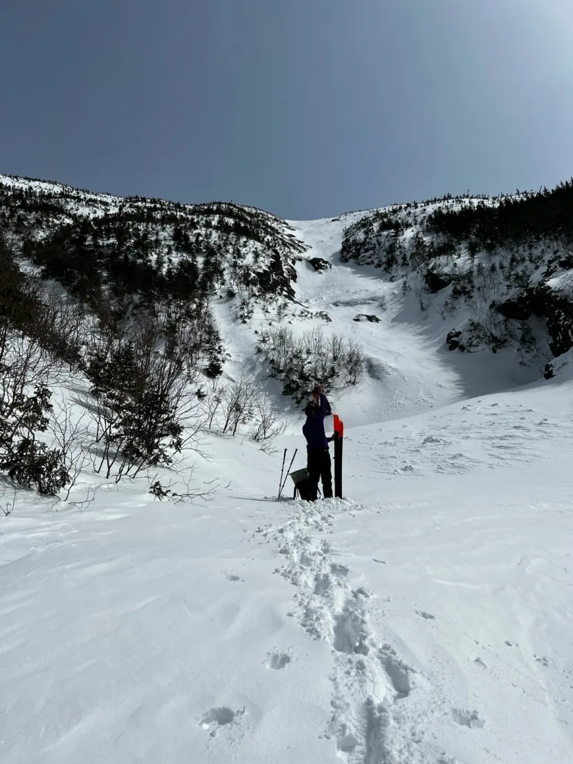
Ammo Central Gully
A long and steep gully in the South Branch of Ammo. It is possible to approach from Lake of The Clouds, but with open water and ice bulges, it’s best to approach from below to assess conditions. Skin along the Ammonoosuc Ravine Trail to just before it begins to ascend towards lake of the clouds. Break left and begin following a bushy drainage. Easy going at first, the skinning turns into technical side hilling around water holes until you reach a split. The left split is the North Branch. Hang a right and come to a second split. The right option is South Gully. The obvious center option is Central. Bootpack up the steep and sustained gully, until the angle eases. Follow the low angle gully to where it peters out just shy of the summit of Mount Washington. Ski the low angle upper gully until you reach the convex roll. An ice bulge is often present here that is easily skirted. Steep skiing leads to an abrupt flat spot, often sporting a water pool. Skier this and follow the path you skinned in back to the Ammonoosuc Ravine Trail. Be aware that this area is a large terrain trap, and there have been avalanche fatalities here. Even a small amount of snow could sweep you into a flat spot or a water hole.
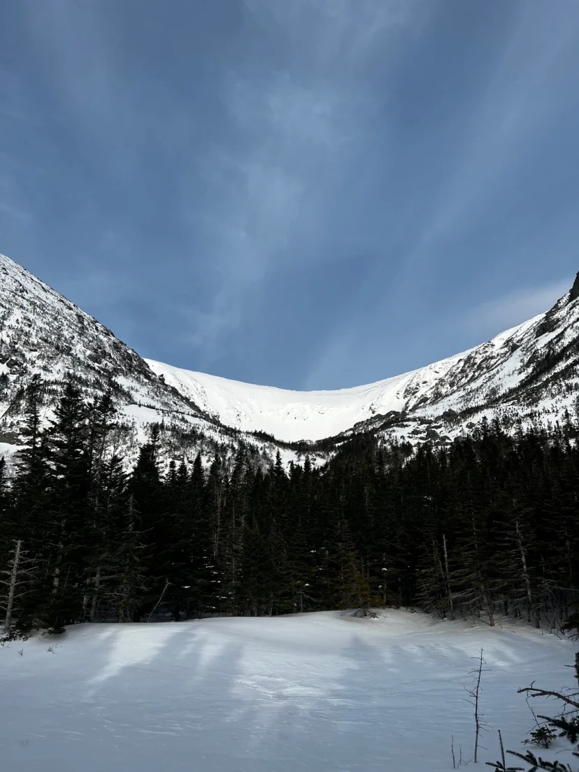
Center Headwall
Perhaps the steepest line east of the Mississippi, and the birthplace on American steep skiing, the 50 degree Headwall of Tuckerman Ravine has been a proving ground since the days of wooden skis. A more serious undertaking in mid winter, this line can see hundreds of skiers per day come springtime. The best approach is to climb Left Gully or The Chute and traverse over. The opening turns can feel like skiing off the edge of a marble. Be careful to spy your line here, you can’t really see anything from above, and you don’t want to get cliffed out on The Icefall. Once you confirm you’re in the right spot. Pick either of the two gullies that form the Center Headwall and rip. When these have good snow and the slough is roaring, it can feel like Alaska. The angle eventually mellows and the gullies blend into an open bowl. Congrats, you made it to the bottom. Hopefully you did it feet first ;)
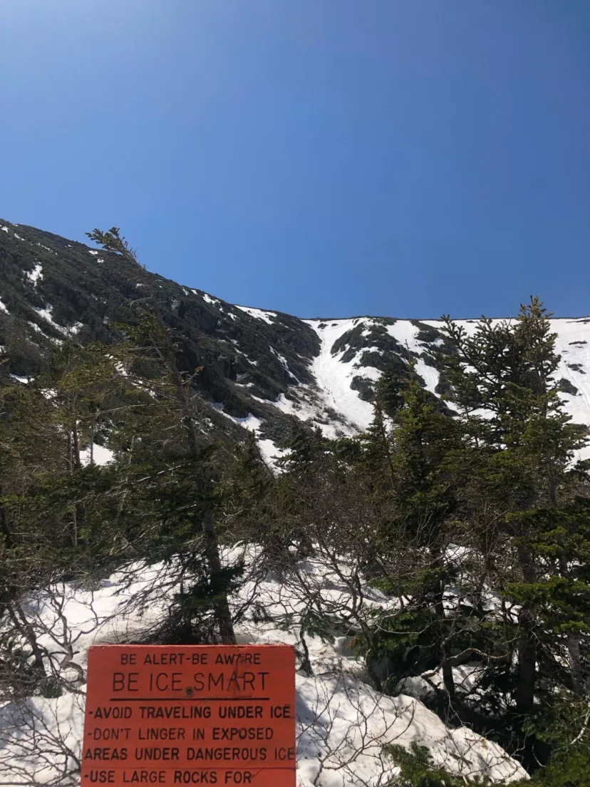
Left Gully
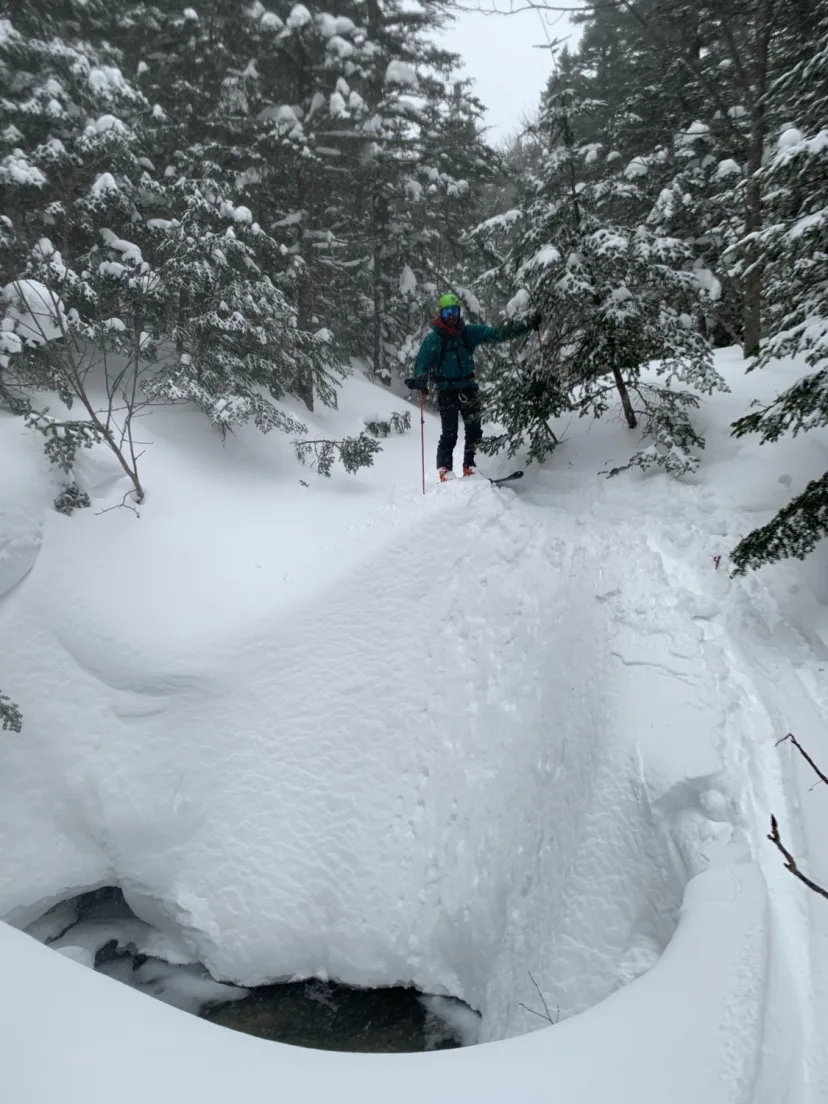
Upper Cutler
A fun way to mix it up when the snow is deep, from the top of the sherb, cut left into the woods and locate the drainage. Ski the low angle gully, navigating around the occasional water hole, until you pop out at the second bridge of the Tuckerman Ravine Trail. Ski down to the nearest crossover and join the Sherb, or continue down the Lower Cutler.
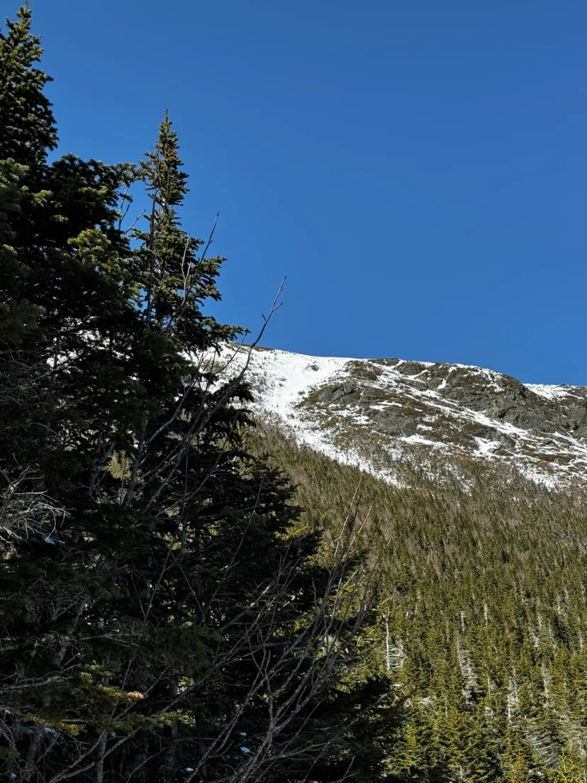
Gully #6
The shortest gully in Gulf of Slides, this line is a bit of a misfit. It’s much further down the ridge and starts in a much lower drainage. If you’ve ever skinned by the exit for Gully #6, the bushwhack is as bad as it looks. You are much better off topping off Boott Spur and hiking in from above, or better yet, do it on a day when the ridge has a good ice coating abs ski the ridge to the entrance. Gully 6, due to starting at a lower elevation and facing more southerly, can be one of the first lines to corn up. By the same principle, it can also be a roller ball nightmare when other lines are only seeing surface warming. Ski a beautiful opening gully, that feels very remote for the east side. The line slowly pinches out and becomes more bushy until you are fully in the woods. Just as all hope of making a complete turn begins to dwindle, you emerge from the woods onto Gulf of Slides Trail. Despite all the shenanigans involved, this line deserves more traffic than it sees.
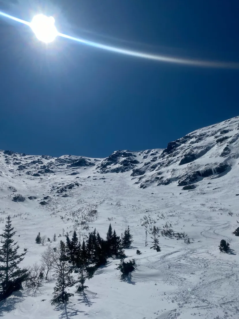
Airplane Gully
A really great line, one of the classics for sure. Airplane Gully is one of the most reliable routes in the range and can often be skied well into May. The name comes from a plane crash that occurred here in 1990. Old timers will tell you about picking up $100 bills from the crash site only to have them confiscated by rangers. Skin The Cog to just above Jacob’s ladder and break left to the ridge. Airplane Gully has a number of variations, but the skiers left entrances is the widest and easiest entrance. A cornice can often guard the top. Drop in and ski 40 degree turns to a constriction. Exit the rock walls into a long runout. This gets skinnier as you descend and gradually decreases in angle until you are just above Spaulding Lake. Your best exit is to bootpack by out Airplane and ski down the Cog.
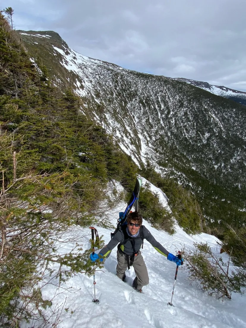
Bifocal Gully
Also called Pony Express. This is the most defined ski line on Mount Franklin. The name comes from the clearly defined upper gully and lower gully, which are split by a moss/rock choke. To access the line, traverse South beneath the summit of Mount Monroe, either ski Southern Snowfields into Franklin Cirque, then climb the line from below, or traverse high and gain the ridge, and follow it to the top of the gully. Drop in and enjoy a nice section of turns until you reach the chockstone. A short downclimb or a traverse around it through the bushes gains you access to the lower gully. Ski out to a big open patch and begin the climb out where you feel most inspired. Enjoy the solitude of this deep wilderness zone.
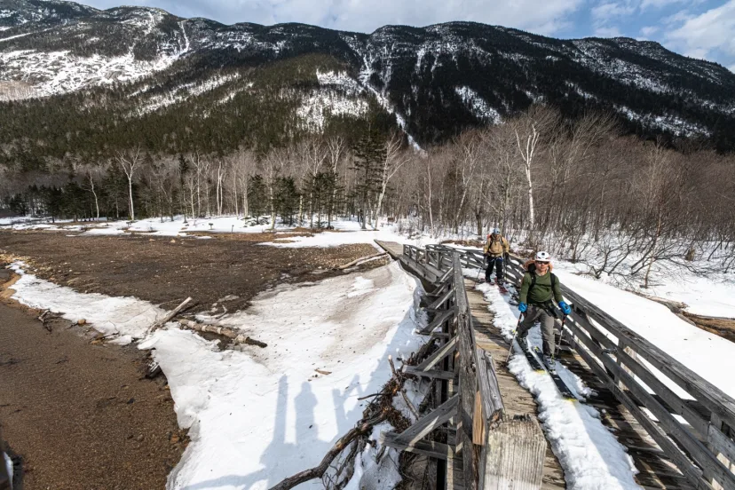
Landslide Gully
Perhaps one of the best ski lines in the White Mountains, Landslide Gully is obvious from the parking area at Willey House. The path of the slide nearly touches the Saco River. It’s non existent approach and incredible skiing would make this a classic line, if not for the fact it almost never forms. Wind scouring and low elevation keep this, and all the other Webster Routes from forming as reliably as higher the elevation terrain. When it’s in, this is a real treat. Cross the bridge at Willey House and skin towards the obvious slide path, the line begins with a long boulder field that is hopefully somewhat covered by the time you’re thinking about skiing this. The boulders end and a long, remarkably smooth slab takes you to a set of ice bulges. These can be skirted to either side. The upper gully steepens and narrows a little more, and tends to hold more snow. In powdery conditions, you may want to bring ascent plates. The gully splits into two variations here, take the left variation here if you’re looking to access the legendary hallway, the right is a tight rock lined chute, but is more bushy. The left variation ascends for another couple hundred feet until it dead ends in the trees. An unlikely little slot up and right takes you into the beautiful hallways you’ve likely seen in photos. This high walled chute is barely a ski length across and requires precise hop turns. Drop in and make agile turns, trying not to bury a tip in the wall. Be sure to stop and look around plenty, this is a magical spot. Just as your hop turns muscles are starting to fade, the slot spits you back out into the main gully. Some more open turns lead you back to the junction with the right variation. Ski fall line until you are above the ice bulge, and skirt it to whichever side looks more negotiable. Ski the long and open runout back to the bridge at Willey. Look back and reflect on how much variety was packed into that single run!
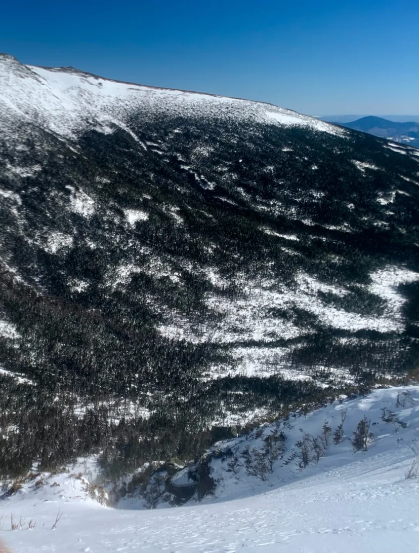
Double Barrel
One of the most eye catching lines in Oakes. Double Barrel is two chutes side by side. Hike south from lake of the clouds along the ridge beyond Mount Monroe. There are two options, the skiers right side is tighter, rock lined and steeper. The left side is a little wider and less defined. Pick whichever inspires you most and drop in. Ski consistent fall line turns down to treeline. Skin up a steep drainage to the bottom of Robinson’s Neighborhood to exit.
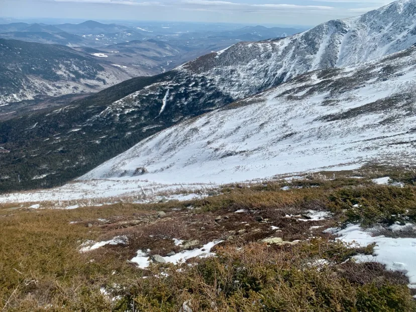
Raymond Cataract
The large drainage between Tuckerman and Huntington Ravine. Unlike other ravines which are comprised of many different gullies, Raymond is just one big gully. As a result a lot of water drains through here, and the line is generally a gushing waterfall, except in deep snow years when it fills in enough to be skiable. Approach from either Tuckerman or Huntington Ravine and descend through bushes into the main body of the line. The upper part of the line has a max pitch of 25 degrees. Skiing something so low angle on a mountain as steep as Mount Washington feels a little strange, like skiing an infinity pool. As you drop back into treeline, the gully gets narrow and rolls from 25 to 45 degrees in just a handful of turns. The next section of skiing is a water fall in the summer, and it’s not uncommon to encounter open water here. Ski through this steep section to the woods below, and follow the drainage out to the Huntington Ravine Fire Road. Be aware that this area is a massive terrain trap, and the convex roll I mentioned above is a textbook spot to trigger an avalanche. Raymond Cataract was the scene of a fatal avalanche in 2019 that resulted in the loss of a beloved member of the ski community. Please approach this line with caution.
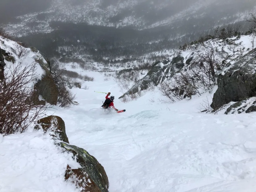
Great Gully
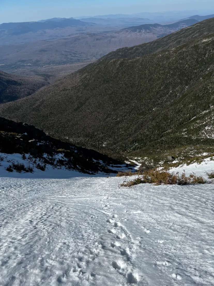
South Sister
A great line. South Sister is the most reliable line in Castle Ravine. This line differs from North and Middle because it’s wider and less defined. While the other sisters have condition dependent cruxes, South Sister is usually skiable most years. Pick through bushes at the very top, gaining an open chute a little similar to GOS Main. Ski steep and sustained turns to where South Sister merges with the runout of Middle/North Sister.
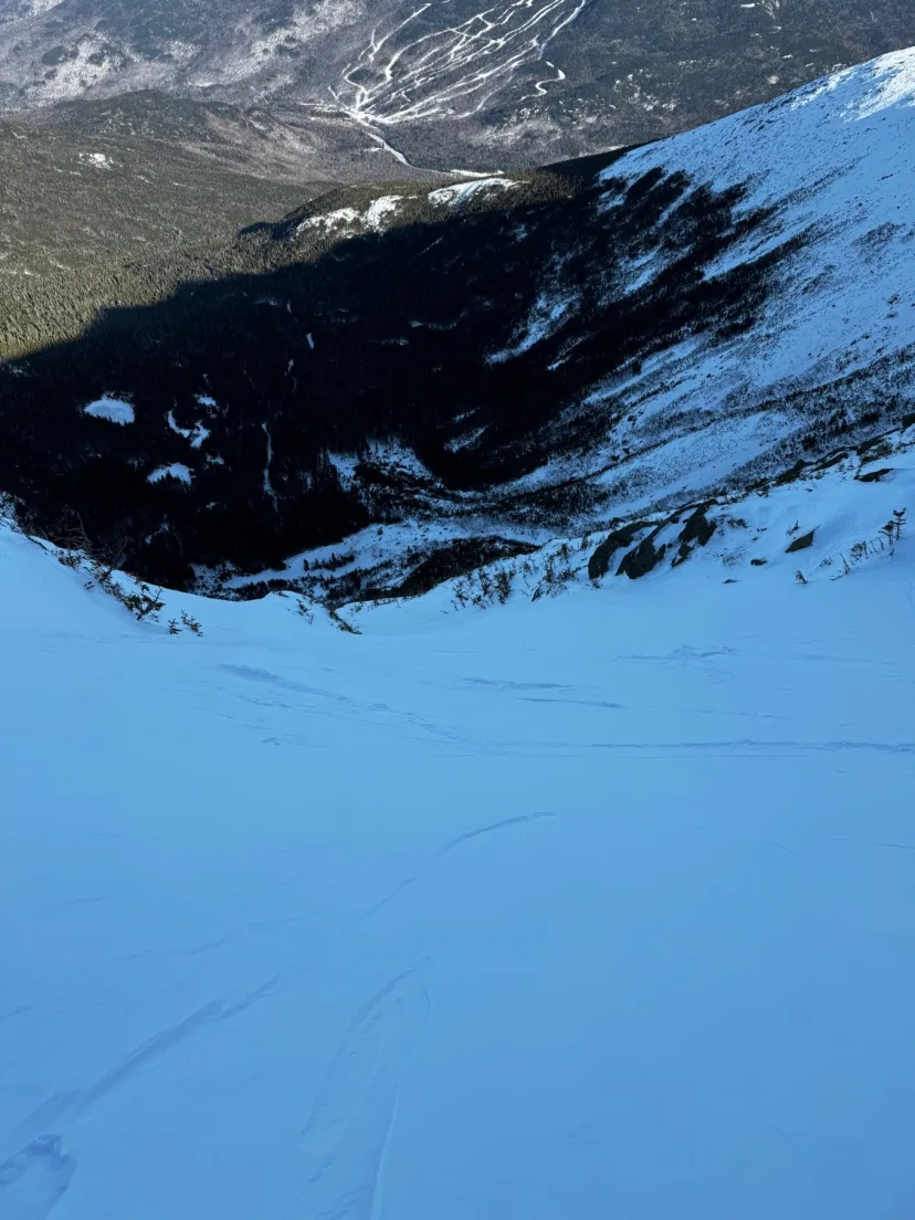
The Duchess
Steep, complex, daunting, this route is most certainly one of the King lines in Tuckerman Ravine. Best accessed by climbing Hillman’s and walking over to skiers left. Duchess begins with a hanging snowfield above a blind roll. Ski in and descent towards a bush island in the center, from here you have two options. Traverse high and right for a bushy adventure into a clean exit gully, or ski more naturally fall line to a construction, sporting a small mandatory hop in thin conditions. Both options join a steep, high walled gully to finish. Ski out the lower snowfields and bushwhack back to the exit of Hillman’s or the Sherb.
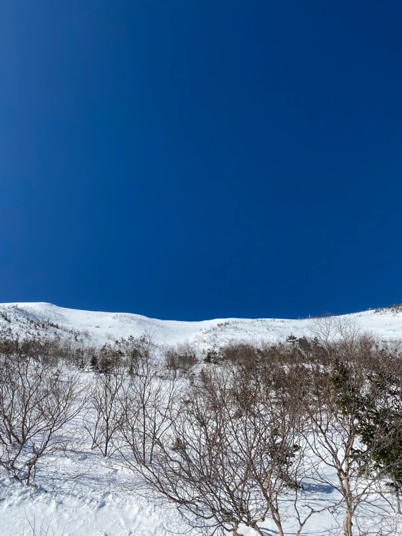
South Snowfields
Also known as The Sandbox, the South Snowfields represent the wide, bowl like area located beyond Main Gully. Once a heinous bushwhack, dedicated efforts by Granite Backcountry Alliance have created a narrow path to access the bottom of these snowfields. The easiest option is to skin in from Gulf of Slides Trail and bootpack the final headwall, but another option is to approach by climbing Main Gully and hiking over from above. Either way, the run begins with wide open skiing, more reminiscent of a line in Colorado than in New Hampshire. Unfortunately, the angle quickly eases and the line becomes bushy. Pick your way through and descend towards the exit path.
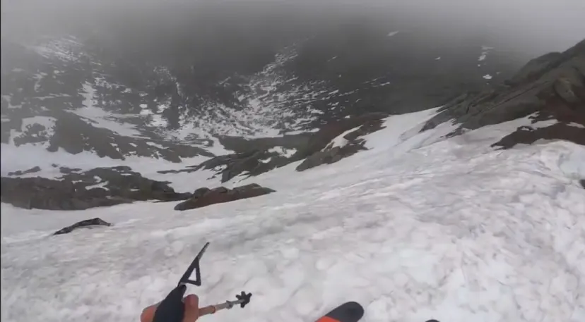
Spacewalk
If Airplane Gully wasn’t spicy enough for you, give this thing a try. Spacewalk, also sometimes called Moonwalk, is a very steep chute, situated above a cliff. It’s challenging and high consequence, but if you’re well prepared and conditions are good, it can be a great line. Just uphill from Airplane’s entrance, you can find the drop in. A cornice can sometimes guard the top. The first few turns are in the 50 degree range, then it mellows to 40 or so. Ski the chute until it cliffs out, then hang a hard left to join Airplane.
Interactive map preview
Open the full map for layers, filters, and route planning tools.
Open full mapYour next adventure starts here
Create your own maps with custom routes, waypoints, and layers. Then share with your friends to kick off your adventure planning.
