Mountaineers Route
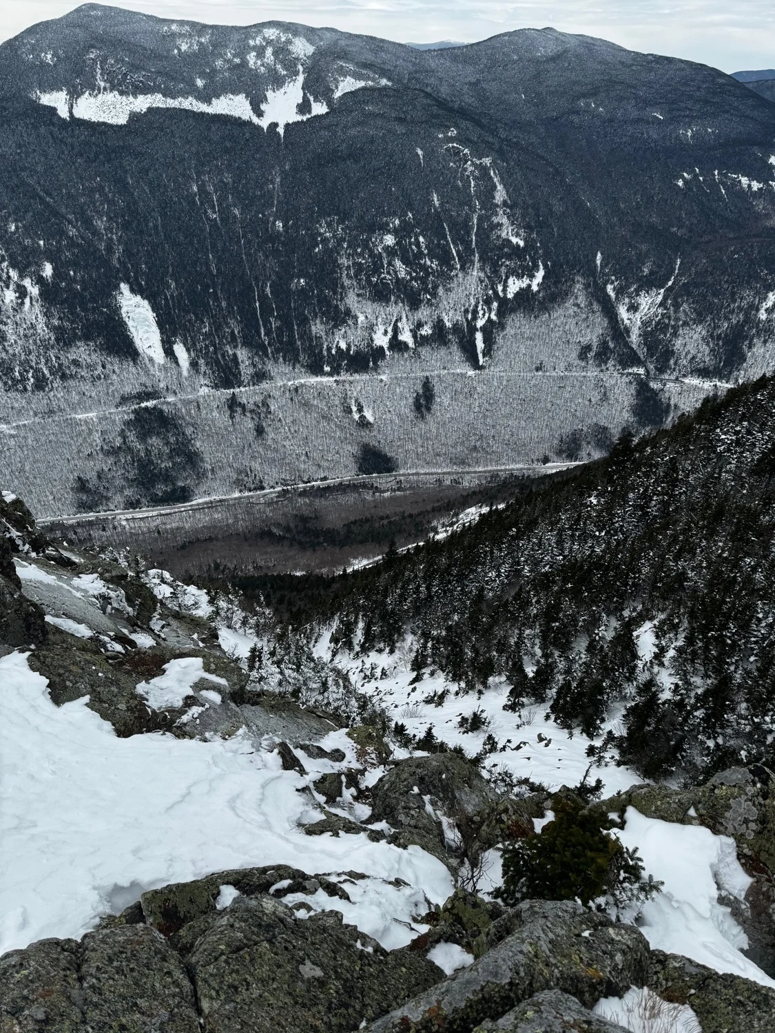
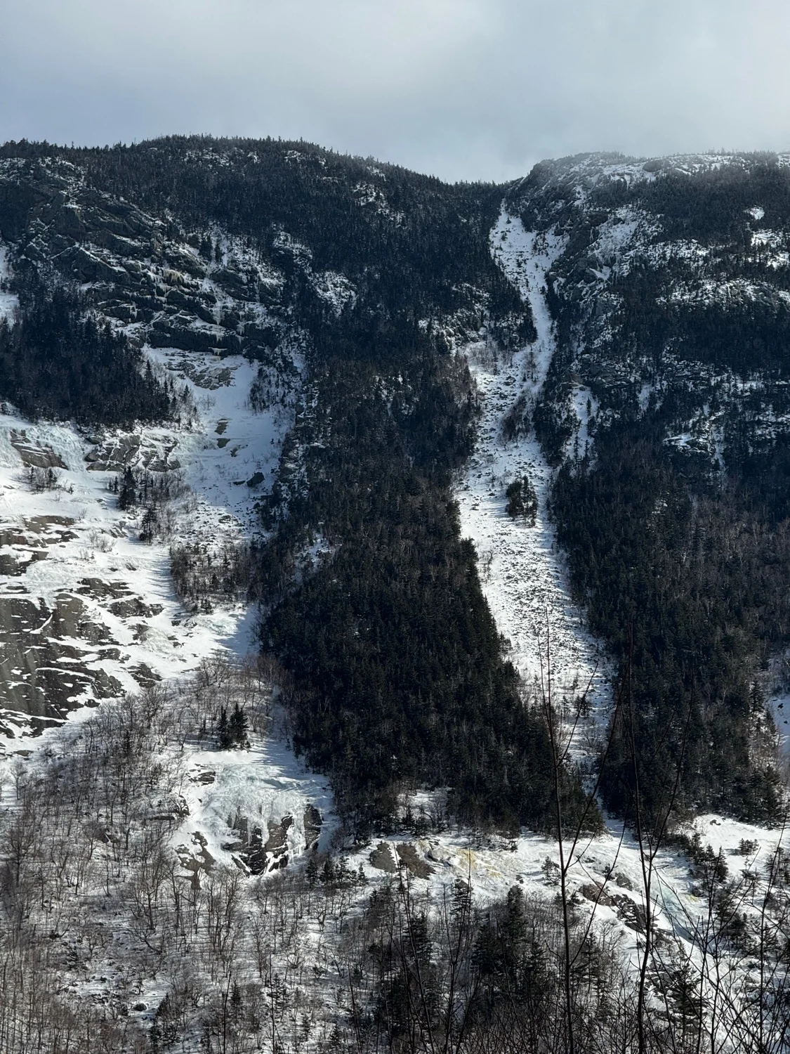
Perhaps the rarest line in the White Mountains. What would be the longest run in the range unfortunately spends most seasons as an unskiable talus slope. Due to constant wind scouring and being lower elevation, any snow that falls on this line tends to get destroyed. Only when big storms fall on East wind (and don’t get scoured away the next day) does the Mountaineers Route form up.
The best approach is to skin from the Highland Center up Webster-Jackson Trail to the summit of Mount Webster. Just below the summit to skiers right, bushwack down into the line. We’ve through a long talus slope, milking the best stretches of snow, until the talus slope closes out to a narrow gully. This is the top of The Bore-Tide Slab, a large section of low angle water ice. Bushwack to skiers left and gain a sneaky exit through the trees that takes you around the slab. You’ve cleared the meat of the line, but you still have a lot of work to do. Ski steep natural glades, likely traversing back and forth a bit to find the best path through the woods, until the angle mellows out. Locate the Saco River and follow it back to the wooden bridge at Willey House. Hopefully you stashed a car here.
If not, cross the street and skin up to the railroad tracks on Mount Willey, and skin back to your car at the highland center.
Mountaineers Route
Perhaps the rarest line in the White Mountains. What would be the longest run in the range unfortunately spends most seasons as an unskiable talus slope. Due to constant wind scouring and being lower elevation, any snow that falls on this line tends to get destroyed. Only when big storms fall on East wind (and don’t get scoured away the next day) does the Mountaineers Route form up.
The best approach is to skin from the Highland Center up Webster-Jackson Trail to the summit of Mount Webster. Just below the summit to skiers right, bushwack down into the line. We’ve through a long talus slope, milking the best stretches of snow, until the talus slope closes out to a narrow gully. This is the top of The Bore-Tide Slab, a large section of low angle water ice. Bushwack to skiers left and gain a sneaky exit through the trees that takes you around the slab. You’ve cleared the meat of the line, but you still have a lot of work to do. Ski steep natural glades, likely traversing back and forth a bit to find the best path through the woods, until the angle mellows out. Locate the Saco River and follow it back to the wooden bridge at Willey House. Hopefully you stashed a car here.
If not, cross the street and skin up to the railroad tracks on Mount Willey, and skin back to your car at the highland center.
Length
1.0 mi
Elevation gain
46 ft
Elevation loss
-2,581 ft
Average slope angle
29º
Max slope angle
48º
Aspect
Interactive map preview
Open the full map for layers, filters, and route planning tools.
Open full mapYour next adventure starts here
Create your own maps with custom routes, waypoints, and layers. Then share with your friends to kick off your adventure planning.
