Ruby Mountain
Ruby Mountain, a 7400 ft peak in the North Cascades, offers an unparalleled alpine skiing experience. The tour starts at Happy Creek, accessible from Highway 20, and typically involves an initial skin followed by a boot hike through thin snow coverage. The forested trail soon gives way to challenging, steep slopes. Spectacular views greet you as you ascend, offering sights of Jack Mountain, Hozomeen, and the Southern Pickets. The summit of Ruby Mountain, reached after approximately five hours, offers an unmatched panorama of the North Cascades. Be prepared for a thrilling descent amidst steeps, bowls, half pipes, cornices, and cliffs. The best time for this tour is on a clear, bluebird day following fresh snowfall. However, skiers should be aware of potential hazards such as variable snow conditions and steep slopes, and the need for careful navigation during descent.
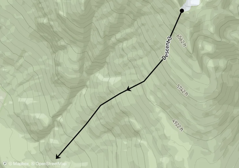
Descent 3
1.7 mi
5 ft
-5,274 ft
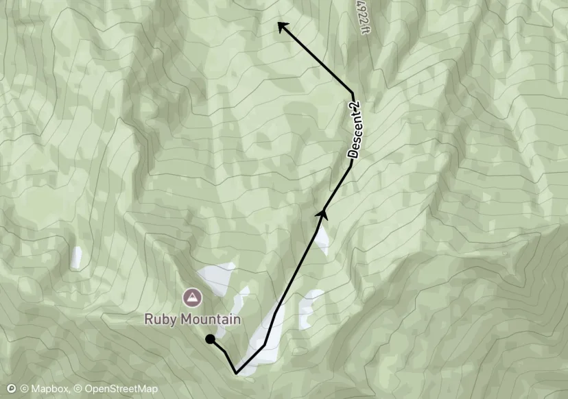
Descent 2
1.7 mi
87 ft
-2,981 ft
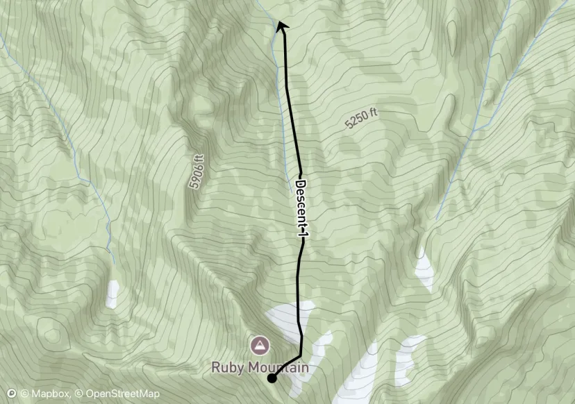
Descent 1
1.1 mi
0 ft
-2,844 ft
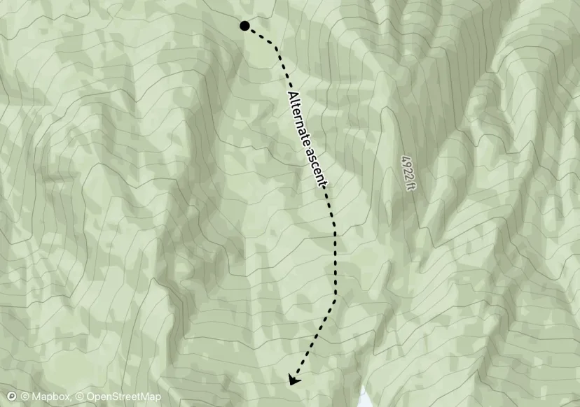
Alternate ascent
1.4 mi
2,773 ft
-4 ft
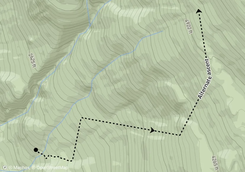
Alternate ascent
1.6 mi
3,241 ft
-30 ft
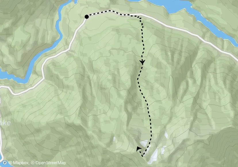
Ruby Mountain Approach
3.9 mi
5,320 ft
-54 ft
Stay on the road until 2240', then follow the summer trail until it ends. After that, stay to the east of Happy Creek.
Interactive map preview
Open the full map for layers, filters, and route planning tools.
Open full mapYour next adventure starts here
Create your own maps with custom routes, waypoints, and layers. Then share with your friends to kick off your adventure planning.
