Big Bend, Texas BDR-X
The Big Bend, Texas BDR-X is the latest addition to BDR’s lineup of X routes, which are “shorter BDR-style routes that loop”, tailored for dual-sport and adventure motorcycle travel. Set against the rugged landscape of west Texas in the largest protected portion of the Chihuahuan Desert in the United States, and within the unique backdrop of the Rio Grande river, this route stands out as a premier destination for adventurous riders seeking a remote and unforgettable journey.
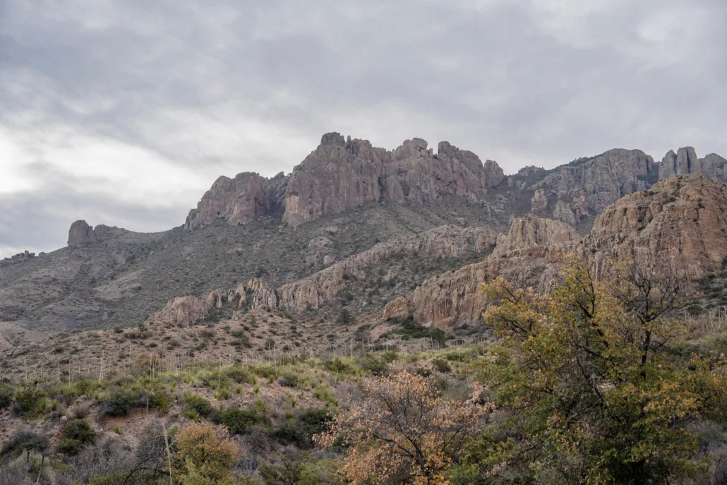
Spanning 623 miles, this route weaves through the iconic terrain of Big Bend National Park, Big Bend Ranch State Park, and other remote wilderness, offering a unique off-pavement adventure. Riders can explore the untamed beauty of the Chisos Mountains, encounter hidden historical gems, experience vibrant artistic communities, and even venture into Mexico with an optional foot crossing.
This route is an immersive riding experience in the heart of Texas’ ‘Gift to the Nation,’ making it a must-visit destination for riders seeking an authentic and unforgettable desert adventure.
Important Route Update in Section 3 – Terlingua Ranch
We’ve recently learned that certain roads within Terlingua Ranch lack public easements. As a result, we have removed the Terlingua Ranch portion from Section 3 of the route. We’re exploring potential alternatives, but for now, please respect the private property in this area and avoid riding this segment to help maintain positive relationships with local residents and landowners.
The GPX tracks have been updated. Remember to download the latest route tracks before your trip. Download the latest tracks here.
Big Bend, Texas BDR-X
The Big Bend, Texas BDR-X is the latest addition to BDR’s lineup of X routes, which are “shorter BDR-style routes that loop”, tailored for dual-sport and adventure motorcycle travel. Set against the rugged landscape of west Texas in the largest protected portion of the Chihuahuan Desert in the United States, and within the unique backdrop of the Rio Grande river, this route stands out as a premier destination for adventurous riders seeking a remote and unforgettable journey.
Spanning 623 miles, this route weaves through the iconic terrain of Big Bend National Park, Big Bend Ranch State Park, and other remote wilderness, offering a unique off-pavement adventure. Riders can explore the untamed beauty of the Chisos Mountains, encounter hidden historical gems, experience vibrant artistic communities, and even venture into Mexico with an optional foot crossing.
This route is an immersive riding experience in the heart of Texas’ ‘Gift to the Nation,’ making it a must-visit destination for riders seeking an authentic and unforgettable desert adventure.
Important Route Update in Section 3 – Terlingua Ranch
We’ve recently learned that certain roads within Terlingua Ranch lack public easements. As a result, we have removed the Terlingua Ranch portion from Section 3 of the route. We’re exploring potential alternatives, but for now, please respect the private property in this area and avoid riding this segment to help maintain positive relationships with local residents and landowners.
The GPX tracks have been updated. Remember to download the latest route tracks before your trip. Download the latest tracks here.
1. Alpine to Rio Grande Village
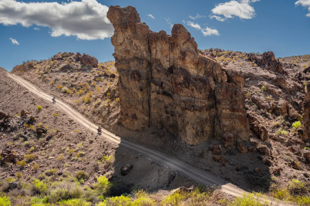
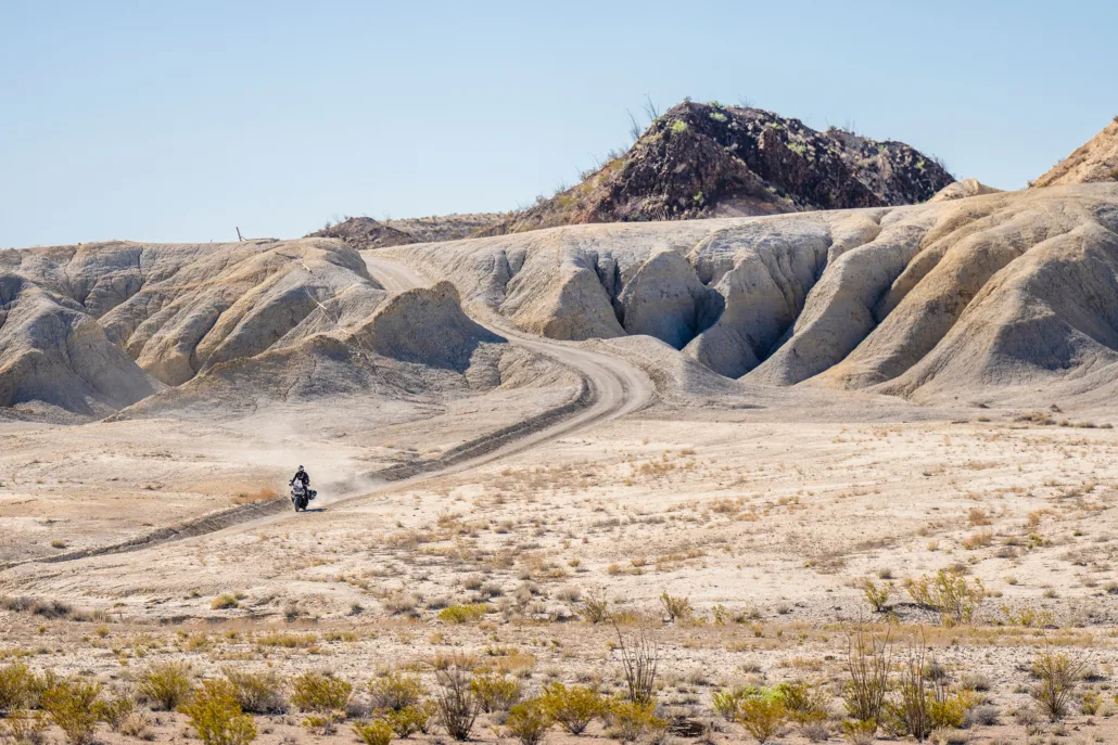
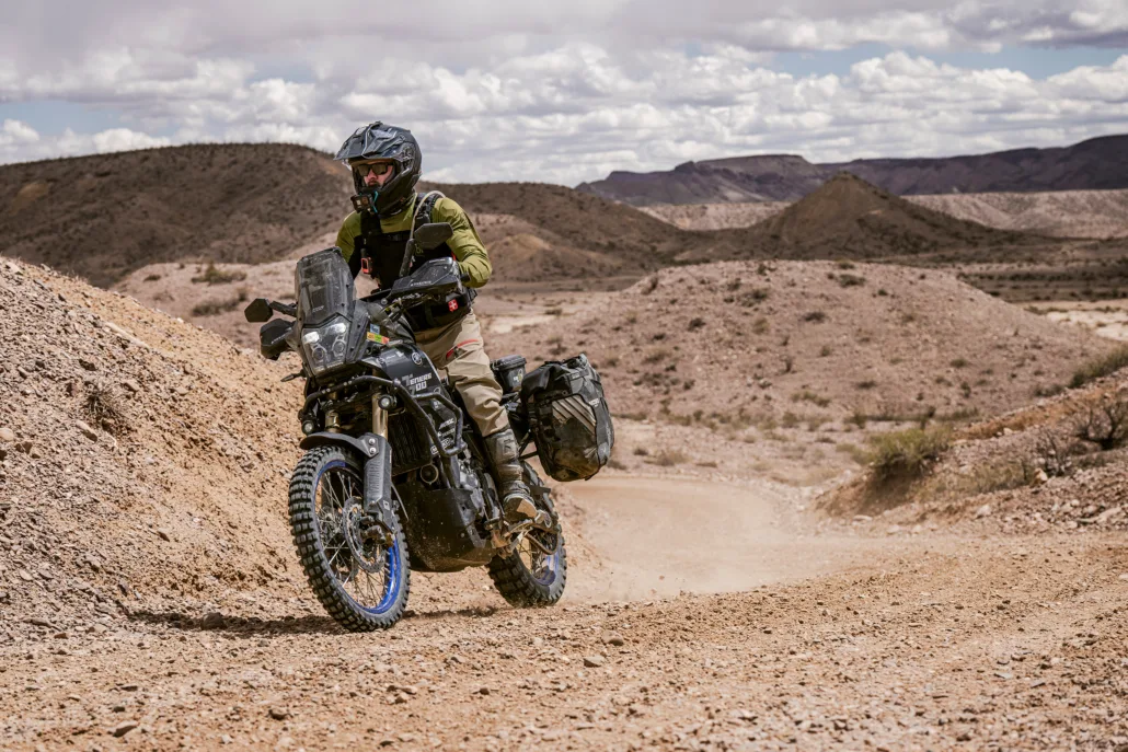
ALPINE TO RIO GRANDE VILLAGE – 143 miles Your journey begins in Alpine, where you’ll find ample options for food, fuel, and lodging. Be sure to fuel up, and as you head south, keep an eye out for herds of Aoudad, the majestic African wild sheep transplanted here. Turning east, you’ll transition from paved to dirt roads. Reduce your speed and navigate carefully. A rest stop at Terlingua Ranch offers food, cold drinks, and Accommodations. Entering Big Bend National Park, you’ll encounter a brief but exciting stretch of primitive two-track, which may feature patches of deep sand. After reaching Highway 385, the route becomes paved and continues to the Fossil Bone Exhibit and Panther Junction, which has food, fuel and entrance passes. For experienced riders, an optional harder route on Old Ore Road provides a challenging 29-mile experience through rugged desert terrain, including rocky climbs, off-camber turns, switchbacks, and sand. There are no bailouts on Old Ore Road, and while this section is not for the faint of heart, the challenge is worth the reward. Meeting the mighty Rio Grande, visit Boquillas Overlook for panoramic views and the optional excursion into Mexico at Boquillas Crossing. Don’t forget your passport! Section 1 concludes at Rio Grande Village, where you can find fuel and supplies at the general store (available from 9 am to 5:30 pm). Be sure and pay your entrance fee at the visitor center if you haven’t already. There is no lodging here, but a campground is available. For additional lodging and camping, head to Chisos Basin, located high above the desert floor, or exit the park and stay in Study Butte or Terlingua. Reservations are required in advance for all park accommodations.
2. Rio Grande Village to Study Butte
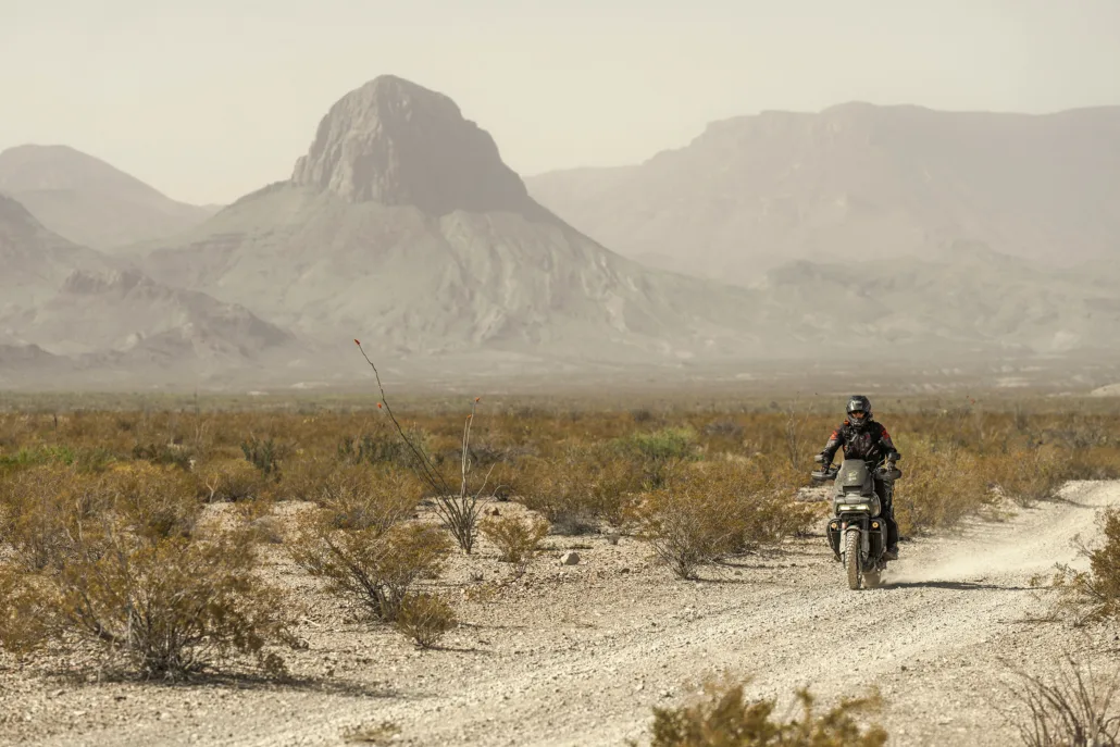
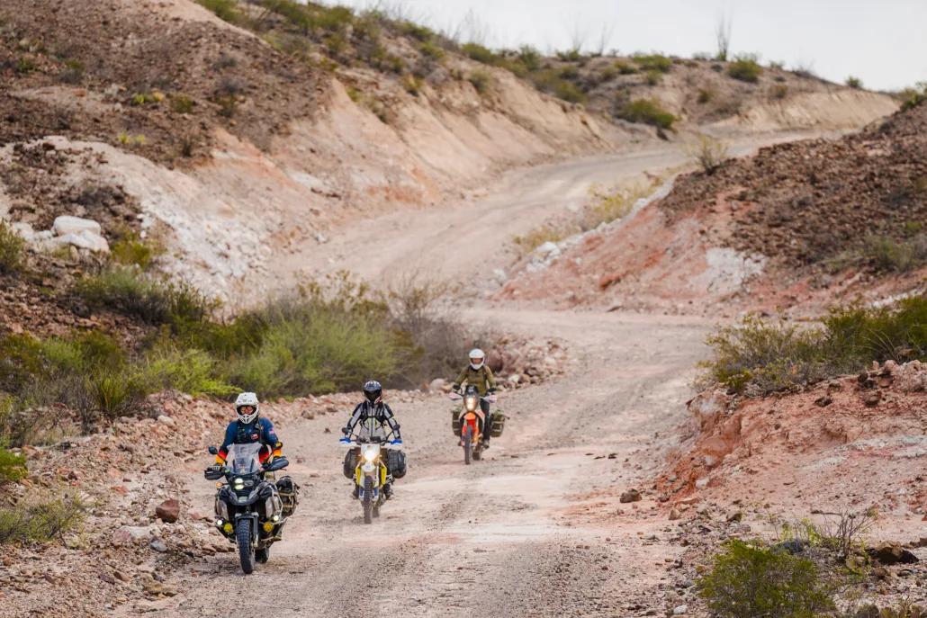
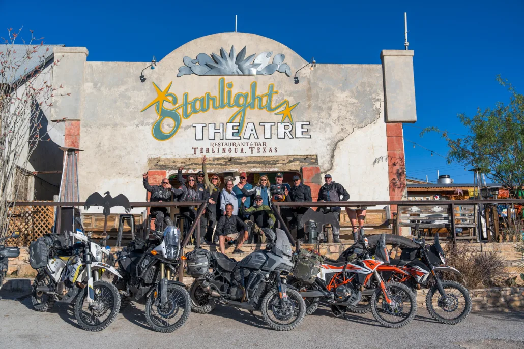
RIO GRANDE VILLAGE TO STUDY BUTTE – 84 MILES The River Road is a true gem, traversing miles of rugged desert terrain, showcasing the raw beauty of this expansive wilderness. Take a break at Boquillas Hot Springs, accessible via a short scenic hike past the remnants of an old hotel, pictographs, and natural hot springs along the Rio Grande. Midway along River Road, advanced riders can take Black Gap Road. This highly-challenging road includes deep ruts, steep descents, rough ledges, rocky terrain, and the notorious Black Gap—a ramp of stacked rocks cutting through the rock formation. Near the junction of these roads, riders can visit Mariscal Mine to view the impressive remains of a decommissioned mercury mine. After a short but sweet stretch of pavement, stop at Elena Canyon Overlook for breathtaking views. Continue on Maverick Road, the final stretch of gravel leading out of the National Park and into the small towns of Study Butte and Terlingua. Study Butte and Terlingua offer various lodging options and excellent dining spots. When in Terlingua, be sure to visit the Starlight Theatre for a great meal and a chance to relax on “the porch.” CAUTION: River Road is a 52-mile stretch of continuous primitive dirt with no bailouts and takes longer than expected. Carry sufficient food, fuel and water as you will be far from assistance in this remote area.
3. Study Butte to Presidio
STUDY BUTTE TO MARFA – 124 MILES Departing Study Butte/Terlingua, stop in Lajitas for fuel and snacks before a blissful stretch of paved road as you cruise alongside the Rio Grande on FM170 before embarking on an optional 47-mile detour into Big Bend Ranch State Park. This scenic out-and-back route ends at the Sauceda Bunkhouse, where you can replenish water or stay overnight, with a reservation. Highway 169 features a mixture of gravel and pavement with expansive views as you head north. Section 3 concludes in Marfa, known for its eclectic vibe and artsy charm and features a multitude of great lodging and food options. CAUTION: This section is over 170 miles if you stop in the State Park, so after you leave the Terlingua area, stop in Lajitas for food and fuel, and don’t forget to pick up your Big Bend Ranch State Park entrance pass at the Barton Warnock Visitors Center. Riders coming from Marfa should visit Fort Leaton for permits before entering the park. In either direction, riders can detour into Presidio for fuel, food, lodging, and permits with an entry point into Mexico.
4. Presidio to Van Horn
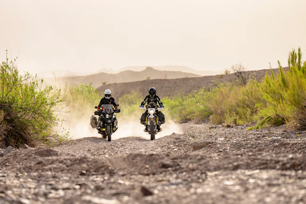
MARFA TO VAN HORN – 144 MILES After a brief stretch of pavement, Pinto Canyon turns to dirt as you make your way south and features incredible vistas. Reaching the village of Candelaria, you’ll begin one of the best parts of this route as you navigate remote two-track along the Rio Grande on Chispa Road. A notable feature is Godzilla Hill, featuring a long, steep climb followed by a steep descent, marked by a distinctive rock formation resembling Godzilla. This hill and this section are considered impassable when wet, so if weather conditions are poor, turn back and return on the track to Marfa. This entire stretch along the Rio Grande is remote with no bailouts, so ensure you have all necessary supplies. Watch for ranch gates and make sure to leave them as you found them. After extensive desert riding, you’ll rejoin the pavement for a short ride into Van Horn, where you can find food, fuel, and lodging.
5. Van Horn to Alpine
VAN HORN TO ALPINE – 128 MILES After several hundred miles of rugged dirt, Section 5 offers reprieve with a rewarding stretch of smooth pavement. Departing Van Horn, make a stop at the Prada art installation before cruising some of the finest paved mountain roads in Texas. Highway 118 winds through dramatic terrain with continuous twists and turns. Consider a visit to the McDonald Observatory before descending into Fort Davis. This charming town offers food, fuel, lodging, and the historic fort to explore. A stretch on Highway 118 completes the final miles back to Alpine. Each of these towns — Alpine, Fort Davis, and Marfa — make an excellent starting or ending point for your adventure.
Interactive map preview
Open the full map for layers, filters, and route planning tools.
Open full mapYour next adventure starts here
Create your own maps with custom routes, waypoints, and layers. Then share with your friends to kick off your adventure planning.
