Lost Coast, California BDR-X
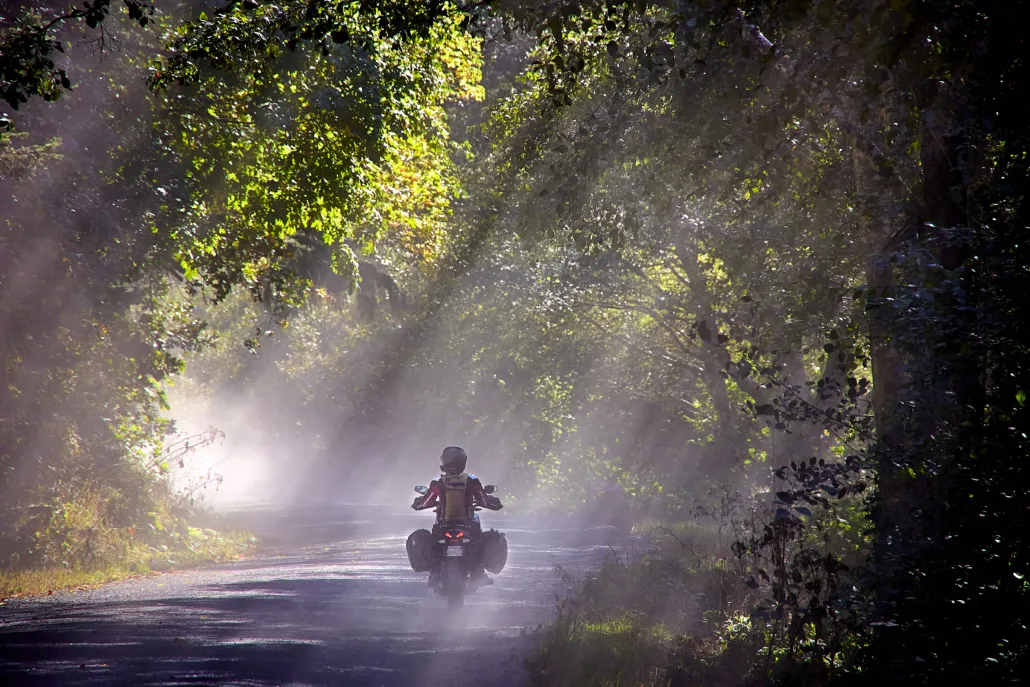
The Lost Coast BDR-X is a 500-mile figure-eight loop that ventures deep into the untamed heart of Northern California’s last stretch of
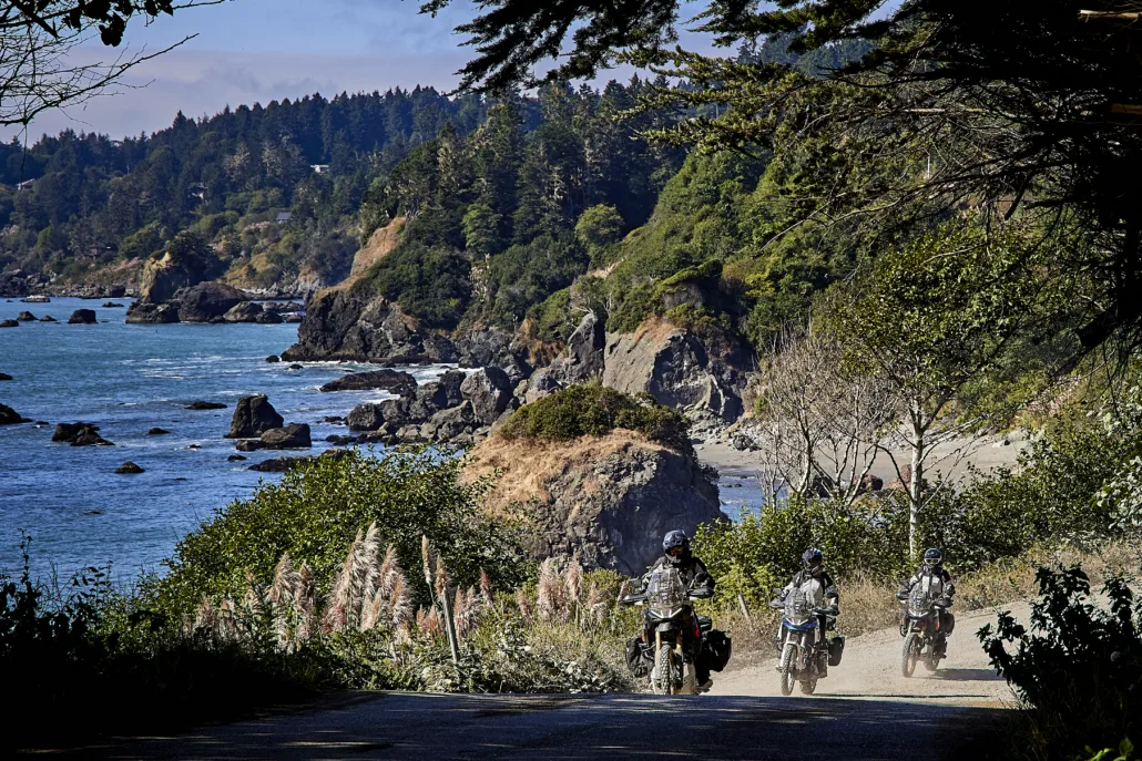
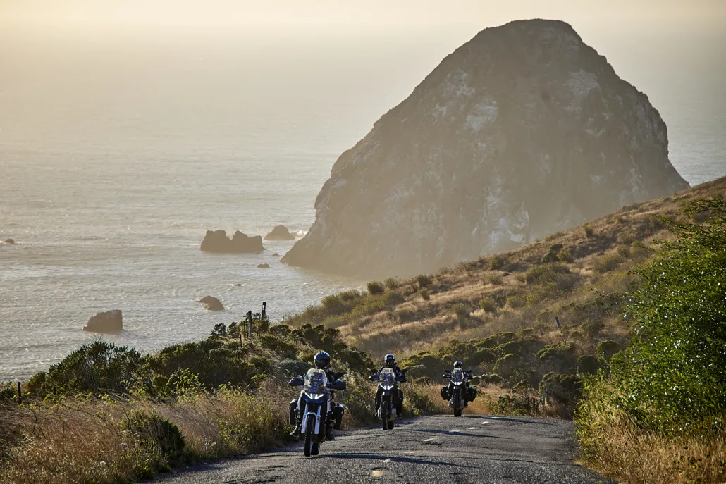
Riders will tackle endless switchbacks on both dirt and pavement, each turn revealing new views of rugged coastline, misty ridges, and dense forests. The ride blends world-class pavement, remote forest roads, and historic coastal towns, where adventure meets the area’s rich history and laid-back charm.
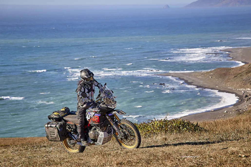
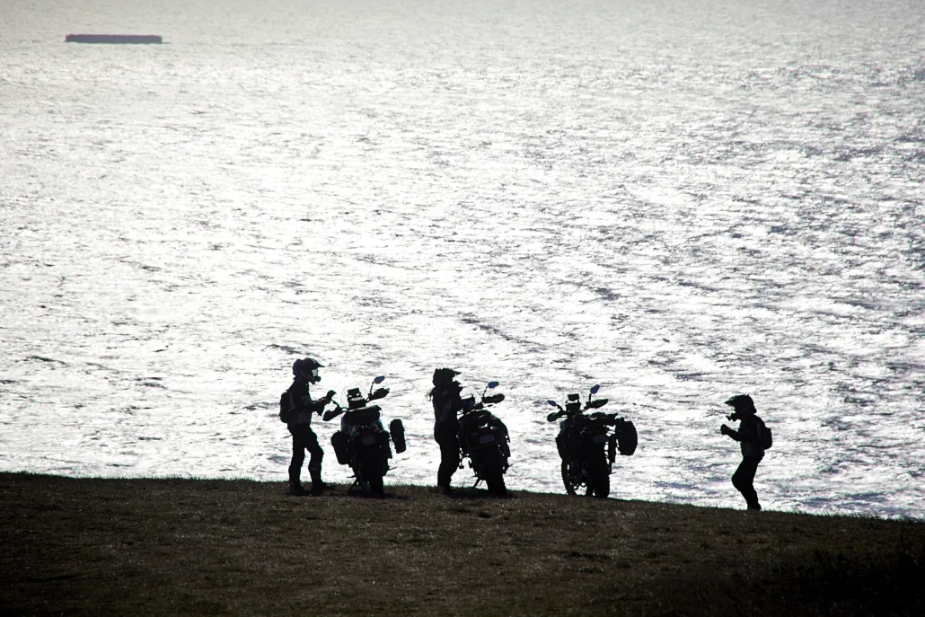
From fog-draped ridges to secluded beaches, the Lost Coast BDR-X offers a rare kind of ride, defined by open space, natural beauty, and a sense of true escape. Out here, the ocean, forest, and sky move together, reminding you what it feels like to be far from the crowds.
The best season for this route is from about late May through October with seasonal road closures prohibiting the full loop ride during the wetter months.
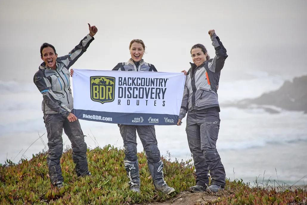
This route was made possible through the generous support of Aprilia, All Terra by Alpinestars, SW-Motech, and Continental Tires.
Lost Coast, California BDR-X
The Lost Coast BDR-X is a 500-mile figure-eight loop that ventures deep into the untamed heart of Northern California’s last stretch of
Riders will tackle endless switchbacks on both dirt and pavement, each turn revealing new views of rugged coastline, misty ridges, and dense forests. The ride blends world-class pavement, remote forest roads, and historic coastal towns, where adventure meets the area’s rich history and laid-back charm.
From fog-draped ridges to secluded beaches, the Lost Coast BDR-X offers a rare kind of ride, defined by open space, natural beauty, and a sense of true escape. Out here, the ocean, forest, and sky move together, reminding you what it feels like to be far from the crowds.
The best season for this route is from about late May through October with seasonal road closures prohibiting the full loop ride during the wetter months.
This route was made possible through the generous support of Aprilia, All Terra by Alpinestars, SW-Motech, and Continental Tires.
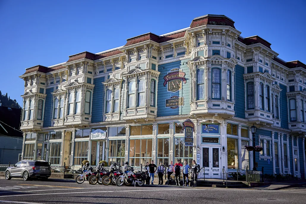
1. Fort Bragg to Shelter Cove
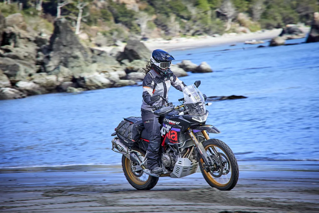
FORT BRAGG TO SHELTER COVE – 63 miles Fort Bragg makes the perfect start to your adventure with ample lodging and food options. Before you leave town, stop at Glass Beach for a short walk to this iconic spot where you can search for tumbled glass pieces washed upon the shore. As you head north along Highway 1 you’ll instantly get a sense for the stunning views of the Pacific Ocean that lay ahead as you meander along the breathtaking California coast. Usal Road is the first taste of dirt as you ride along a primitive forested two-track with a few great views of the coast. While generally mild, this road can be particularly challenging at times, especially after a storm and is considered impassable when wet. Stop by Usal Beach, which features a campground, a wide sandy shoreline, and often a herd of elk. Be sure to park where the beach road is firm and not sandy. Take a side trip to the Needle Rock Visitor Center and keep an eye out for herds of elk in this wildlife preserve before the last stretch of primo riding into the quaint town of Shelter Cove. Note: The northern section of the Usal Road is typically closed for the winter and usually opens for the season right before Memorial Day weekend, depending on weather conditions from the previous winter. Check the County of Medocino’s Department of Transportation website for road closures and delays.
2. Shelter Cove to Rio Dell
SHELTER COVE TO RIO DELL – 74 MILES Ride a loop around lovely Shelter Cove and visit the iconic black sand beaches, Seal Rock and the Mendocino Lighthouse. Kings Peak Road features tight dirt through the forest, with an optional advanced section on Saddle Mountain featuring steep, narrow switchbacks rewarded with fantastic views of the coast. Take a side trip to the Kinsey Ridge viewpoint and a rest at the quaint Honeydew Store. The optional extension to Windy Point Knoll provides a stunning ride on a primitive 4wd road, dropping down to an impressive grassy knoll right along the raging Pacific. While not technical, this road is steep and would be nearly impossible when wet. After a stop in Petrolia, Mattole Road features some of the best views of the ocean yet along blissful pavement. Enjoy the final stretch of scenic dirt on Bear River Ridge before descending into Rio Dell, the crossing point of this figure-8 loop.
3. Rio Dell to Blue Lake
RIO DELL TO BLUE LAKE – 87 MILES Rolling farmland makes way for tight forested roads as you leave Rio Dell. Redwood House Rd ascends deeper into the woods toward the furthest inland portion of the route yet. Showers Pass is a flowy dirt road high in the hills, with switchbacks galore and sweeping views through this emblematic grassland. Mountain View Road descends into more woods and meanders back to Kneeland Road and the ridge crest. The last stretch on Maple Creek brings even more twists and turns, full of panoramic views as you descend into Blue Lake. Here, the casino offers lodging, food, and fuel. Reservations in advance are recommended.
4. Blue Lake to Ferndale
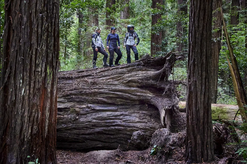
BLUE LAKE TO FERNDALE – 143 MILES Section 4 starts off with a bang as you ascend Bald Mountain, one of the highlight portions of this route, full of endless vistas along this vast ridge. Take a rest at “the couch” before crossing Highway 299 to Bair Ridge. This road is primitive, tight, forested and absolutely incredible as you cross through the Hoopa Reservation. There is no camping allowed here, so Ride Respectfully on this land as you pass through. The climb up Bald Hills will put your switchbacking abilities to the test before entering a less-visited section of Redwoods National Park. Pause at Redwood Creek Overlook then admire these ancient giants as you descend to Highway 101. The second half of this section meanders on and off the highway, with great beach access, camping, and towns along the way including Trinidad. Make a detour to Table Bluff Beach for views of Humboldt Bay before crossing the Fernbridge and reaching historic Ferndale
5. Ferndale to Fort Bragg
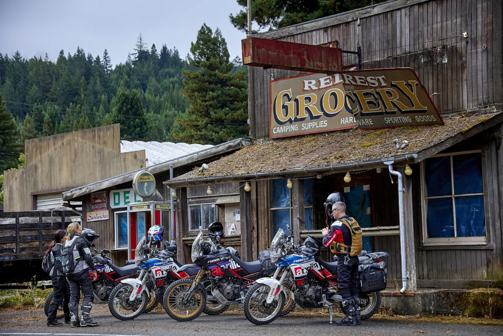
FERNDALE TO FORT BRAGG – 152 MILES As you pass through the “X” of this route in Rio Dell/Scotia, fuel up before Shively Road, a narrow paved road through the woods. Be aware, the bridge over Eel River is seasonally closed between late October and mid-June each year. After Shively you’ll meander through the giant redwoods along the Avenue of the Giants before beginning Dyerville Loop Road. This next stretch features a collection of twisty paved and dirt roads. Be sure to stop and visit the Richardson Creative Exhibit, an outdoor art display on private property open to respectful visitors. Please don’t go past the Bigfoot sculpture—beyond it is the artist’s private home. The route carries on, twisting and turning with impressive views as you reach the New Harris General Store. With food, drinks, gas, and supplies, this is a place you don’t want to miss. In a few more miles you can grab a snack at the honor-system farm stand before reaching Highway 101. Be sure to fuel up as you pass through Laytonville. Fort Bragg–Sherwood Road provides a spectacular finish to this route, beginning with flowy gravel before narrowing into a rugged, overgrown stretch where corners disappear into the brush. Ride Right—oncoming traffic is possible. Though not especially technical, the road is seasonally closed, impassable when wet, and may have ruts or rocks depending on maintenance. Note: The Fort Bragg-Sherwood Road is typically closed to traffic from November to May due to wet conditions that make the unpaved sections muddy and impassable. Check the County of Medocino’s Department of Transportation website for road closures and delays.
Interactive map preview
Open the full map for layers, filters, and route planning tools.
Open full mapYour next adventure starts here
Create your own maps with custom routes, waypoints, and layers. Then share with your friends to kick off your adventure planning.
