Colorado BDR
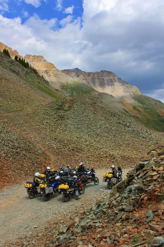
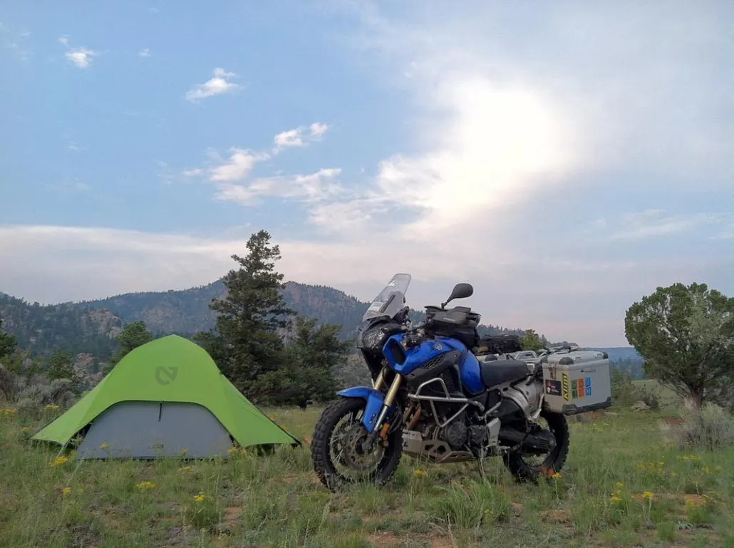
If getting high is your thing, Colorado offers some of the tallest mountains passable by motorcycle in the US. With several passes over 12,000 feet, there is no shortage of views on this route, just shortness of breath while taking in the sights in the thin air of Ophir, Corkscrew, Hurricane, California, Cinnamon, Cumberland, Cottonwood, Weston and Hagerman passes.
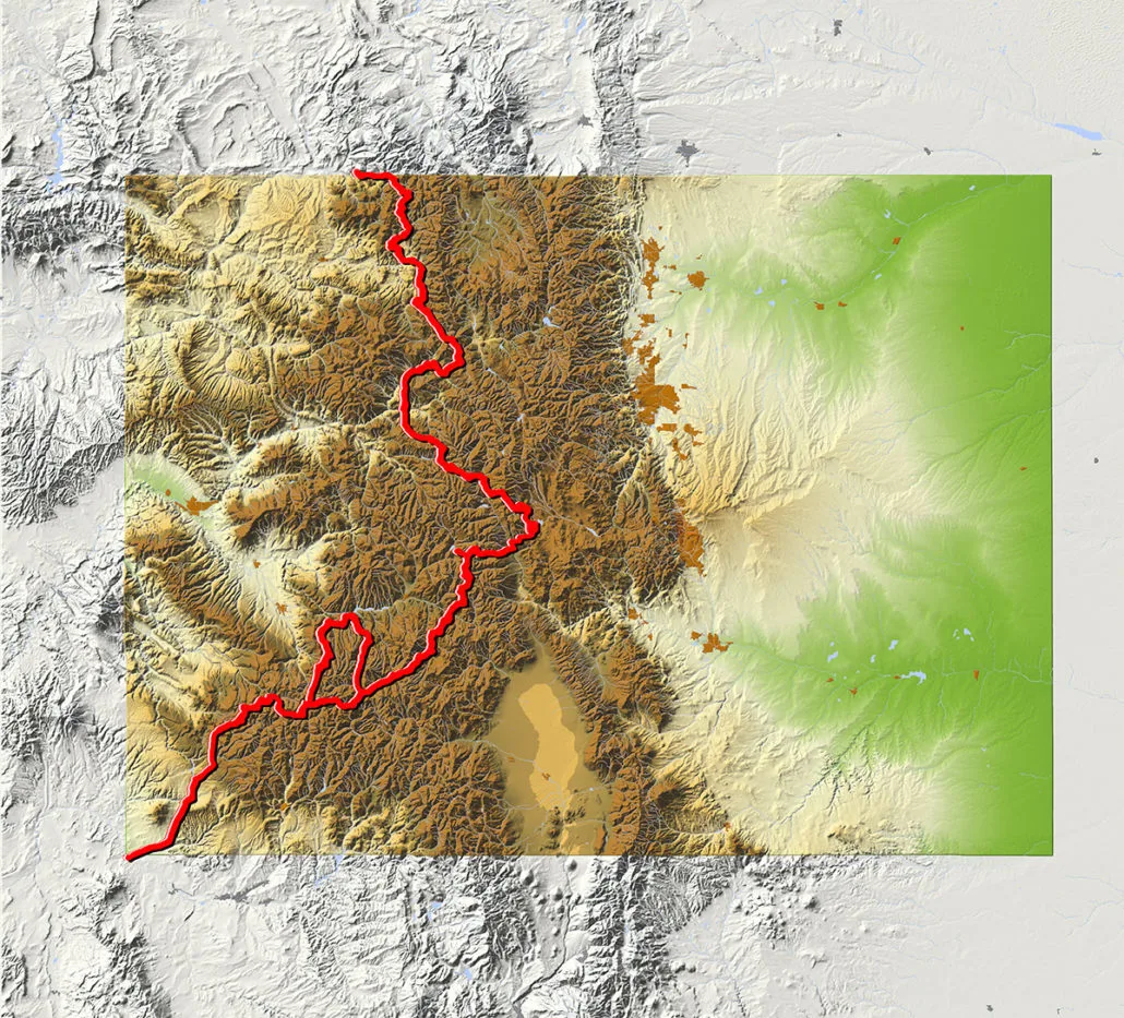
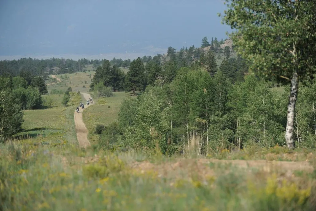
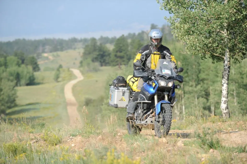
Beginning in the four corners location where, CO, AZ, NM and UT intersect, this 745-mile route winds its way north through the Rocky Mountains to the Wyoming border. The terrain includes dirt roads with rocks, sand and even a few water crossings to keep it exciting.
Best time of year: July through September. Most of the route can be done in late June. Depending on snowpack you might not make it through some high passes until sometime in July.
Colorado BDR
If getting high is your thing, Colorado offers some of the tallest mountains passable by motorcycle in the US. With several passes over 12,000 feet, there is no shortage of views on this route, just shortness of breath while taking in the sights in the thin air of Ophir, Corkscrew, Hurricane, California, Cinnamon, Cumberland, Cottonwood, Weston and Hagerman passes.
Beginning in the four corners location where, CO, AZ, NM and UT intersect, this 745-mile route winds its way north through the Rocky Mountains to the Wyoming border. The terrain includes dirt roads with rocks, sand and even a few water crossings to keep it exciting.
Best time of year: July through September. Most of the route can be done in late June. Depending on snowpack you might not make it through some high passes until sometime in July.
1. Four Corners to Telluride
Four Corners to Telluride – 131 Miles The COBDR officially begins at the Four Corners Monument where the borders of New Mexico, Arizona, Utah and Colorado converge. Lodging at the start of your journey can be found in nearby Durango or Cortez. Follow paved roads to the small town of Dolores prior to heading onto the dirt. Riders can fill up with fuel before heading north on a mix of narrow two-track and wide-graded roads on the way toward Groundhog Reservoir. There is a small convenience store at the reservoir for drinks and snacks. While the official route follows a dirt road just before the town of Telluride, consider riding through this historic downtown and up to Bridal Veil Falls for amazing views down into the valley floor a thousand feet below.
2. Telluride to Lake City
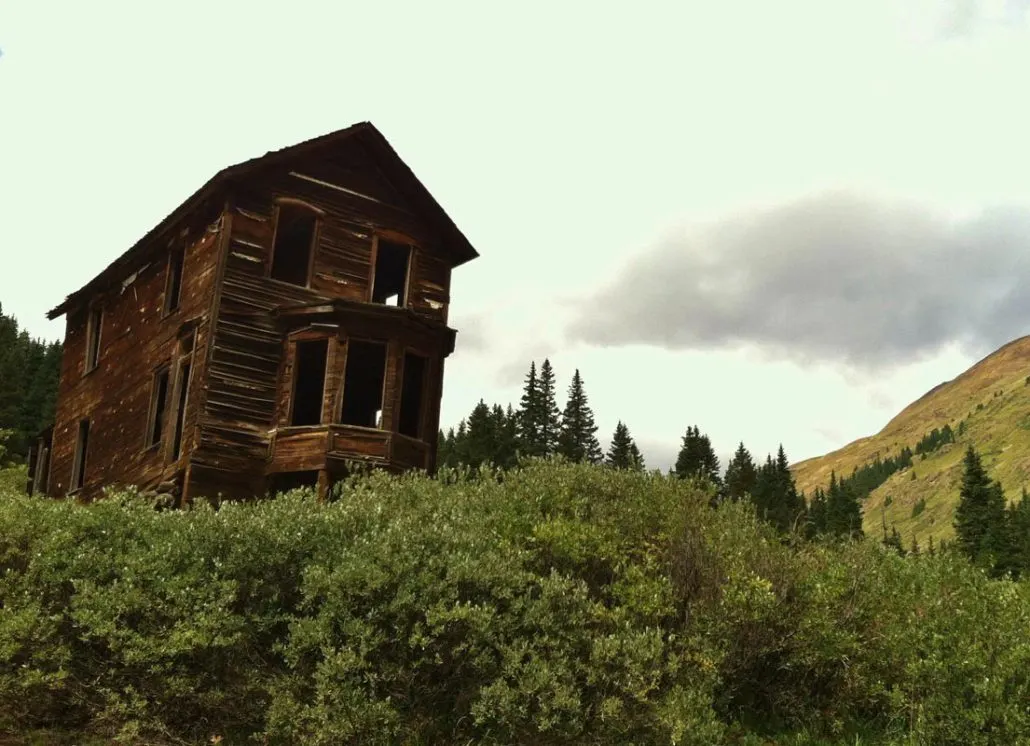
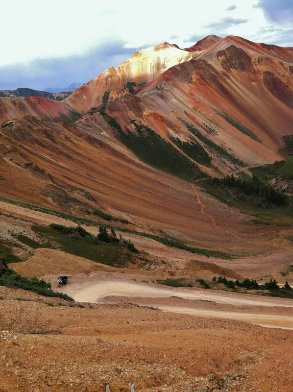
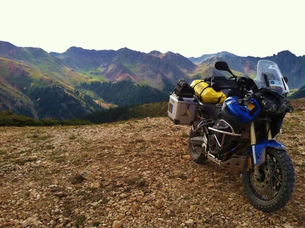
Telluride to Lake City – 123 Miles Heading west from the charming village of Telluride, the main route ascends a fantastic stretch of alpine dirt on Last Dollar Road. Enjoy picturesque mountain views as you make your way north. Stop in downtown Ridgway for food, gas or lodging before starting Owl Creek Pass. This well-maintained gravel road features a multitude of twists and turns, scenic views, lake access and camping. After a quick stretch on Highway 50, Alpine Plateau Road climbs to over 11,000 feet as you make your way south into charming Lake City. Section 2 Alt Harder – Alpine Loop (69.5 miles) Through the heart of Southern Colorado’s San Juan Mountains, this section delivers dramatic passes, ghost towns and one of a kind vistas and is a highlight of the trip. But be advised, this optional advanced section features high elevations, rocky passes, tight switchbacks, and challenging climbs. The first riding challenge comes on Ophir Pass, just outside Telluride. This is a rocky climb with tight switchbacks that requires steadfast momentum and careful line choice. The east side of the pass mellows out for a great descent to Highway 550. Enjoy a few miles of incredible scenic pavement on The Million Dollar Highway, and consider visiting the towns of Ouray and Silverton just a few miles off route. The ride east from Hwy 550 ascends impressive terrain over Corkscrew Pass, known for its stark red rock cliffs and tight switchbacks. Ascend California Pass next before dropping into the restored ghost town of Animas Forks. Cinnamon Pass is the final challenge as you climb again to over 12,000 feet via tight switchbacks and rocky terrain, before smoothing out for the final descent into Lake City.
3. Lake City to Buena Vista
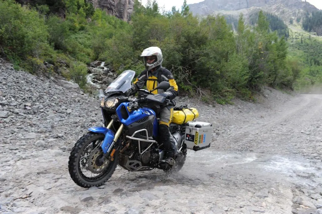
Lake City to Buena Vista – 144 Miles Section 3 provides a much different riding experience than the first two sections as you skirt through alpine plateaus on your way to Highway 50. For those looking to camp, beautiful spots can be found near Los Pinos Pass, and keep an eye out for moose. After crossing Highway 50, you’ll ride over Waunita Pass into Pitkin, a charming village worth a stop with food, fuel and lodging options. Cumberland Pass features an incredible climb to over 12,000 feet before dropping into historic Tincup, and you can also detour to Taylor Park for fuel and supplies. A few small water crossings make the route interesting before hitting the well-traveled and freshly paved surface of Cottonwood Pass. Buena Vista is one of the larger towns along the COBDR with plenty of places to eat and sleep along the base of the majestic Collegiate Peaks.
4. Buena Vista to Gypsum
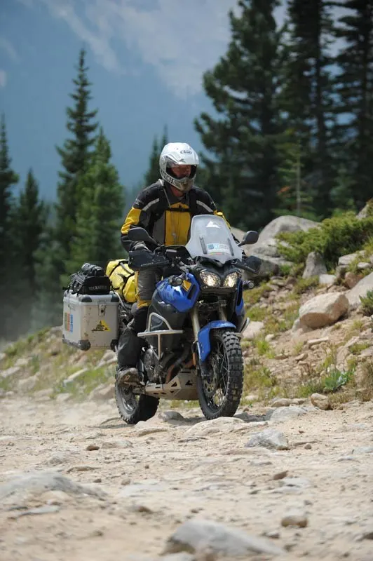
Buena Vista to Gypsum – 143 Miles Just outside Buena Vista, the route follows a sandy two-track road through an OHV area. This stretch features a few photo-worthy water crossings, and a bypass is available when the water levels are too high to cross. Weston Pass is the first of several passes on this section and offers a multitude of dispersed camping options on either end. Food, lodging and fuel are available in Leadville, a historic mining town and one-time front runner for Colorado’s state capitol. Hagerman Pass is typical of Colorado’s backcountry, offering stunning views of the rugged alpine tundra, and features a small water crossing and challenging rocky descent. After descending into the Fryingpan River Valley for a short stint on blacktop, the route heads over Crooked Creek Pass. Lime Creek Park has a few primitive camp sites at the base of a steep limestone canyon. Alternatively, ride to the other side of the pass and pay for a spot at Sylvan Lake State Park. Narrow logging and hunting roads will bring you from Sylvan Lake to Gypsum through dense pine and aspen forest groves. There is great camping near Gypsum as well as hotels here and nearby Eagle.
5. Gypsum to Steamboat Springs
Gypsum to Steamboat Springs – 122 Miles The main route of section 5 heads west out of Gypsum then follows scenic Colorado River Road, a stunning section with red sandstone cliffs along the mighty river. The optional advanced track on Trail Gulch Road begins on mellow dirt that runs past the Gypsum Mine north of town, but can be challenging at times with ruts and soft silt beds and is considered impassable when wet. Low sage and black dirt offer a unique contrast to the alpine settings experienced in previous sections. Keep an eye out for State Bridge along the Colorado River and Highway 131. This funky venue offers camping in teepees and yurts and periodically hosts live music events. North of State Bridge you’ll encounter blissful dirt roads with a few water crossings. Camping is very limited once you cross Highway 134 near Gore Pass, so riders looking to pitch a tent should keep their eyes peeled between State Bridge and the historic stagecoach stop just south of the highway. The small section of road below the dam at Stagecoach Reservoir is particularly stunning in the early morning or late evening when the sun bounces off the river winding next to the road.
6. Steamboat Springs to WY Border
Steamboat Springs to WY Border – 81.2 Miles Just northwest of Steamboat Springs, the route connects gently winding roads through acres of lush farmland. These are well used roads, so be wary of farm trucks and other traffic. As you pass Steamboat Lake, the road narrows and ascends into a serene pine forest, but remains relatively easy. The final stretch meaners through ranches before ending on Highway 70 in Wyoming near the WYBDR. The small towns of Clark and Columbine offer a few amenities and make a great lunch stop or a place to grab a cabin. Camping can be found at Steamboat Lake and in dispersed areas of the national forest.
Interactive map preview
Open the full map for layers, filters, and route planning tools.
Open full mapYour next adventure starts here
Create your own maps with custom routes, waypoints, and layers. Then share with your friends to kick off your adventure planning.
