California North BDR
The Northern California Backcountry Discovery Route (CABDR-North) is the 13th route developed by the BDR organization for dual-sport and adventure motorcycle travel.
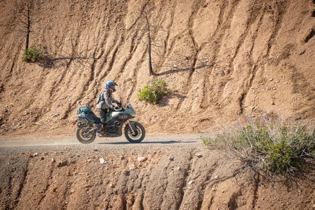
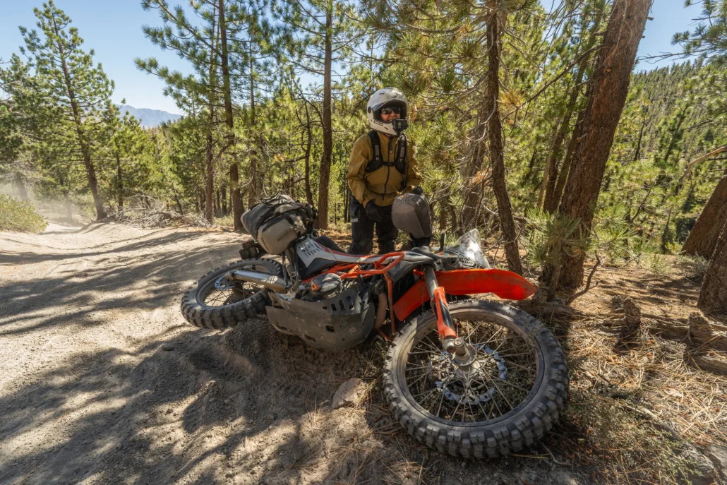
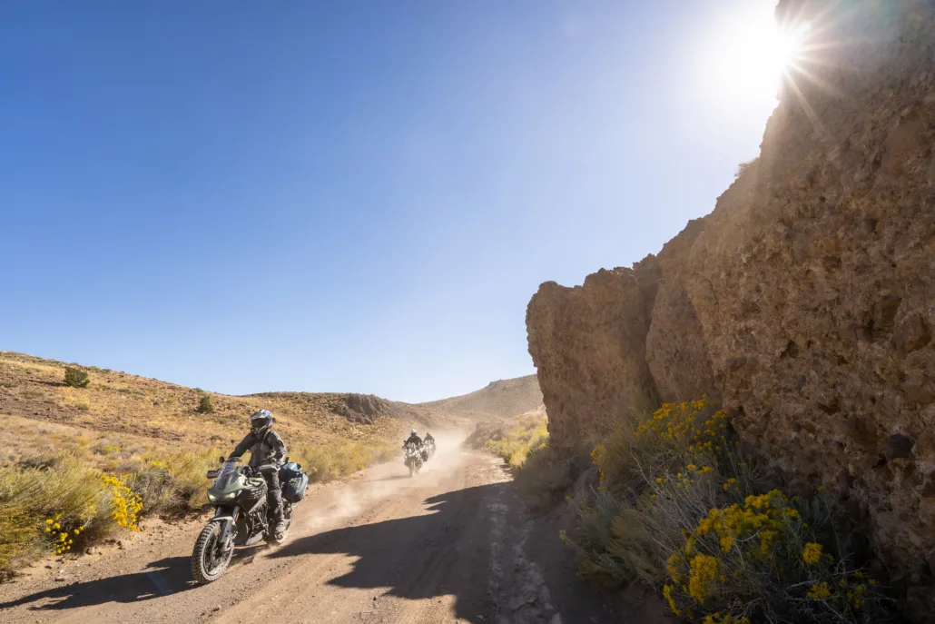
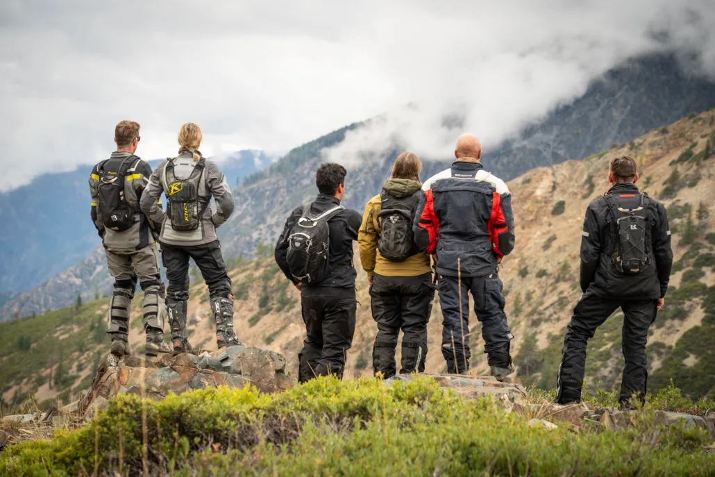
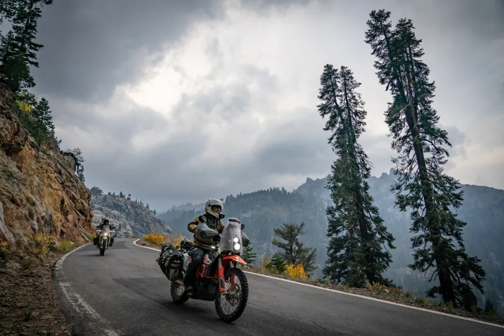
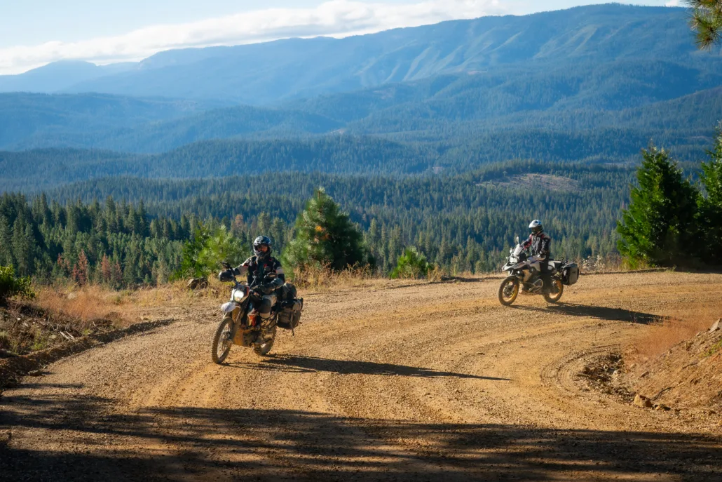
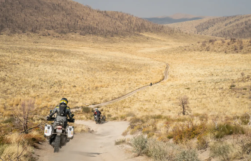
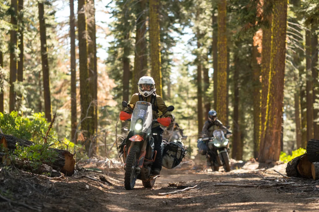
The Northern-California Backcountry Discovery Route (CABDR-North) is a 940-mile, off-pavement route designed for adventure motorcycles. Starting in Mammoth Lakes, CA atop Minaret Vista, you’ll traverse the Great Sierra Nevada Range’s conifer forests, mountain meadows, and gentle slopes, concluding in the high desert of the Modoc Plateau just north of Alturas, CA at the Oregon border. Ride blissful forested two-tracks, tackle rugged canyon and mountain roads, and ascend peaks to fire lookouts with unparalleled views. Explore quaint towns nestled in the High Sierra’s folds, with historic inns dating back to the 1880s. Beyond the thrill of the twisty roads and scenic vistas, you can delve into California history, discover relics of mining towns, and witness geological wonders. The route caters to riders of varying skill levels and offers optional challenging sections plus three expert segments. Immerse yourself in Northern California’s appealing blend of adventure, history, and epic scenery.
Read more about the route in the Film Trailer Press Release article.
* * *
ROUTE SPONSORS
This route was made possible with support from BDR Industry Partners
BMW Motorrad USA, Zero Motorcycles, Edelweiss Bike Travel, Outback Motortek
California North BDR
The Northern California Backcountry Discovery Route (CABDR-North) is the 13th route developed by the BDR organization for dual-sport and adventure motorcycle travel.
The Northern-California Backcountry Discovery Route (CABDR-North) is a 940-mile, off-pavement route designed for adventure motorcycles. Starting in Mammoth Lakes, CA atop Minaret Vista, you’ll traverse the Great Sierra Nevada Range’s conifer forests, mountain meadows, and gentle slopes, concluding in the high desert of the Modoc Plateau just north of Alturas, CA at the Oregon border. Ride blissful forested two-tracks, tackle rugged canyon and mountain roads, and ascend peaks to fire lookouts with unparalleled views. Explore quaint towns nestled in the High Sierra’s folds, with historic inns dating back to the 1880s. Beyond the thrill of the twisty roads and scenic vistas, you can delve into California history, discover relics of mining towns, and witness geological wonders. The route caters to riders of varying skill levels and offers optional challenging sections plus three expert segments. Immerse yourself in Northern California’s appealing blend of adventure, history, and epic scenery.
Read more about the route in the Film Trailer Press Release article.
* * *
ROUTE SPONSORS
This route was made possible with support from BDR Industry Partners
BMW Motorrad USA, Zero Motorcycles, Edelweiss Bike Travel, Outback Motortek
1. Mammoth to Bridgeport
MAMMOTH TO BRIDGEPORT – 94.8 MILES The official start of your journey begins just a few miles from the resort town of Mammoth Lakes atop Minaret Vista (9,265’). Take in the incredible views and crisp mountain air, then choose your own adventure as the route splits. The first optional advanced section follows OHV trails through the largest Jeffrey Pine Forest in the world, which can be sandy with hidden roots underneath. Later in this section, the second advanced option loops around Obsidian Dome, with tight forested turns and primitive sandy terrain (be mindful of OHV traffic on the advanced sections). Admire the scenic wonders of Mono Lake with its unique Tufa Spires, then adhere to the main route if you’re not up for a technical water crossing with large, slick boulders, which can get quite deep depending on the season. The northern portion meanders through the hills above Bodie, and if you like old mining towns, Bodie State Historic Park is worth exploring (fee required). Continuing toward the town of Bridgeport, the section ends with an epic two-track with views of Nevada and the Sweetwater Range.
2. Bridgeport to Bear Valley
BRIDGEPORT TO BEAR VALLEY – 89.5 MILES After a ride up Hwy 395, turn onto Burcham Flat Road to hit the dirt. If you dare, take the optional Expert tracks, but make sure you allow several hours. Expect steep, rocky, loose terrain with sheer drop offs as you summit Mount Patterson (11,673’), and rocks and potentially deep sand on the remote Sweetwater Loop north of Lobdell Lake. If you summit Patterson and have had enough, simply backtrack the way you came and rejoin the main route. These challenging sections should not be attempted late in the day or alone as they are remote with no bailouts and don’t reconnect with the main route for nearly 40 miles. Continuing northward, follow the smooth turns of Hwy 89 as it climbs over Monitor Pass (8,314’). The paved fun intensifies on Hwy 4 as the road narrows to one lane over Ebbetts Pass (9,186’), marking the official transition from the steep escarpment of Eastern Sierras to the more gentle slopes of the western flanks of the Great Sierra Nevada Range.
3. Bear Valley to Kyburz
BEAR VALLEY TO KYBURZ – 116 MILES Blissful forested two-track awaits just outside of Bear Valley, as you meander through the deep pines before reaching the backwoods pavement of Winton Road. Heads up, Winton Road closes on Nov 1st or after the first significant snowfall. The route continues west via scenic paved roads into Buckhorn, then follows narrow primitive dirt and paved roads along the Mokelumne River where several great camping opportunities can be found. Advanced riders can take the optional ALT Harder track via 7N08 for a primitive downhill dirt road prone to ruts and washouts, dropping you out right along the picturesque river, but be advised this road is gated until late spring each year. Steep dilapidated pavement switchbacks take you up the other side of the canyon, topping out with an epic traverse of the Bear River Reservoir dam. Soon, the route follows Hwy 88 then continues northward on forested tracks with an optional quick out-and-back to the Leek Springs Hill Lookout Tower (7,621’). A short ride on the historic Mormon Emigrant Trail leads to even more forested dirt and the end of Section 3 on Hwy 50 in the tiny town of Kyburz.
4. Kyburz to Truckee
KYBURZ TO TRUCKEE – 111 MILES Take a journey back in time as you ride part of the original Pony Express Trail just outside of Kyburz. Ice House Road comes next, with paved banked turns as the route travels around the Desolation Wilderness west of Lake Tahoe. The original road to the Sacramento Valley leads past Uncle Tom’s Cabin, a homestead from the 1840’s that once welcomed pioneers, and is now a watering hole and campground. Broken pavement and dirt roads with a few challenging rocky sections lead down to French Meadow Reservoir. From there, you’ll ride incredible two-track as it climbs up and over the mountains towards Truckee, and a stunning paved section over Donner Pass. Walk through the tunnels hand-carved through Sierra Granite by Chinese immigrants to complete the Transcontinental Railroad, and stop at Donner Memorial State Park. The infamous Donner Party was stranded here in the winter of 1846 after encountering deep snow and resorted to cannibalism to survive. Hopefully you’ve packed enough snacks and won’t have to do the same.
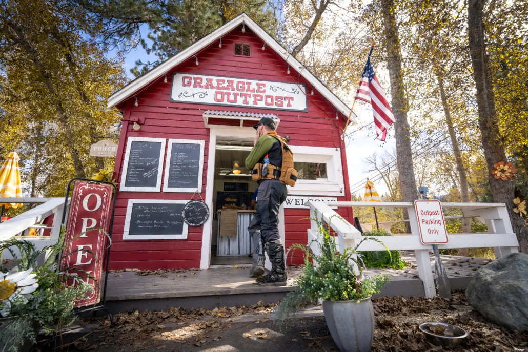
5. Truckee to Graeagle
TRUCKEE TO GRAEAGLE – 138 MILES Leaving Truckee, the route passes by Boca Reservoir and turns to flowy dirt roads with an optional rocky climb up Verdi Peak (8,444’). Fill up in Sierraville, then travel the historic Henness Pass Road and Webber Lake, with pristine camping available at water’s edge. WARNING: The very steep descent on dirt to Downieville via Galloway Road is a highlight, but not advised when wet, so an optional bypass track is available. The main route follows a pleasant gravel road up Forest Road 93 just a few miles east of Downieville. An optional harder track offers a rocky, narrow climb, where you can continue north to the main route, or take the optional Expert section for a steep, challenging climb to a trailhead parking area just 3/4 mile from Sierra Buttes Lookout (8,587’). Although the road continues, the GPS track ends in a parking area on the left, where we suggest you park your bike and hike the rest of the way to the summit. WARNING: The road from the parking area to the summit is extremely dangerous, with steep, rocky, tight switchbacks and exposed cliff edges. Single-lane pavement brings you to Gold Lake Hwy before exiting onto dirt and yet another spectacular lookout in this section, Mills Peak (7,324’), before reaching the quaint town of Graeagle.
6. Graeagle to Chester
GRAEAGLE TO CHESTER – 117 MILES Bring your A-game leaving Graeagle, as this section includes rocky and faint two-track and steep climbs through burned out forest. Use extra care reading the primitive grass-covered roads and watch for fallen trees and hanging branches. Relax with a quick spin up to Argentine Rock Lookout (7,209’) with views of Sierra Buttes, Lassen Peak and the town of Quincy. Another short trek leads to Mt. Hough Lookout (7,232’), followed by a winding descent to the hamlet of Taylorsville, which lacks fuel but features a wonderful general store with great burgers, shakes, sundries, and espresso, and has been serving the community for over 100 years. After passing Round Valley Reservoir, the landscape turns ominous and enters the aftermath of the 2021 Dixie Fire that consumed almost one million acres of Northern California forests. Dirt roads through a deep canyon take you past the ghost town of Seneca, site of one of the largest gold nuggets found in California. Fun flowing two-track roads through burned forests (be mindful of tree branches sticking out on the trail!), bring a smooth finish to the town of Chester on the banks of Lake Almanor.
7. Chester to Bieber
CHESTER TO BIEBER – 125 MILES Treat yourself with views of Lake Almanor before tackling primitive overgrown forest roads that lead to yet another lookout, but this one is unique. Antelope Mountain Lookout (7,684’) is one of the first fire lookouts in the country to be solar powered (through a joint venture between NASA and the US Forest Service). A short optional advanced section descends the backside of the summit, and more delectable two-track leads to Harvey Mountain Lookout (7,354’). The main route soon turns to asphalt all the way to Bieber. For the daring, an optional advanced track intersects the start of Section 8 through Little Valley and entails overgrown grassy terrain with a steep, technical rocky climb that transitions to blissful, faint forested two-track. Don’t forget to leave the gates as you found them! NOTE: If you take the ALT Harder track, this will be the longest stretch between fuel. You’ll have to either take a side trip to Adin (15.3 mi round trip) or continue to Alturas if you have the range (over 180 miles from Chester to Alturas if taking the ALT Harder track).
8. Bieber to Alturas
BIEBER TO ALTURAS – 91.2 MILES Just a few miles from Bieber, take a quick spin up Snag Hill Lookout (6,073’) as you meander through more evidence of past forest fires via beautiful gravel roads and brilliant red chipseal. This section is filled with stunning wide-open vistas as you blaze through undulating gravel and two-track roads through the high desert landscape. Over the river and through the woods to Alturas you go! Cross the beautiful little Ash Creek with plenty of great camping options and check out Manzanita Mountain (7,036’) before making your way to this historic town. If you prefer supernatural company over your riding friends, plan a stay at the Niles Hotel, rumored to have a ghost who resides in a room on the second floor.
9. Alturas to the Oregon Border
ALTURAS TO THE OREGON BORDER – 87.3 MILES After leaving Alturas on a short stretch of tar and more heavenly forest roads, summit your final fire lookout atop Sugar Hill (7,267’). Cross CR-9 for a blissful spin up fresh pavement and well-packed dirt to a moderately challenging section descending an off-camber forested road that sees very little usage. Splish splash through a few creek crossings and into historic Fort Bidwell, with a restaurant and inn occupying the same building that beckons any weary rider. The final miles of this route are as impressive as the first as you meander through dense pine forest with abundant camping opportunities before descending to Highway 395 and up to the Oregon border. There is no fuel here, so take Hwy 395 for 39 miles back to Alturas or 13 miles north to Lakeview, OR. Congratulations on completing an epic adventure!
Interactive map preview
Open the full map for layers, filters, and route planning tools.
Open full mapYour next adventure starts here
Create your own maps with custom routes, waypoints, and layers. Then share with your friends to kick off your adventure planning.
