Chattahoochee, Georgia BDR-X
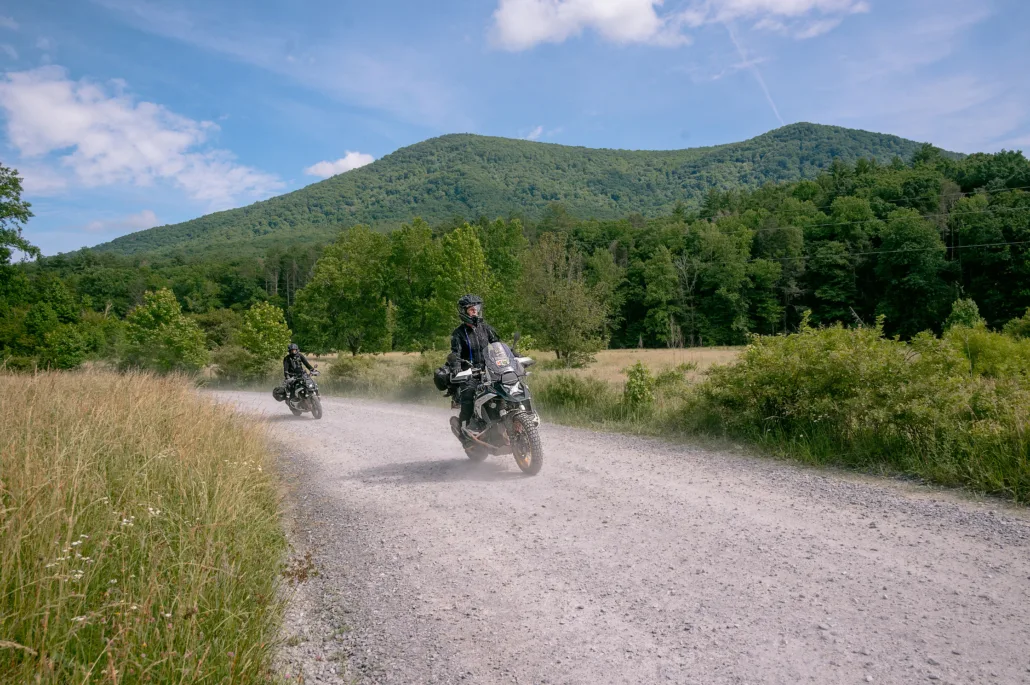
The Chattahoochee BDR-X is a 350-mile loop featuring the best dual-sport and adventure riding in the north Georgia mountains. This unforgettable route combines a collection of graded forest roads, primitive two-track, and scenic backcountry pavement under the dense canopy of the Chattahoochee National Forest.
Quaint mountain towns dot the track including Ellijay, Dahlonega, Suches, and Helen, with abundant lodging and camping opportunities throughout. Riders will criss-cross the Appalachian Trail, tackle rugged climbs, carve twisty pavement, and splash through numerous creek crossings. Unique to the south, the Chattahoochee BDR-X can be ridden most of the year and is best between March and December, weather and seasonal road closures permitting.
UPDATE: The tracks for have been updated as of 2/18/25. Please be sure and download the latest track file HERE before you go.
Chattahoochee, Georgia BDR-X
The Chattahoochee BDR-X is a 350-mile loop featuring the best dual-sport and adventure riding in the north Georgia mountains. This unforgettable route combines a collection of graded forest roads, primitive two-track, and scenic backcountry pavement under the dense canopy of the Chattahoochee National Forest.
Quaint mountain towns dot the track including Ellijay, Dahlonega, Suches, and Helen, with abundant lodging and camping opportunities throughout. Riders will criss-cross the Appalachian Trail, tackle rugged climbs, carve twisty pavement, and splash through numerous creek crossings. Unique to the south, the Chattahoochee BDR-X can be ridden most of the year and is best between March and December, weather and seasonal road closures permitting.
UPDATE: The tracks for have been updated as of 2/18/25. Please be sure and download the latest track file HERE before you go.
1. Ellijay to Suches
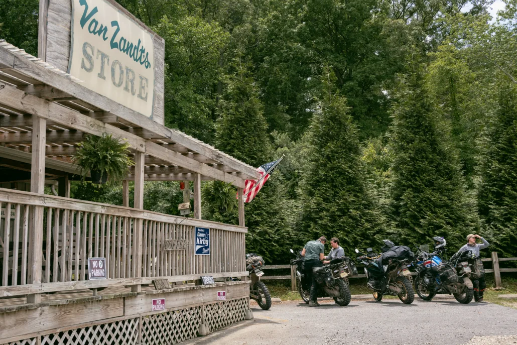
ELLIJAY TO SUCHES – 99 miles Begin your journey in the picturesque north Georgia mountain town of Ellijay, known for mountain biking, hiking, whitewater kayaking, and its numerous apple orchards and wineries. The track meanders along paved and unpaved county roads through mountain farmland before intersecting with Old Bucktown Road. This rugged two-track road climbs steadily to Nimblewill Gap, where the Appalachian Trail (AT) Approach Trail connects Amicalola Falls to the southern terminus of the AT at Springer Mountain. From Nimblewill Gap, the road smooths out as it descends the mountain, connecting with Winding Stair Gap Road and the picturesque Noontootla Creek. Stop for a break at Van Zandt’s Grill and Grocery in Dial, a local favorite. Continue on Old Rock Creek, a narrow two-track road, where you can access a 1/3 mile hike to cross the Toccoa River via the longest swinging bridge in the Eastern US. Visit the US Army Ranger Camp Merrill, home of the Mountain Phase of Ranger training and “The Overhang” café. The route passes near Dahlonega, a quintessential mountain town with restaurants, shopping, and lodging. The final stretch of pavement features a scenic twisty climb over the Woody Gap AT crossing before ending in the charming community of Suches.
2. Suches to Dillard
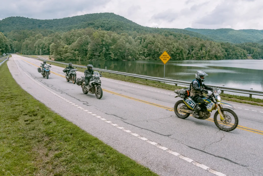
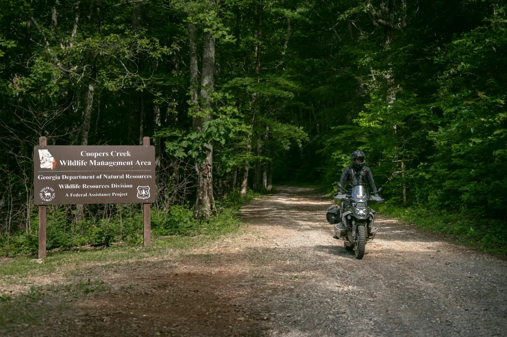
SUCHES TO DILLARD – 142 miles Depart Suches on a twisty paved section of Highway 60 before entering the Cooper Creek WMA area of the National Forest. A series of forest service roads lead to Duncan Ridge, a fun rocky road that eventually intersects Highway 180. Stop at Sunrise Grocery, a local spot for boiled peanuts, local produce, snacks and ethanol free gas! Stop at Helton Creek Falls for a short hike to a scenic waterfall before continuing on the track through a pair of stream crossings. The route passes near Helen, Georgia, a tourist town known for a Bavarian theme, summer swimming and float trips on the Chattahoochee River. The route follows views of Lake Burton, a classic North Georgia mountain lake with summer lakeside dining at La Prade’s Marina. An Alternate Harder option is available to tackle the more challenging Popcorn Creek, which is often muddy, overgrown and rutted, eventually reconnecting with the main route. Ride through a mix of dirt and paved roads with a short detour option to the Chattooga River, a protected Wild and Scenic natural river featured in the 1970s movie “Deliverance”. If you hear banjo music, you might want to pick up the pace. The route then meanders through tight, scenic forest roads at the point where Georgia, South Carolina, and North Carolina meet. Section 2 concludes with a picturesque, curvy paved descent into the town of Dillard, enjoying mountain views along the way.
3. Dillard to Ellijay
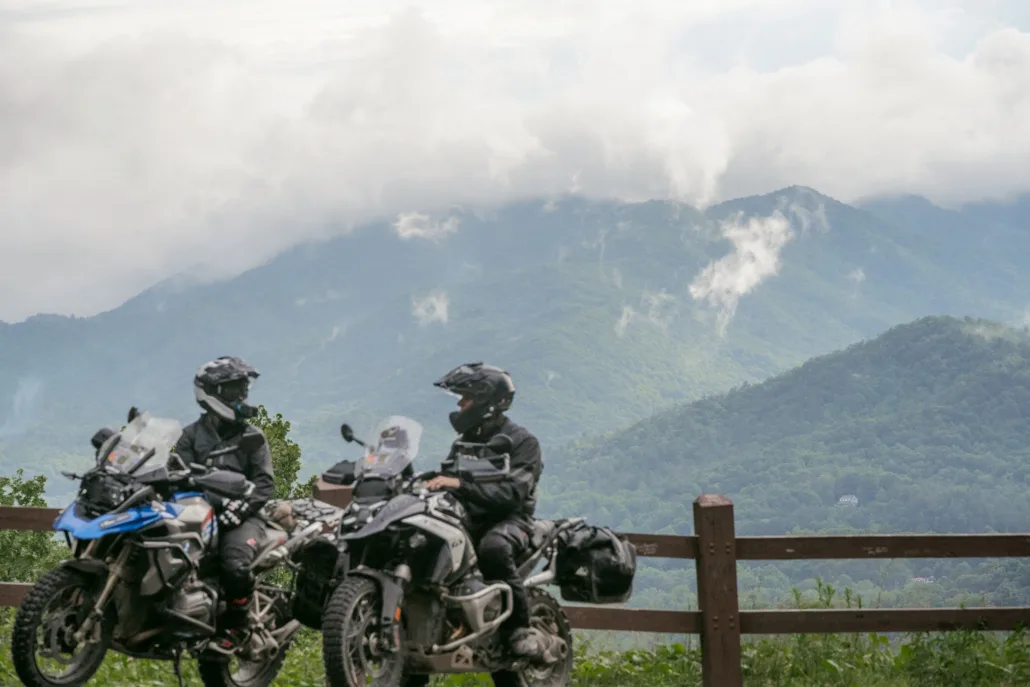
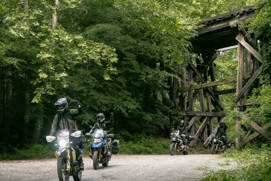
DILLARD TO ELLIJAY – 130 miles Departing Dillard, Patterson Gap Road offers a scenic and winding dirt route through the gap, as it leads to Tallulah River Road. Here, you’ll encounter the longest river crossing of the route at the Tallulah River, then a blissful stretch of dirt with multiple creek crossings and steep, rutted climbs that become more challenging in wet conditions. Consider an extension to Bell Mountain overlook before tackling the twists and turns of Corbin Creek. Brasstown Bald is another worthwhile extension of excellent paved roads to Georgia’s highest point at 4,784 feet and a lookout tower with panoramic views. Mulky Gap Road will lead to Highway 60 with fuel and food available at Cooper’s Creek Store. The journey continues with a series of enjoyable country paved roads and two back-to- back forest roads, offering numerous twists and turns, and some of the most fun riding yet. Follow the Toccoa River for several miles, crossing it on an old iron bridge near tubing rentals and a sandwich café. Section 3 concludes with a mix of pleasant paved and gravel roads, passing under a scenic railroad trestle and ending in the town of Ellijay.
Interactive map preview
Open the full map for layers, filters, and route planning tools.
Open full mapYour next adventure starts here
Create your own maps with custom routes, waypoints, and layers. Then share with your friends to kick off your adventure planning.
