3. Moab to Green River
MOAB TO GREEN RIVER – 158 miles
Leaving Moab, you’ll climb back into the mountains and take in the cool air atop Polar Mesa before descending into picturesque Onion Creek with high cliffs and several small creek crossing opportunities. North of Dewey Bridge, you’ll turn westward on dirt roads that pass former mining camps and abandoned uranium mines that offer plenty to look at, but this area can be sandy in late summer. The route will eventually pull you north of I-70 into the Book Cliffs. Check out the ghost town of Sego, with abandoned buildings and rock arts sites, before dropping down into the town of Green River.
Bull Cyn Overlook & Dinosaur Tracks
Castle Valley Overlook
Castle Valley Overlook Back on the UTBDR, be sure to make a short stop at the upcoming Castle Valley Overlook. It sits right off of La Sal Mountain Loop, just outside of Moab. The overlook is a safe place to pull off the road and park to take in some sweeping views of Castle Valley and its castle-like rocks in the distance. It’s also a good spot to take some photos of the view before continuing with the journey. Unlike some other stops on the route, this particular overlook also offers up limited restroom facilities for riders and other travelers passing through the area. Visit Website »
Dewey Historic Bridge
Dewey Historic Bridge Right on the banks of the Colorado River, keep an eye out for remnants of the old Dewey Historic Bridge which was put into service in 1916. Once the longest suspension bridge in Utah, the narrow bridge was big enough for horse-drawn wagons, but barely wide enough for cars. It eventually landed on the National Register of Historic Places. Sadly, though, most of its wood deck burned in the late 2000s, with just a small showing still visible today. Even so, it’s still possible to stay right on the river’s edge at the nearby Dewey Bridge Campground for a small nightly fee. It’s also a popular spot to launch small boats and a likely spot to run into mountain bikers heading to Kokopelli’s Trail. Visit Website »
Fisher Towers Viewpoint & CG
UTBDR POI
Green River SP & CG
Green River State Park S Green River Blvd Green River, UT, 84525, USA
Hideout Canyon Viewpoint
Hideout Canyon Viewpoint Now well past Castle Valley, stay on the main route as it snakes northeast and on to Fisher Valley. One good place to take in some scenery along the way is from the Hideout Canyon Viewpoint. This section of the UTBDR serves up some high clifftop views overlooking Hideout Canyon, Fisher Valley, and beyond. It’s another short stop on the route, but well worth it. Just pull off on the overlook and use the stop to take in views of the region, and possibly some more pictures before continuing on the Backcountry Discovery Route through Utah.
Moab - Food, Gas, Lodging
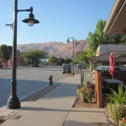
Moab, UT Moab is one of the larger towns along the UTBDR. They have many restaurants, gas stations, and hotels in town. They also have a visitor center where you can get information about more attractions in the area. Visit Website »
Sand Flats Rec Area & CG
Sego Canyon Ghost Town
Sego Ghost Town A short side trip is all it takes to explore one of the UTBDR’s “must do” locations. Just off the route, riders are treated with a stop at Sego Ghost Town. An important coal mining town in the early 1900s, much of the town now sits on the National Register of Historic Places. Despite being mostly wiped out by flash flooding and treasure hunters over the years, remnants of a few of the old buildings and railroad bridges are still visible, as is the Sego Cemetery (39.0236, -109.7108). Not far away, this part of the route also brings riders close to generations of historic rock art in Sego Canyon. Visit Website »
Sego Canyon Rock Art Site
Sego Canyon Rock Art Site A short distance from the Sego ghost town, make time to stop and enjoy the ancient display of petroglyphs and pictographs at Sego Canyon Rock Art Site. Next to the road, the area is made up of a number of rock art panels, consisting of three styles of artwork covering three different time periods. It’s a good spot to park for a while and walk along the vibrant rock walls, taking pictures of artwork left by the Ute Indians and Fremont Indians generations ago. The site also features Barrier-style art. At nearly a thousand years old it’s thought to be the oldest rock art in the area. Visit Website »
The Narrows of Onion Creek
The Narrows of Onion Creek Up next is a section of the UTBDR that is fun for riders. Get ready for an adventure, crisscrossing Onion Creek dozens of times while traveling The Narrows of Onion Creek. The gravel and dirt route leads through a narrow section of the canyon, rewarding riders with some of the best twisty roads around. This improbable pathway connects Fisher Valley Ranch and the Colorado River Valley below. Look for the Totem Pole rock tower along the way, but keep your eyes on the road. A popular section of the Utah route, the Onion Creek Narrows is a likely spot to meet up with fellow riders, mountain bikers and other travelers. Visit Website »
Thompson Springs - Food, Gas, Lodging
Shell
Upper Onion Creek CG
Yellow Cat Mine Buildings
Yellow Cat Mine Buildings As the UTBDR continues it passes through an area called The Poison Strip and leads right by remnants of the Yellow Cat Mine. The old mining structure and support buildings are long since abandoned, but many of them still mark the spot of a large mining operation that shut down decades ago. The region first began to attract uranium miners in the late 1800s, followed by an even larger group of fortune hunters in the mid-century. These days it’s still possible to pull off the route and view the relics but be sure to stay away from open mines. Some of the danger spots are unmarked and not safe to explore. Other mines in The Poison Strip area include Ringtail Mine, Little Eva Mine, Parco Mines, Telluride Mines, Little Pittsburg Mine, Cactus Rat Mine, and many unnamed adit mines. It’s possible to explore this area via old 4×4 roads to see these other mines. Consult USGS topographic maps to see where the mines are located. Visit Website »
UT3 - Moab to Green River
UT3 ALT Harder - Kokopelli Trail
Interactive map preview
Open the full map for layers, filters, and route planning tools.
Open full mapYour next adventure starts here
Create your own maps with custom routes, waypoints, and layers. Then share with your friends to kick off your adventure planning.
