Washington BDR
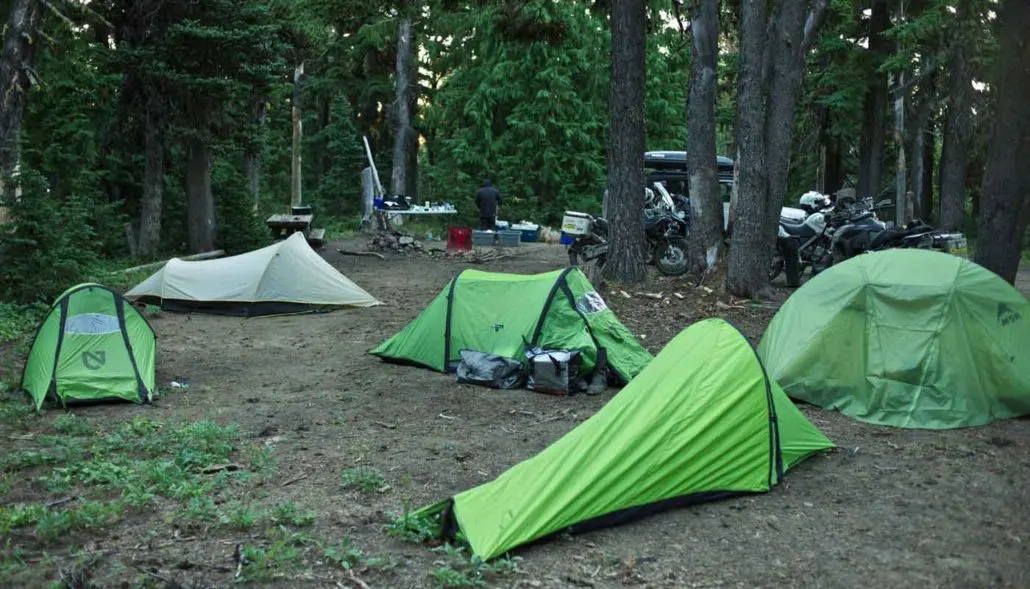
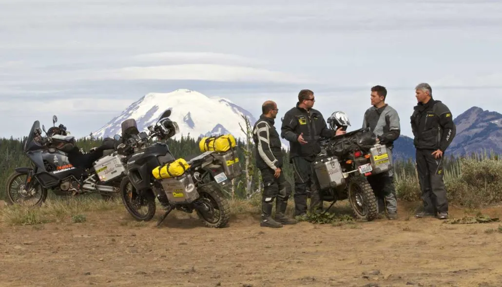
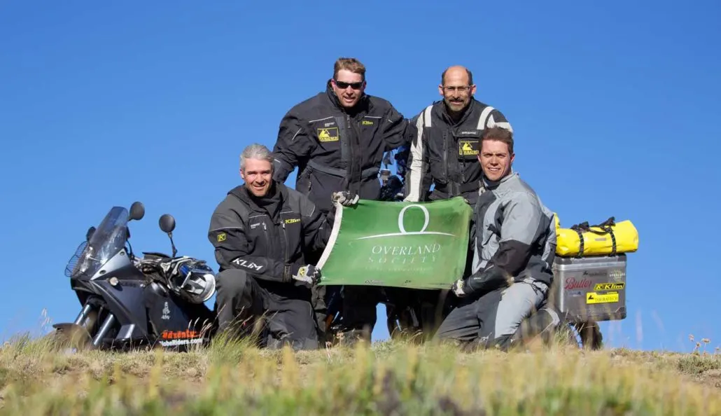
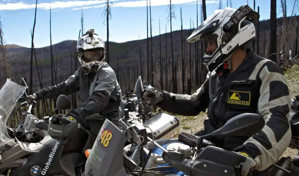
It’s been 15 years since we launched the Washington BDR, our first route. Since then, we’ve been saving up route changes, big and small, for a future update. That time is now! Because of the route changes, we are releasing new GPX tracks, a new printed map (coming in January 2026), and a new short film of the founders riding the WABDR in its new configuration.
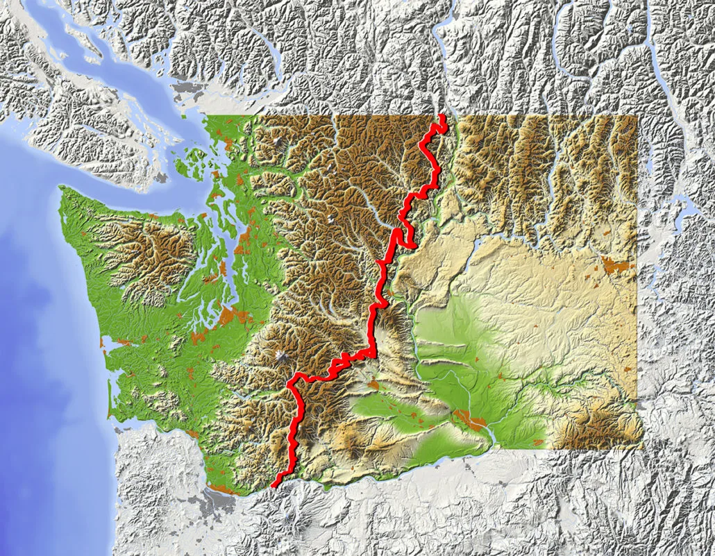
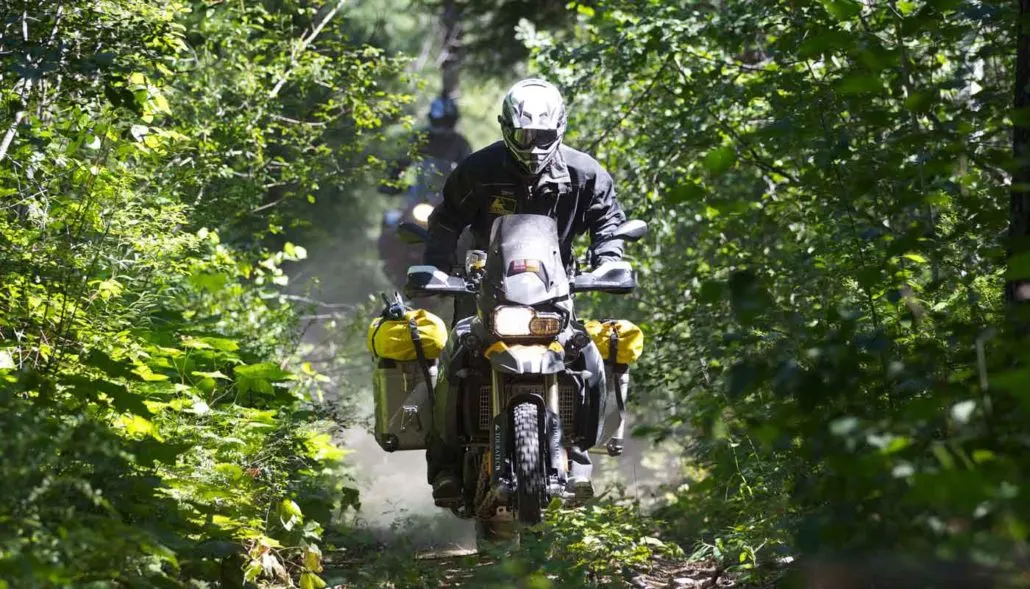
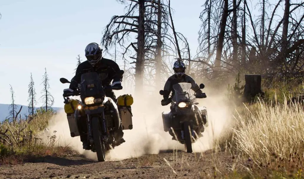
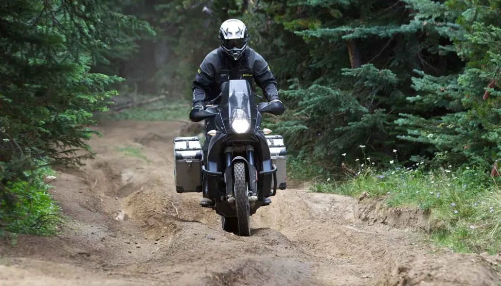
The Washington Backcountry Discovery Route is a multi-day off-pavement ride designed for dual-sport and adventure motorcycles. This route begins at the border with Oregon on the Columbia River and quickly ascends into Washington’s densely forested South Cascade Range, passing by 12,276’ Mt. Adams on the way northward. The central portion of the route explores the more arid eastern foothills of the Cascades and crosses multiple sub-ranges with optional, more difficult rocky and rutted roads. After crossing the Entiat and Chelan Mountains, the route descends and wraps around Lake Chelan to enter the North Cascades.
This remote northern region offers wonderful scenery and undulating backroads before ending at a remote US-Canada border crossing near the ghost town of Nighthawk. It takes around 4-6 days on average to ride this 688-mile route with countless photo opportunities along the way to slow you down. The best time of year to ride it is July-Sept when it’s typically snow free at the highest elevations. Despite being one of the shorter BDRs, the WABDR packs in a lot of stunning viewpoints, quaint small towns, and epic riding that you won’t forget.
Washington BDR
It’s been 15 years since we launched the Washington BDR, our first route. Since then, we’ve been saving up route changes, big and small, for a future update. That time is now! Because of the route changes, we are releasing new GPX tracks, a new printed map (coming in January 2026), and a new short film of the founders riding the WABDR in its new configuration.
The Washington Backcountry Discovery Route is a multi-day off-pavement ride designed for dual-sport and adventure motorcycles. This route begins at the border with Oregon on the Columbia River and quickly ascends into Washington’s densely forested South Cascade Range, passing by 12,276’ Mt. Adams on the way northward. The central portion of the route explores the more arid eastern foothills of the Cascades and crosses multiple sub-ranges with optional, more difficult rocky and rutted roads. After crossing the Entiat and Chelan Mountains, the route descends and wraps around Lake Chelan to enter the North Cascades.
This remote northern region offers wonderful scenery and undulating backroads before ending at a remote US-Canada border crossing near the ghost town of Nighthawk. It takes around 4-6 days on average to ride this 688-mile route with countless photo opportunities along the way to slow you down. The best time of year to ride it is July-Sept when it’s typically snow free at the highest elevations. Despite being one of the shorter BDRs, the WABDR packs in a lot of stunning viewpoints, quaint small towns, and epic riding that you won’t forget.
1. OR Border to Packwood
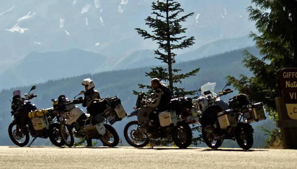
OR BORDER TO PACKWOOD – 119 miles The beginning of the WABDR involves crossing the Bridge of the Gods from Oregon into Washington, just west of Stevenson, WA, where you should top off your fuel tank. The route then heads northeast over Triangle Pass and Trail Peak on gravel and dirt roads in Gifford Pinchot National Forest. On a clear day, riders will be treated to views of three volcanoes: Mt. Hood, Mt. Adams, and Mt. St. Helens, which lost 1,300 feet of elevation in a massive eruption on May 18th, 1980. A short detour from the route to visit the Guler Ice Caves is worth the time. Created by a lava flow over 20,000 years ago, this lava tube preserves ice formations year round. From there, you’ll ride north at the base of Mt. Adams and around Takhlakh Lake before beginning a long descent to the town of Packwood, where you’ll find full services.
2. Packwood to Ellensburg
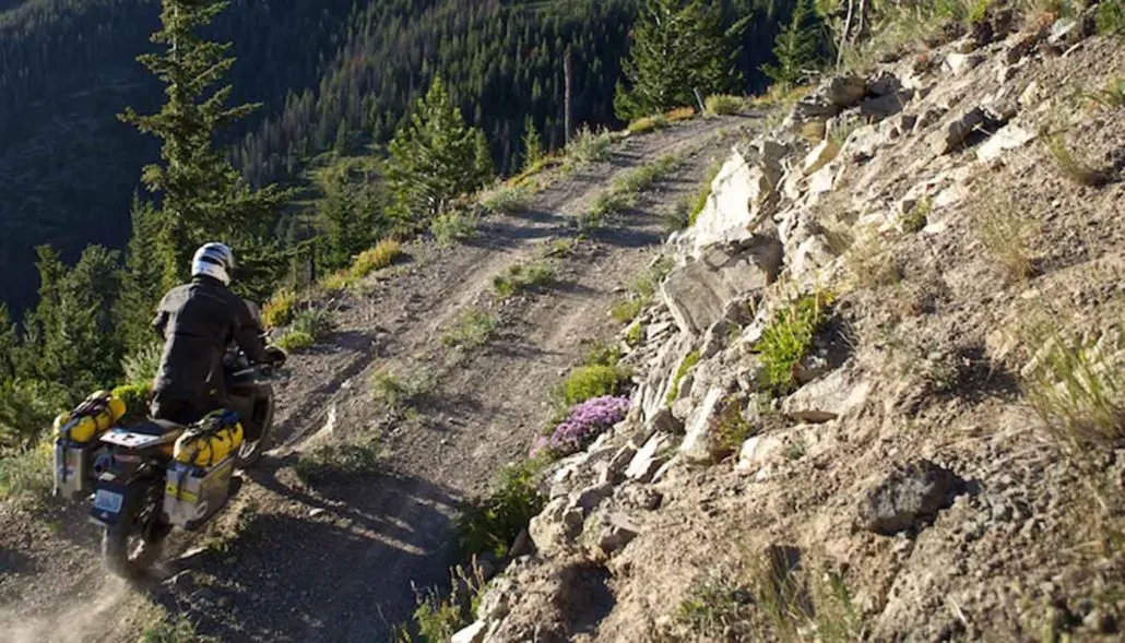
PACKWOOD TO ELLENSBURG – 128 MILES This section begins with an unavoidable, yet scenic, long paved ride on Highway 12 over White Pass. After descending from the pass, the route turns right and meanders south of Rimrock Lake on mostly dirt roads before returning to Highway 12 and crossing over it. The climb up from the highway involves gravel, washboards, and switchbacks before reaching Bethel Ridge. The main route takes you to the town of Nile in the Naches River valley on easy gravel and paved roads. The optional harder section follows rutted and rocky roads near the crest of Bethel Ridge before getting to Nile. Look for views of Mt. Rainier and Mt. Adams from Bethel Ridge. From Nile, the route climbs up to the summit of Cleman Mountain. The optional route to the summit involves a steep road with loose rocks that can be quite challenging. Dropping off Cleman, you’ll be in Evans Canyon, which eventually leads to the Wenas Valley. The last stretch to Ellensburg has two options with an easy trip over Ellensburg Pass or a long, tough trip along the crest of Umtanum Ridge. The latter option has another steep loose rock climb that has been nicknamed Baby Head Hill. When you get to Ellensburg, you’ll find full services in the medium-sized college town.
3. Ellensburg to Cashmere
ELLENSBURG TO CASHMERE – 79 MILES Paved roads head north from Ellensburg toward Table Mountain and Lion Rock Lookout in Wenatchee National Forest. High elevation and twisty dirt roads with views of the Central Cascades make this a very enjoyable section. From Lion Rock to Beehive Reservoir, the route is stunning and rugged and reaches elevations of 6,000 feet along the north edge of Table Mountain. Look for spectacular views to the north toward Devil’s Gulch and the Columbia River. The final descent into Wenatchee is on paved roads, but soon you’ll be rewarded with an entertaining dirt road full of large water bars in Number 2 Canyon. A gradually descending road on dirt and then pavement in Mission Creek valley leads to the town of Cashmere, which has gas, groceries, restaurants, and lodging.
4. Cashmere to Chelan
CASHMERE TO CHELAN – 119 MILES Heading north up Nahahum Canyon from Cashmere brings riders to a 360-degree view atop Chumstick Peak at 5,810 feet. The route then winds up and over Roaring Ridge in the Entiat Mountains before descending steep switchbacks to the one-store town of Ardenvoir, which has a small cafe, gas, and basic rations (closed on Wednesdays). After heading down canyon on paved Entiat River Roa,d the track then turns north, follows a meandering sandy 2-track road, and then rises to Steliko Lookout Tower before returning to the Ardenvoir area. The next 30 miles have a gain of over 4,000 feet as riders climb McKenzie Ridge and the Chelan Mountains. Views of Lake Chelan appear as travelers traverse Slide Ridge before the descent to 25 Mile Creek State Park on the lakeshore. An optional advanced section before Lake Chelan is available and has been aptly named “The Jungle” due to its remote and overgrown nature. The final part of Section 4 follows the southern Lake Chelan shoreline east to the full-service town of Chelan.
5. Chelan to Conconully
CHELAN TO CONCONULLY – 163 MILES The route ascends north from Lake Chelan past the Echo Valley Ski Area toward Cooper Mountain, a 5,867-foot summit with stunning views. The route then ridgecrest of the Methow Mountains before descending toward Lake Chelan again. This stretch is filled with epic views of the lake and eventually reaches the remote South Navarre Campground. After cresting the same mountain range again, the route gradually descends into the Methow River valley. Just before reaching the river and Highway 153, the route turns west on more dirt roads and finally descends Poorman Creek Road into the town of Twisp on Highway 20. The next stretch has a wide variety of roads, from wide dirt and narrow pavement to unmaintained 2-track and deep silt roads. Eventually, you reach Highway 20 and meander into the scenic Loup Loup area. Look for the massive China Wall, which is in the forest just east of the road. The final descent is a steep, loose one on Ruby Grade, and a bit more pavement leads you to the small town of Conconully. Be sure to fuel up your motorcycle in Twisp, as the fuel pumps in Conconully are not working currently.
6. Conconully to Canada
CONCONULLY TO CANADA – 80 MILES Head west out of town on Mineral Hill Road, which leads to seldom traveled silty roads. After getting back onto the main gravel road, you’ll climb up to Baldy Pass with distant views before and after it. The route then drops and climbs a couple more times as it wraps around the west side of Tiffany Mountain. After a short distance, the route enters Loomis State Forest and heads up the ominously named Skull and Crossbones Road, where an old homestead cabin and corral can be seen before heading down to North Fork Toats Coulee Creek. An optional extension leads to a high point called Cold Springs Camp in the forest not far from the Canadian Border. The route then winds down into a spectacular valley just south of Palmer Lake in the Sinlahekin Valley. With the dirt and gravel behind you, pavement leads you north past Palmer Lake through the former town of Nighthawk along the Similkameen River to the Nighthawk border crossing from the US into Canada.
Interactive map preview
Open the full map for layers, filters, and route planning tools.
Open full mapYour next adventure starts here
Create your own maps with custom routes, waypoints, and layers. Then share with your friends to kick off your adventure planning.
