Montana BDR
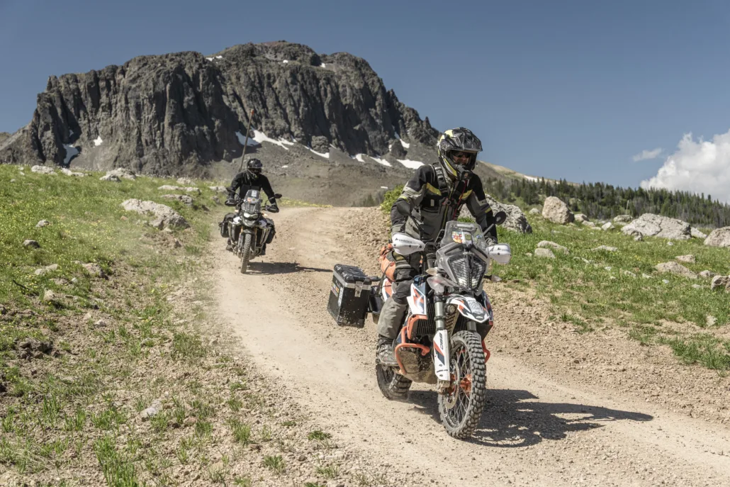
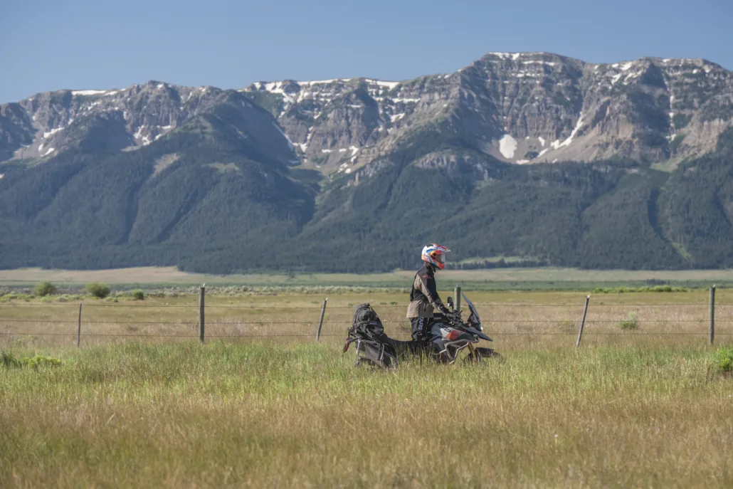
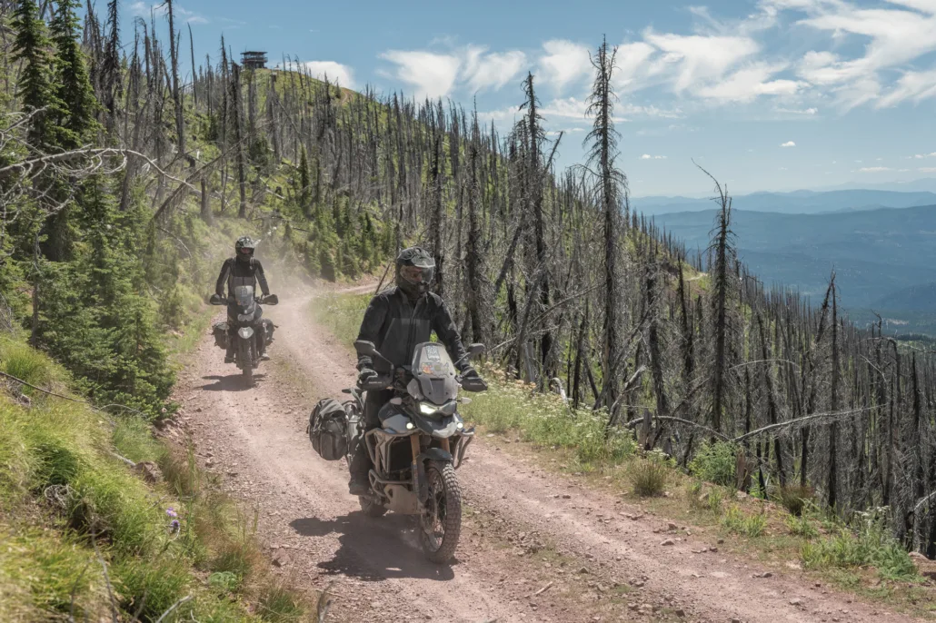
The MTBDR is BDR’s 23rd route and completes the final link in the Western BDR system, creating a continuous backcountry network across the western United States. The approximately 900-mile route begins in Island Park, Idaho, and travels north through Montana before ending near the U.S.–Canada border outside of Eureka.
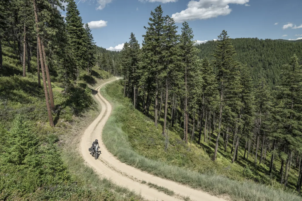
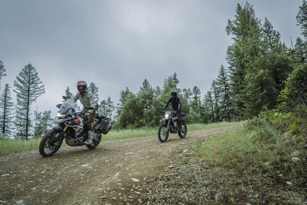
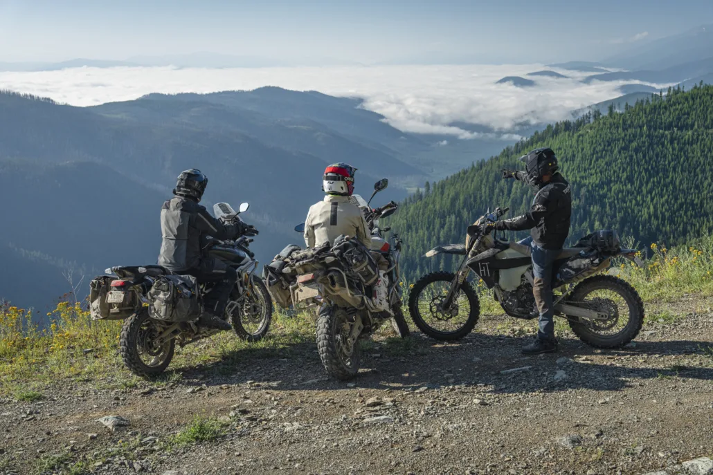
Crossing more than thirteen mountain ranges, the MTBDR takes riders deep into Big Sky Country, weaving together alpine ridgelines, remote valleys, dense pine forests, historic mining towns, wide-open ranchlands, and rugged two-track roads. Highlights include the Gravelly Range, Ruby River Valley, Virginia City, Butte, and the wild landscapes of the East Pioneer, Highland, and Cabinet Mountains.
Blending scenic gravel, flowing forest roads, and optional harder sections for more experienced riders, the MTBDR offers an ideal balance of accessibility and challenge. The route is best enjoyed between July and September, depending on snow levels and seasonal closures.
This route was made possible by the generous support of our Presenting Sponsors: Triumph Motorcycles, onX Offroad, Quad Lock and Edelweiss Bike Travel. BDR is also grateful for the continued support of our industry partners and the incredible riding community.
Montana BDR
The MTBDR is BDR’s 23rd route and completes the final link in the Western BDR system, creating a continuous backcountry network across the western United States. The approximately 900-mile route begins in Island Park, Idaho, and travels north through Montana before ending near the U.S.–Canada border outside of Eureka.
Crossing more than thirteen mountain ranges, the MTBDR takes riders deep into Big Sky Country, weaving together alpine ridgelines, remote valleys, dense pine forests, historic mining towns, wide-open ranchlands, and rugged two-track roads. Highlights include the Gravelly Range, Ruby River Valley, Virginia City, Butte, and the wild landscapes of the East Pioneer, Highland, and Cabinet Mountains.
Blending scenic gravel, flowing forest roads, and optional harder sections for more experienced riders, the MTBDR offers an ideal balance of accessibility and challenge. The route is best enjoyed between July and September, depending on snow levels and seasonal closures.
This route was made possible by the generous support of our Presenting Sponsors: Triumph Motorcycles, onX Offroad, Quad Lock and Edelweiss Bike Travel. BDR is also grateful for the continued support of our industry partners and the incredible riding community.
1. Island Park, ID to Virginia City
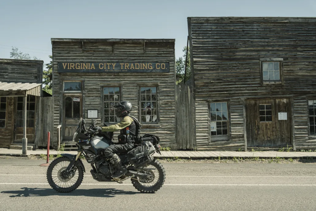
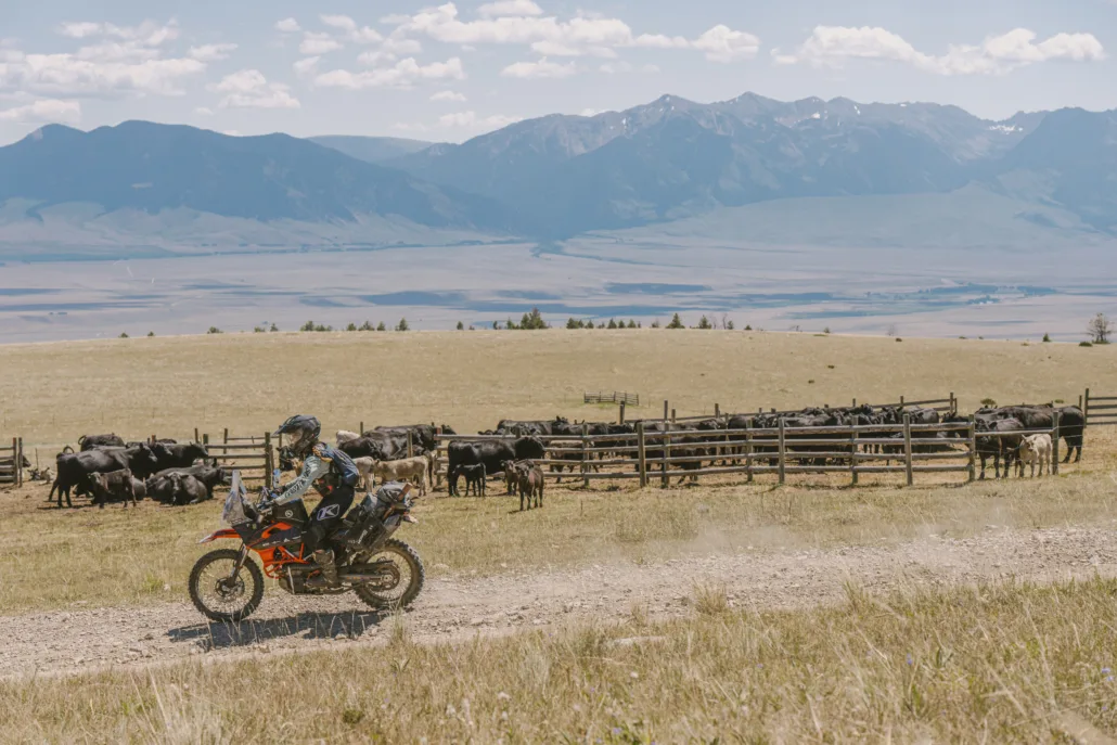
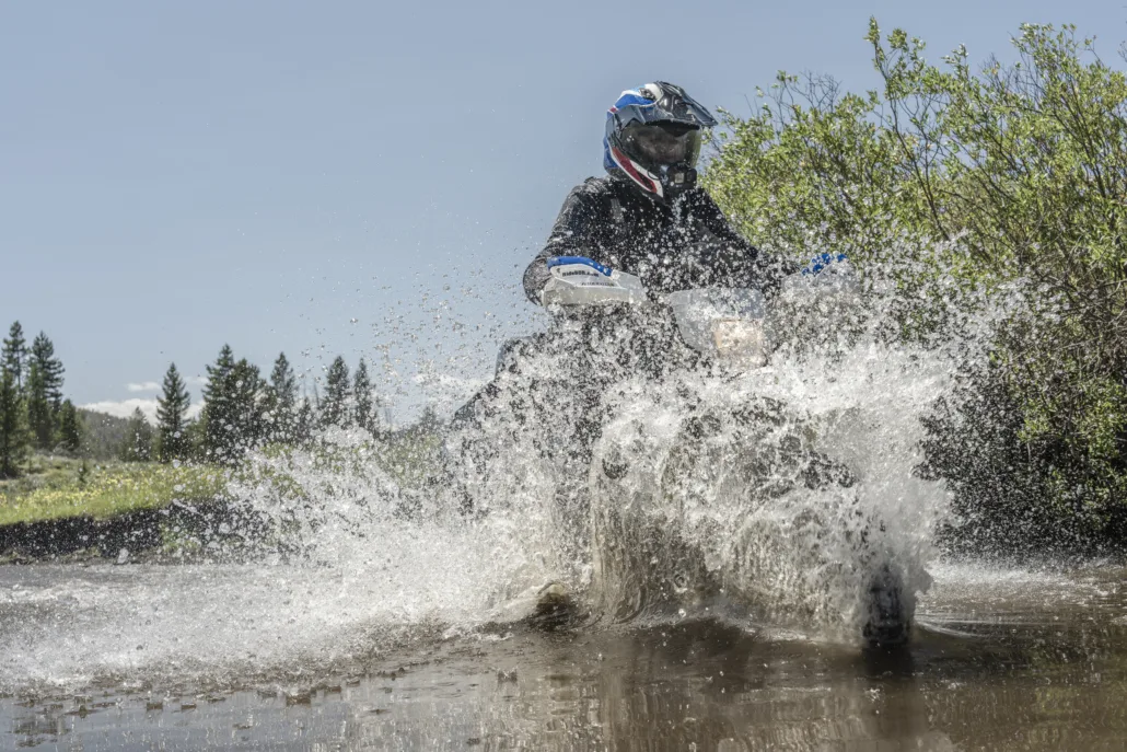
ISLAND PARK, ID TO VIRGINIA CITY – 105 MILES The fun begins just outside of Island Park, Idaho with a mix of pavement and wide gravel roads near Henrys Lake. You’ll soon cross into Montana at Red Rock Pass (7,120 ft) and the Centennial Mountains come into view to the south before the route turns north around the Red Rock Lakes National Wildlife Refuge. The roads in this area are sandy and can be deep in places, so be prepared. The route continues north and follows a blissful 2-track road as you ascend into the Gravelly Range which opens on July 1st annually. Experience amazing views through the Gravellies as you ride above 8,000 ft for over 30 miles. Black Butte at 10,547 ft is impossible to miss near the crest of the range. The route descends into the Madison River Valley passing through a housing community, so please Ride Respectfully. After passing by Axolotl Lakes, cross a 7,200 ft pass and descend several miles to Virginia City on rugged 2-track that can be slick when wet.
2. Virginia City to Butte
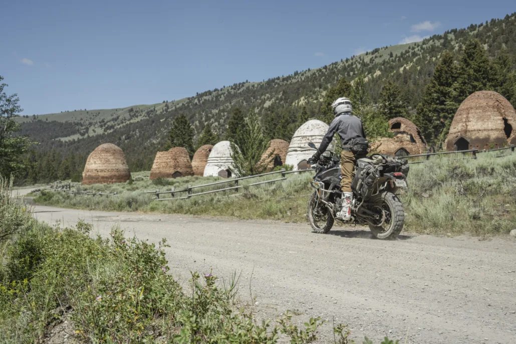
VIRGINIA CITY TO BUTTE – 139 miles An optional harder route ascends Alder Gulch and descends Barton Gulch, featuring tight switchbacks and loose rocks. The main route then follows wide gravel roads through farm and ranch land in the Ruby River valley before reaching Highway 41. Wide dirt roads through the picturesque Big Hole River valley lead to paved roads into Melrose where you can get food and fuel. Beyond Melrose the track climbs into the East Pioneer Mountains. The historic Glendale smelter site and beehive-shaped charcoal kilns are a must see. After descending from the Pioneers, an optional harder section follows rugged roads in the Moose Creek (“Crick”) drainage and ascends into the Highland Mountains. This road is primitive, rocky and has a large water crossing that can be challenging during spring runoff. Finally, the route descends from the Highlands into Butte, the largest city on the route and one of the most historic. Consider visiting the Berkeley Pit viewing area or other sites near the Old Town.
3. Butte to Lincoln
BUTTE TO LINCOLN – 146 miles Leaving Butte, the route begins on pavement before transitioning to a mix of wide gravel and lesser-traveled dirt roads. After the Interstate 15 corridor the main route heads north from the tiny town of Basin on the scenic Basin Creek Road and the optional harder track follows I-15 east before turning north. The Occidental Plateau Alt Harder is long and much more difficult with varied challenges, including high elevation, steep hills, and very rocky terrain, but has rewards like the historic Comet Mine and several epic viewpoints. After food and fuel in Elliston, the route climbs into the mountains past Empire Mine and an optional extension to the Granite Butte summit and lookout tower. Section 3 ends at the town of Lincoln where riders can visit the ‘Blackfoot Pathways: Sculpture in the Wild International Sculpture Park’ and a variety of lodging and dining options.
4. Lincoln to Seeley Lake
LINCOLN TO SEELEY LAKE – 72 miles This section is just 72 miles but packed with fun riding. Start by ascending Huckleberry Pass before descending to the Blackfoot River valley. Coopers Lake and Browns Lake provide options for a swim to cool down or clean off the dust and sweat. Stop at the Ovando general store and historic sites or grab a meal at Trixi’s Saloon on Highway 200. The route climbs again before traversing the south end of the Swan Range. Although it’s a bit long at 8.4 miles each way, the ride up to Mt. Morrell Lookout is worth the time. If the summit gate is closed, it’s just a short walk to the tower, and there are views from the saddle at the gate. Seeley Lake features multiple restaurants and large campgrounds on the lake but has limited lodging options.
5. Seeley Lake to St. Regis
SEELEY LAKE TO ST. REGIS – 133 miles Due west out of Seeley Lake, enter the Mission Mountains in Lolo National Forest. The route soon enters the Flathead Indian Reservation and follows a public thoroughfare, known as Jocko Canyon Road, to the small town of Arlee. While on the reservation, stay on the route and do not venture off to camp or for any other Reason. If you do want to camp on the Flathead Reservation, non-members need a CSKT Conservation Permit and a specific Flathead Reservation Camping Stamp, which are purchased together and allow access for activities like camping and hiking on tribal lands. Permits are available online through the Montana Fish, Wildlife & Parks (FWP) licensing portal ( https://ols.fwp.mt.gov ) or in person from various local vendors in towns like Polson, Ronan, and St. Ignatius. Beyond Arlee, the route stays in the reservation before re-entering Lolo NF and heading up the Ninemile Creek Valley. Enjoy the ride on West Side Ninemile Road and the ascent onto Ninemile Divide before your final descent to St. Regis.
6. St. Regis to Thompson Falls
ST. REGIS TO THOMPSON FALLS – 72 miles The route leaves St. Regis on Highway 135 and then goes around the north side of Camels Hump Mountain before a series of switchbacks return you to the Interstate 90 corridor. From there, you’ll climb back into the Coeur d’Alene Mountains on tight, forested roads before eventually dropping into Thompson Falls. This town provides full services and offers a short walking excursion on footbridges to the Clark Fork of the Flathead River and the Thompson Falls Dam.
7. Thompson Falls to Libby
THOMPSON FALLS TO LIBBY – 113 miles After a short stretch of pavement from Thompson Falls the route turns to dirt and climbs to Vermilion Pass at over 6,000 ft in the Cabinet Mountains. Be sure to stop at impressive Graves Creek Falls on your way to the pass. On your descent, you’ll ride the shoreline of picturesque Fishtrap Lake followed by a series of fun, flowy dirt roads. After a stretch on Hwy 2, venture back into the foothills of the Cabinet Mountains through tight forested 2-track roads and consider the worthy side trip to Howard Lake before the last stretch of Highway 2 that leads to the town of Libby.
8. Libby to Canada Border
LIBBY TO CANADA BORDER – 125 miles The final section of the MTBDR heads north out of Libby on beautiful scenic ridge roads and works its way up to a cabin and viewpoint on the upper reaches of Big Creek Baldy. After descending, the roads get more primitive and overgrown so use extra caution for branches, downfall, and vehicles heading in the opposite direction. As the route meanders along the next ridge, beautiful Lake Koocanusa comes into view, with the tallest bridge in Montana. Consider the short side trip up to Black Butte Lookout before reaching Eureka. The final stretch passes by homes and farmland, then turns to rugged 2-track before officially ending at a remote parking spot. Here you can follow a walking path to the US/Canada border, clearly indicated by a clearcut alley of trees as far as you can see. NOTE: the border is electronically monitored and crossing the border will activate a response from Homeland Security. Ride Respectfully on this final out-and-back to preserve our right to visit this special place.
Interactive map preview
Open the full map for layers, filters, and route planning tools.
Open full mapYour next adventure starts here
Create your own maps with custom routes, waypoints, and layers. Then share with your friends to kick off your adventure planning.
