Oregon BDR
The Oregon Backcountry Discovery Route (ORBDR) is the 12th route developed by the BDR organization for dual-sport and adventure motorcycle travel.
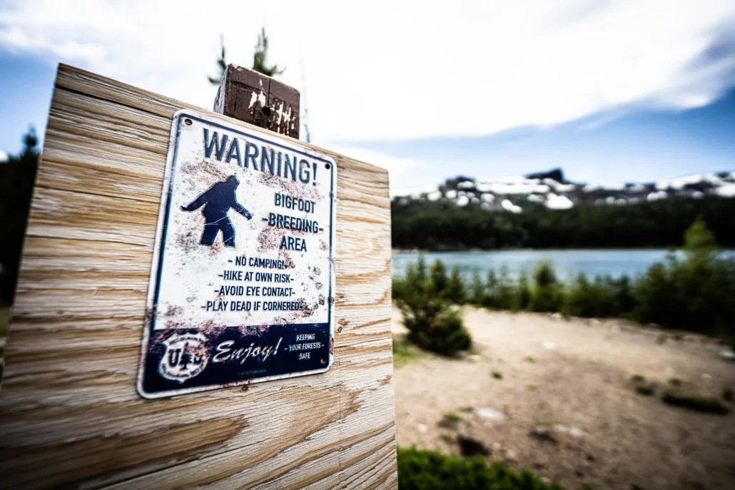
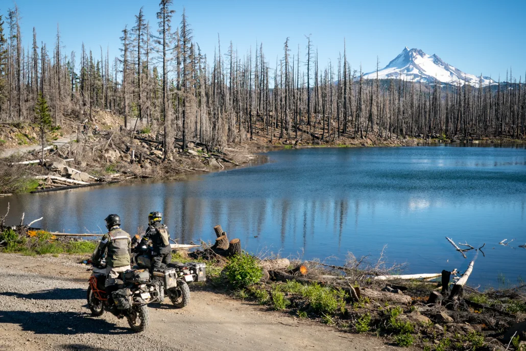
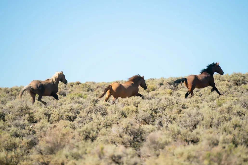
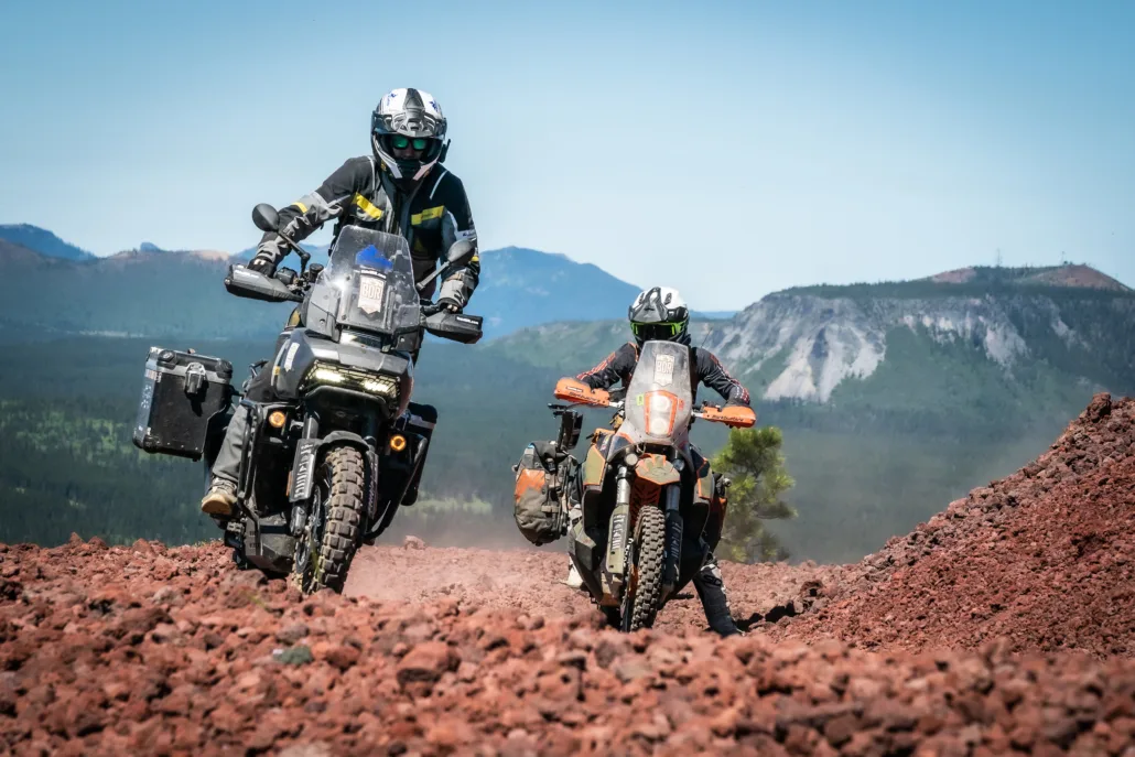
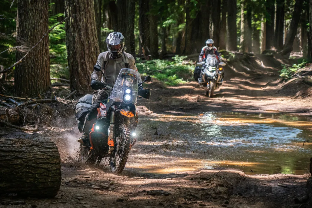
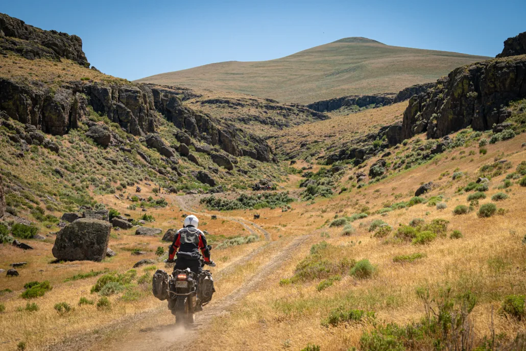
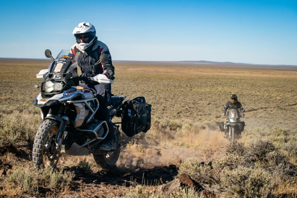
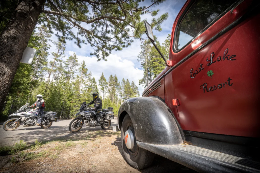
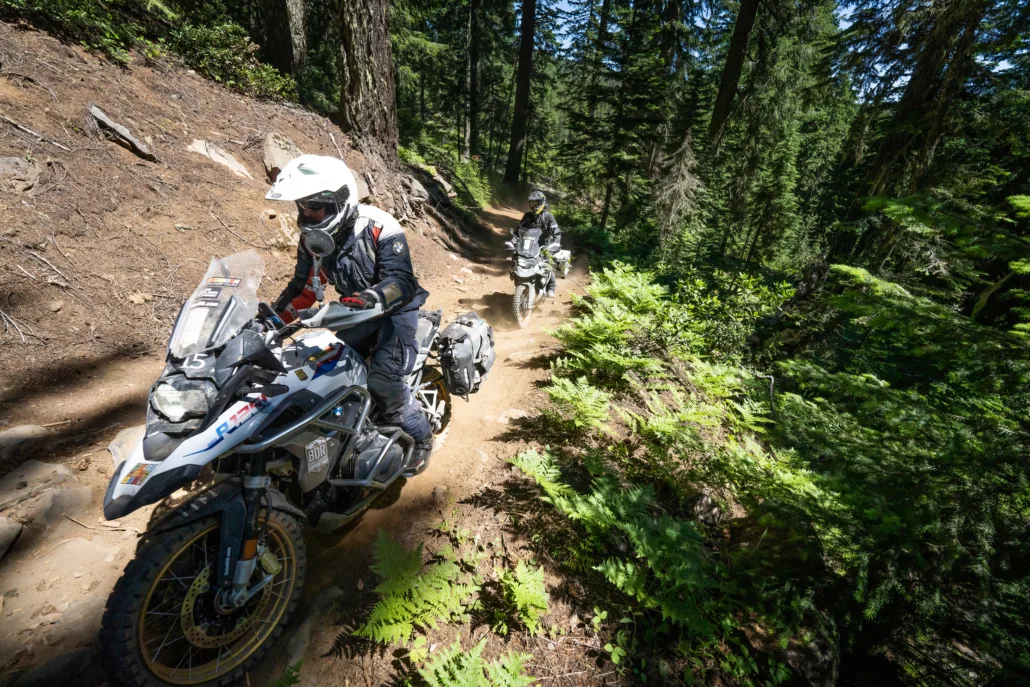
The Oregon Backcountry Discovery Route (ORBDR) is a 682-mile, multi-day off-pavement ride designed for adventure and dual-sport motorcycles. Starting at the terminus of the CABDR-N at the California border and exploring north through ancient pine forests and into the rugged mountains of the Cascade Range, challenges include lava rocks, silt, sand, and arduous mountain roads. From sagebrush steppe and hot springs, to caverns and glaciated volcanoes, riders are guided into remote territories that reveal many of the state’s natural wonders, providing prime sightseeing and recreational opportunities. With stunning views throughout and terrain that is certain to test your riding skills and endurance, the ORBDR is one of the best ways to discover the backcountry of Oregon.
Please note: Since the Oregon BDR was released, we’ve listened closely to rider feedback and learned from real-world experience on the route. In November 2025, we’re excited to introduce major updates to the first three sections of the ORBDR to improve rideability and extend the riding season. The original southern sections often faced closures due to wildfire restrictions and extreme summer heat in the high desert, making it difficult to complete the route from start to finish. The revised Sections 1–3 now travel through higher-elevation National Forests, offering cooler temperatures, more consistent conditions, and a longer, safer season to ride the full route—from mid-June through mid-October.
You can purchase the map with the addendum HERE, or, if you already own the 2nd Edition map, you can purchase the addendum separately HERE. Read more about the permanent update HERE.
Oregon BDR
The Oregon Backcountry Discovery Route (ORBDR) is the 12th route developed by the BDR organization for dual-sport and adventure motorcycle travel.
The Oregon Backcountry Discovery Route (ORBDR) is a 682-mile, multi-day off-pavement ride designed for adventure and dual-sport motorcycles. Starting at the terminus of the CABDR-N at the California border and exploring north through ancient pine forests and into the rugged mountains of the Cascade Range, challenges include lava rocks, silt, sand, and arduous mountain roads. From sagebrush steppe and hot springs, to caverns and glaciated volcanoes, riders are guided into remote territories that reveal many of the state’s natural wonders, providing prime sightseeing and recreational opportunities. With stunning views throughout and terrain that is certain to test your riding skills and endurance, the ORBDR is one of the best ways to discover the backcountry of Oregon.
Please note: Since the Oregon BDR was released, we’ve listened closely to rider feedback and learned from real-world experience on the route. In November 2025, we’re excited to introduce major updates to the first three sections of the ORBDR to improve rideability and extend the riding season. The original southern sections often faced closures due to wildfire restrictions and extreme summer heat in the high desert, making it difficult to complete the route from start to finish. The revised Sections 1–3 now travel through higher-elevation National Forests, offering cooler temperatures, more consistent conditions, and a longer, safer season to ride the full route—from mid-June through mid-October.
You can purchase the map with the addendum HERE, or, if you already own the 2nd Edition map, you can purchase the addendum separately HERE. Read more about the permanent update HERE.
1. New Pine Creek, CA to Paisley
NEW PINE CREEK TO PAISLEY – 128 miles The Oregon BDR starts in the quaint town of New Pine Creek, CA (no gas) and winds steeply up the Warner Mountains, bringing you quickly up to beautiful forested dirt roads, open meadows, and rugged landscapes. After descending to Lakeview where gas is available, the route passes by Cottonwood Reservoir then follows more gravel and two track roads in Fremont National Forest. Keep your eyes on the road because the stunning ridgeline view as you descend into the town of Paisley will really grab your attention. Gas up in Paisley and, if you have time, visit Oregon’s oldest operating saloon, the Pioneer Saloon for some great food and drinks. Stop by Summer Lake Hot Springs to camp or stay in a cabin (reservations required, no day-use soaking allowed).
2. Paisley to Chemult
PAISLEY TO CHEMULT – 136 miles Leaving Paisley, you’ll ascend the Winter Rim for some fantastic views of Summer Lake and beyond on smooth, twisty gravel roads. While riding Winter Rim, you can choose the main route on well-maintained roads or take two optional harder routes along moderately rocky and muddy two-tracks. Take the short out-and-back up to Indian Mountain for a panoramic 360 view in all directions before making your way east through very remote and beautiful pine forests in the Wimena National Forest. Crossing the Thompson Reservoir Dam will spice things up on a short rocky section and a great view of the reservoir. Continuing eastward through the remote pine forest there is an optional stop at Rodman Rock for a view of the surrounding mountainsides and forest valleys, eventually ending in Chemult for gas and supplies.
3. Chemult to Sunriver
CHEMULT TO SUNRIVER – 102 miles You’ll take gravel roads that head north out of Christmas Valley as you start Section 3. Not far into the day’s ride, two optional 1/4 mile hikes lead to a volcanic feature called ‘Crack in the Ground’ and a viewpoint at ‘Green Mountain Lookout’ (5,190’). The route then turns onto Millican Road (remember to leave gates as you found them) and then enters Deschutes National Forest. The roads in this area are usually in good shape early in the year but can get silty and rocky as the riding season progresses. Take it easy if the silt is deep or if the roads are wet, as they’ll be slick and sometimes impassable. If time permits, take advantage of two optional out-and-back rides to discovery points: the viewpoint on Pine Mountain (6,348’) and Paulina Crater in Newberry National Volcanic Monument. This next section might provide some of the most epic and memorable riding on the entire ORBDR. We’ve dubbed this “The LUGE” as it is a fun section of tight, twisty forest road that winds down the mountain and feels like riding a luge. After recomposing yourself and wiping the smile off your face, the main track follows a road that wraps around the north end of the Paulina Crater and then crosses Highway 97 at the town of Sunriver.
4. Sunriver to Sisters
SUNRIVER TO SISTERS – 68 miles Gas up in the resort town of Sunriver and get ready to enter an area of Central Oregon that hosts outdoor recreationalists of all kinds. Keep the speed down and watch for walkers and cyclists who could be crossing the roads on singletrack trails in the vicinity. The next section of the ORBDR hopscotches between dirt and tarmac via Cascade Lakes Highway and Skyliners Drive. Soon afterward, expect steady climbs into an area where snowpack occasionally lingers into mid-July. If the snow is gone, this segment is a real treat with fun, flowy roads and includes an optional short side trip to Three Creek Lake, which has a small store with limited supplies. The track then descends into an area adjacent to private timber lands (heed all signs). After the dirt fun ends, you’ll ride a few miles on pavement to the vibrant western-themed town of Sisters, named for the Three Sisters volcanoes which are visible from portions of the route.
5. Sisters to Detroit
SISTERS TO DETROIT – 76 miles The track north of Sisters journeys back onto roads within Deschutes National Forest. Skylight Cave is a recommended short side trip for cave lovers to get their spelunking on. After a fun whoops-filled section of the Old Santiam Wagon Road, the ORBDR begins to loop around Cache Mountain. An optional more difficult road branches off to Cache Mountain summit (5,579’) and excellent views of the Cascade Range can be seen. The riding north of Cache Mountain can be sandy and include plenty of bumps in late summer. The next segment is a delightful experience which soon connects with a brief ride on Highway 20. The route then follows miles of typical forest roads before descending to the east shore of Detroit Lake. Paved roads lead the rest of the way to the town of Detroit which was devastated by the Beachie Creek Fire in 2020. The town is being rebuilt and can use the infusion of tourist dollars, so stop and support local businesses while riding through or staying for the night.
6. Detroit to Government Camp
DETROIT TO GOVERNMENT CAMP – 92.5 miles North of Detroit is another area that has been impacted by recent wildfires. In 2021, the Bull Complex Fire burned a large portion of Willamette National Forest and the ORBDR, as originally designed, had to be adjusted due to road closures. The route now ascends the Breitenbush River Valley on FS-46, then meanders on forest roads eastward toward Olallie Lake. The lake is accessed via an out-and-back on FS-4220, but there is a more direct, harder route for those who are comfortable with steep rocky and rutted roads. There’s a small store on the shore of this scenic lake which has food and supplies in the summer months (no fuel there). Olallie Lake also offers excellent camping and has cabins available. After Olallie, the route becomes a navigational challenge, so you’ll want to pay close attention to the GPS tracks as intersections are easily missed. Near the end of Section 6 the route passes by both Timothy Lake and Clear Lake which are excellent places to visit. The final miles are on Highway 26 and end at the town of Government Camp which has a fine selection of lodging, restaurants, and pubs.
7. Government Camp to Hood River
GOVERNMENT CAMP TO HOOD RIVER – 83.2 miles The last section of the ORBDR leaves Government Camp on Highways 26 and 35. After leaving pavement, the route follows a blissful series of roads on a circuitous route through Mount Hood National Forest. The byways in this area to the southeast of Mount Hood are rocky and exposed at times, so keep your focus and ride within your ability. Factor in stopping at the numerous amazing viewpoints along the way. After a long descent from Bennett Pass, the track then heads true north following high elevation roads on Gunsight Butte, Lookout Mountain, and Surveyors Ridge. The last ten miles are on pavement, but they are exceptionally scenic and pass through rural farms within the Hood River Valley. The ORBDR ends at Port Marina Park where Hood River meets the mighty Columbia River in the city of Hood River.
Interactive map preview
Open the full map for layers, filters, and route planning tools.
Open full mapYour next adventure starts here
Create your own maps with custom routes, waypoints, and layers. Then share with your friends to kick off your adventure planning.
