Hourglass
Tight skiing chute skiing directly off the summit of Mount Mansfield. A Vermont classic.
Drop in near a prominent boulder on the summit, ski down a low angle snowfield, this funnels into a very steep and narrow chute. Ski tight turns into a wider runout that fans out, as the name would imply. This tight section is steep and can slough you out easily on a powder day. Although small, the avalanches this terrain can produce could easily sweep you into trees below. From here you can descend straight down through another chute and ski towards Taft Lodge, or hang a hard left towards the Adams Apple to gain access to Hellbrook and other lines in that area.
As with all terrain on the Chin, be aware that you are stepping outside the resort boundary into the wilderness here. There are unmarked hazards such as cliffs, avalanche terrain, and miles of unmarked forest that one can easily become lost in if they don’t know where they are going. Carry a beacon, prove, shovel, water, food, warm layers, and a first aid kit, and travel with one or more partners. Most importantly, be willing to turn around if you have doubts about conditions or finding your route. It’s better to bail than become a rescue statistic.
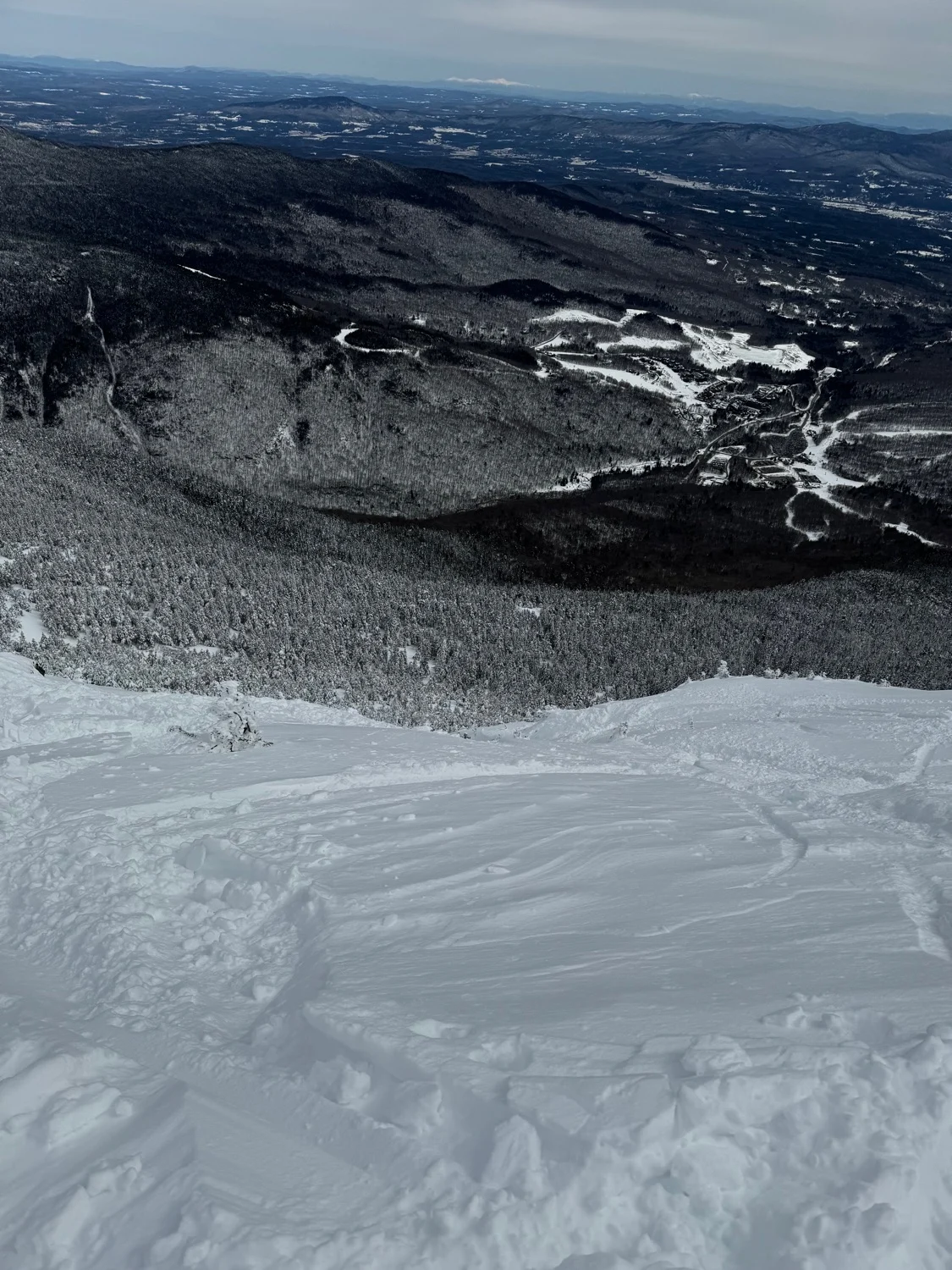
Length
0.3 mi
Elevation gain
0 ft
Elevation loss
-745 ft
Average slope angle
29º
Max slope angle
56º
Aspect
Interactive map preview
Open the full map for layers, filters, and route planning tools.
Open full mapYour next adventure starts here
Create your own maps with custom routes, waypoints, and layers. Then share with your friends to kick off your adventure planning.
